This post was supposed to be about the drive from Crescent City to San Francisco along the Pacific Coast Highway, with gorgeous photos of white, ocean waves smashing into the vertigo inducing cliffs hugging the coast. But it is not. “Why?” you ask. Let me tell you.
First, while everyone warns one should get to the USA National Parks early to beat the crowds, I have never read anywhere that one should start the journey on the Pacific Coast late to beat the fog. So I left Crescent City about 8:00 AM and encountered 5 straight hours of fog.


Second, despite one of my talents being the ability to read maps and generally navigate by the sun, I had been convinced that maps and compasses are passé and I needed a GPS to get me through the USA. I had reluctantly bought a Garmin GPS and my son had installed it for our trip to Florida in February. He set it to the proper British accent (we christened it James) and it got us to Florida and back, although how difficult can it be to go due south and return straight north, especially since my car has a compass embedded in the rear view mirror. Nonetheless, I resolved to test James on my extended USA road trip.
James worked okay generally, but there were some flaws. While James directed me to Henderson, Nevada after a long drive from Sedona, he inexplicably quit about 10 miles from the destination on the middle of a newly named interstate. I was driving in the dark, doing about 80 miles an hour (the legal speed limit) when James advised he could not configure and turned himself off. Period. No reconfiguring, no telling me the Interstate had just recently changed from a different highway. Nothing. Just a black screen. So I took the nearest exit, turned on Google Maps on my phone and Siri (the voice on my I-phone) guided me to the hotel.
I ceased relying on James, but would check him out occasionally. He was useless in Edmonton; its street and avenue numbers instead of names being impossible for James to locate, but he was okay in Banff and Vancouver.
However, the Pacific Coast Highway was a complete bust for James. He kept trying to send me along Highway 101 – the quickest route- but I wanted to drive Highway#1 along the ocean. I ignored him and did not get lost once. Admittedly, this was not a difficult achievement since all I had to do was keep the Pacific Ocean on my right.
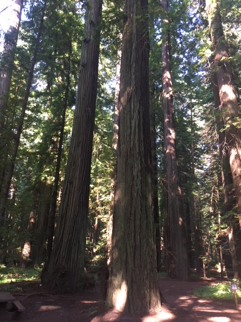
Once the fog lifted, the scenery was spectacular.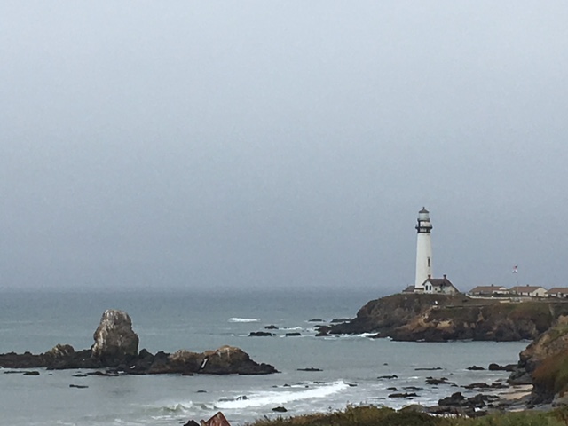
But James continued to disappoint. I gave him one last try- get me to my hotel in San Francisco -which was actually near the Oakland airport. James led me off the Highway to Richmond, then Berkley and next, in his perfect butler voice, directed me to veer right. This was the most useless command imaginable, since I was on a 6 lane highway, each of which veered right and led to 3 separate ramps-one to Alameda, one to the Oakland Airport and another to San Francisco. Since I was staying near the Oakland airport, I thought I would veer right, then take the middle exit, but James insisted that I veer right and stay in the right lane. I stupidly trusted technology, stayed in the right lane and found myself on the Oakland/San Francisco toll bridge to San Francisco. $6.00 (US) later and 4 miles down the highway, James directed me to “when possible, make a U-turn.” The nearest exit was at Treasure Island, which has only dead ends and construction zones and no possible way of getting back on the San Francisco toll bridge heading west. I gave up on James, shut the damn thing off and pulled out my I-phone and Google Maps.
Siri directed me back onto the bridge for two miles, then make a left turn at the Embarcadero in downtown San Francisco, guiding me back on to the bridge the way I needed to go and, eventually, over an hour later than necessary, to my hotel in Oakland. ,
I spent 2 days touring San Francisco. I had been there previously in 1978, seeing most of the main tourist sites then. This time, my first stop was at the Tourist Information Center, where I picked up a paper map. Using it, San Francisco was remarkably easy to navigate. I took a free walking tour (I tipped $20) of Chinatown and the financial district, where two other participants asked where I got the paper map. After the tour, I walked to the most crooked street in the world, Lombard Street, followed by North Beach, , Ghiradelli Square and Fisherman’s Wharf. Everything looked pretty much as I remembered it, but with many more tourists.
I left San Francisco with James relegated to the glove compartment. I would rely on Google Maps for the next part of my trip. I continued down the Pacific Coast Highway for about 300 kilometers. As I had arrived at the Pacific Coast Highway much later in the day, the fog was mostly gone and the scenery spectacular.


You have to change the settings in your GPS. It’s probably on the fastest route setting.
I am jealous as heck of this Pacific Coast Drive.
I wouldn’t be able to do it at the moment anyway because I had a growth removed from my backside would not have been able to sit for that long.
Sent from my iPad
>
LikeLike
It is not easy changing the settings in the gps. I’m still struggling with volume control. You will love the pacific coast highway. Less a highway and more a road with lots of viewpoints. I was stopping every few minutes to take pictures or admire the view and breathe in the ocean scent. Wish you a swift recovery.
LikeLike
Hilarious (as always)! Solution – re christen GPS ‘Jeeves’. Or ‘Cato’ if you want a sparring partner, not a passive aggressive companion that was James.
LikeLike
James is definitely passive aggressive. Who else tells me to make a u-turn in the middle of a freeway. James was trying to send me in the right direction, but with imbecilic suggestions.
LikeLike
It’s the 2 faced response – agrees to send you safely to location and proceeds to send you head on, into oncoming traffic, followed by an inexplicable shut down! Chuck (or run). Unless, James makes a wicked martini…
LikeLike
Hilarious!!
LikeLike