Stalking Dragons in Komodo

People have aversions to one type of animal or another. A good friend refuses to visit Australia for fear of poisonous spiders; another is petrified of dogs and still another went to such extremes as banning barbecues and other forms of outdoor eating to avoid encountering bears at her Lake of the Woods cabin. My particular dislike is reptiles. I refuse to touch a snake, am fearful of crocodiles and not enamoured of frogs since being introduced to the venomous strawberry dart frog in Costa Rica,

I make two exceptions. Turtles and tortoises are benign stately creature that invoke feelings of gentleness and peace, not terror. Then there are lizards. By all accounts, they should be on my Avoid At All Costs list, but for some unfathomable reason, I like them. Give me an iguana park, such as in Guayaquil, Ecuador and I am a happy camper, plopping grapes onto their darting 6 inch long tongues and watching them snap back into their mouths. Or geckos, whose presence deters the far more frightening cockroach and reduces the mosquito population.

Thus, I could not forego the opportunity to see the granddaddy of all lizards, the Komodo dragon. Measuring over 3 metres, weighing up to 150 kilos and capable of running at speeds of up to 20 mph, Komodo dragons are mammoth carnivores. Their numbers, however, are slim. There are only between 3,000 and 5,000 in the wild, congregating on a half dozen Indonesian islands including Flores, Rinca, Komodo and Padar, all 450 kilometres from Bali.

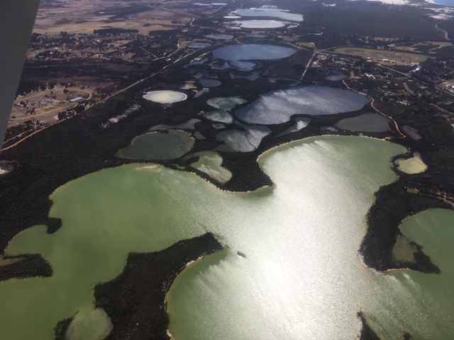
Getting there was a challenge. I took an hour and a half flight from Bali to Flores, enjoying the spectacular scenery below of  hundreds of Indonesian islands ranging from jungle terrain to grass covered mountains, over inhabited islands with rice paddies and fishing fleets hugging the coast to barren volcanic outcrops.

Flores is touting itself as the new Bali, with a population of only 200,000 and the laid back feel that Bali may have had 40 or 50 years ago. Its newish airport, in the city of Labuan Bajo, is aptly called Bandara Komodo and a giant mural of a Komodo dragon greeted me as I stepped off the plane.

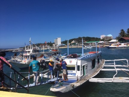
After checking into my hotel (with AC, good bathroom, WIFI, pool and ocean view room), I set out for the main town to arrange a tour to Komodo. Labuan Bajo feels small. Although there are asphalt roads and I encountered at least one traffic light, most of the “downtown” lines the harbour, where tour agencies and dive schools dominate the main street. I arranged for a tour to Komodo along with 5 other stops, aboard a fast boat for the next day.

I met my other tour mates in the car doing the hotel pick-ups: a Venuezalan working in Singapore who had worked for two years in London at the University of Western Ontario, a lady from Latvia who, when asked, told everyone she was from Europe because no one had heard of Latvia, and a couple from Singapore, the fellow was working in Jakarta and was fluent in Indonesian. We also met our two guides, Katherine and Sari, neither of whom looked over 18, and our boat captain and his assistant, both chain smokers in their early 20’s. We embarked on our boat, Wonderful Komodo, which had seating for 12, all outdoors except for a small covered cabin which offered minimal protection due to a smashed window, and no bathroom facilities. To provide seating, the crew threw the life vests onto the roof, never to be seen again.

After an hour motoring amongst the islands, we arrived at our first destination, the island of Padar, one of 3 larger ones (and 26 smaller ones) that makes up the Komodo National Park. The Park is dedicated to preserving the Komodo dragon, whose survival is in doubt due to villagers killing the dragons’ natural food (deer and pigs) and environmental pressures like fires. Tourism is viewed as a possible saviour – the fees and employment brought by the tourist trade provides strong incentives for the Indonesians living on the islands to work to preserve the animals rather than kill them.

We disembarked at Padar, paid the park entrance fee and climbed up one of its many hills to enjoy breathtaking views:

IMG_5224

Another 30 minutes by boat and we approached Komodo, where, to my chagrin,  a cruise ship was moored in the harbour. I shouldn’t have been surprised – this ship had been the subject of an episode of Mighty Ships and the stop at Komodo was one of the highlights. Still, after all the challenges I had faced to arrive at Komodo, I felt a little cheated to see the ship there, It certainly detracted from the remoteness of the place.

IMG_5236(1)
Cruise ship off of Komodo Island

As we approached the park office, our luck with the weather ran out. We had been one step ahead of ominous rain clouds all morning, but they caught up with us and opened with a flood of water. We took cover under the tarpaulin shielding the eating area, but after a while there was 6 inches of water underfoot and we were all sitting high on benches in a vain attempt to keep our feet dry. Our guides gave us a choice – wait out the rain (it could be a very long time), or don rain jackets and go visit the dragons. We chose the latter.

As required, we paid the ranger fee and met our ranger who told us the rules. “The dragons are dangerous”, he explained. “Stay on the paths, in a group and if approached by one, let me handle it.” He carried a yellow wooden two pronged pitchfork, which would be used to tame a dragon if it came near. “The dragons have a third eye on the top of their head and if the stick was placed there, it disorients the dragons.” With that, we started along a path towards a watering hole where dragons often congregated.

Sure enough, a dragon was laying there. Eight or 9 feet long, its eyes followed us as we moved around, occasionally lifting its head, but never its body. The ranger knew this one well; he said it was an older one (he could tell by its weight, or lack thereof) and that it was unlikely to attack. With that, he directed each of us to go around and behind the dragon (what happened to staying with him in a group?) while he expertly took pictures of us with the dragon. Despite our ranger’s assurance that this dragon would not hurt us, its powerful arms were intimidating. If we were in a foot race, I have no doubt who would win:

IMG_5250
Me and the dragon

Over the course of the next hour, we came across 3 more dragons, all near watering holes and none standing, They lay still for hours on end, completely camouflaged with the surrounding ground, until an unsuspecting deer comes for a drink, then they pounce. They secrete a poisonous venom, along with biting their prey with strong, sharp teeth. They have been known to kill humans. The younger ones, under 7 or 8 years old, climb trees and spend their formative years there, to avoid being cannibalized by their parents, staying on the ground only once they become too heavy to climb.

IMG_5259
Komodo dragons lying in wait

The rest of the day was spent snorkeling, walking on pretty pink beaches and searching (unsuccessfully) for mantra rays in the water. But I didn’t care. I had come to see the dragons and they did not disappoint.

Boracay: Paradise Lost

With Manila failing to impress, just another overcrowded, smog filled mega city with limited historical, architectural or cultural attractions of interest to me, I turned to what all the experts identified as the crowning glory of the Philippines, its islands. It has over 7,000, but 3 kept coming up as particularly beautiful: Cebu, Palawan and Boracay. Cebu was on the Canadian Foreign Affairs watch list, so I vetoed it. Palawan looked positive, but hours of searching on Expedia.com failed to turn up appealing hotels within my price range. They were either outrageous, hundreds of dollars per night for western style resorts, or so cheap that necessities like air conditioning and private bathrooms were lacking.

Thus, Boracay won by default, but it was a risky choice. In April, 2018, the Philippines’ president, Rodrigo Duterte, declared the island “closed” due to its lack of cleanliness; he actually called it “a cesspool.” For 6 months, the island was off-limits to tourists, while the locals picked plastic off the beach, reconstructed sewer lines so that hotel sewage did not flow directly into the sea and upgraded infrastructure to ensure environmental standards were adequate. The island had reopened in October, 2018. I thought, naively, that since it had only been open for a few months, there would be few tourists, far less than the 2 million that arrived there in 2017, and everything would be relatively clean.

If I wanted to create a case study in how to make a bad first impression of a sun destination, Boracay would be perfect. After an uneventful, but expensive ($600 round trip) 40 minute flight from Manila, me and the other passengers walked to the miniscule Caticlan airport arrivals area where we waited half an hour for our luggage to be off-loaded manually from the plane, put into luggage carts then again manually unloaded, not onto conveyor belts, but raised tables. As soon as a few bags were placed on the tables, the 150 or so passengers surged forward to see if their bags were some of the offloaded lucky ones, only to be pushed from behind by other like-minded passengers. When it couldn’t get much worse, an Air Asia flight landed and dislodged another 150 passengers into the already cramped arrivals area. More pushing and shoving ensued.

Eventually, I retrieved my luggage (Philippine Airlines had decided it was not appropriate hand luggage, despite fitting easily into the metal measuring contraption) and went outside to look for a sign with my name from my pre-arranged hotel transfer. I found it and was escorted to a mini-SUV where 3 Filipino Americans were waiting. They were here for a wedding and the mother, perhaps in her 60’s, was none too happy. They had flown from Los Angeles that day, the wedding was in two days and she had been excluded from the planning process. Nonetheless, she said, 70 of the groom’s friends and relatives had flown in from the USA for the ceremony. Her daughter volunteered the bride’s family was from Boracay, which partly explained the location, but more importantly, it was 1/3 the price of a similar wedding in the USA.

We drove a grand total of less than 10 minutes in the comfort of the air conditioned SUV, when the transfer guide ordered us out of the vehicle. We had reached the boat jetty but before we could enter the terminal, we had to stand in line for registration and confirmation of a hotel on Boracay that had been issued an environmental compliance certificate. Naturally, this required filling out forms in triplicate using carbon paper (hadn’t seen that in decades) along with presenting our passports and providing personal information (occupation “not applicable” sufficed) which bore little relevance to protecting the environment.

Upon finishing the formalities, our guide hustled us into the boat jetty terminal, past the ticket taker and onto the pier, a concrete affair with basic, but colourful catamarans lining both sides, tethered by ropes and narrow, shaky gangplanks we were forced to traverse to enter the boat. I handed my bag to the guide, uncertain if I would be able to either maneuver it into the boat  or throw it on the roof where a crew man caught suitcases and piled them high on the cabin, with no visible signs of securing the bags. With misgivings, but no other choice, I ensured my cell phone was pushed deep in a pocket, grabbed both of the flimsy railings and gingerly crept the 10 feet or so down the wooden plank and onto the boat.

IMG_4958
Boat transfer to Boracay

Inside, the luxury level remained low. A narrow passageway was flanked by rows of narrow wooden seats, each carrying two passengers. Above the seats hung two long poles, holding life vests which were uniformly ignored by all. As soon as the last seat filled, the captain turned the motor, backed out of the mooring place and off we scooted to Boracay, less than 10 minutes away on a relatively smooth crossing.

Arriving at Boracay, we disembarked on the same, rickety gangplank, but instead of stepping onto a solid pier, the 100 foot floating jetty in Boracay was made from recycled plastic, which may be environmentally sound, but bounced around in the waves and made pulling wheeled luggage a challenge. To top it off, the jetty ends, not at a wooden or concrete pier, but right on the beach, in sand, through which we now dragged our bags and dirtied our feet.

The guide led us to an open air jeepney which would transport us and our luggage to our respective hotels. Boracay is a fairly small island, only 10.2 kilometres and shaped in an oval, with some parts being only a kilometre wide. The jeepney drove to Main Road (as opposed to Back Road) which, not surprising, is the main road on the island. It is heavily built up, with structures lining both sides, but at least half of the structures were either closed due to lack of environmental certification, or undergoing some sort of construction, making my first impression of Boracay equivalent to visiting a massive building site, with the noise and dust to match.

I wrongly would have expected Main Road to bear some resemblance to an actual road. Aside from being bordered on both sides by buildings, it didn’t. To comply with the environmental decrees, new sewers under the road were being drilled, leaving most of the road unpaved and sandy, with the work not expected to be complete until 2020. Sidewalks did not exist and the road was so narrow that two normal size SUVs could barely pass each other. Welcome to Paradise!

IMG_4967
Main Road

It was time to hit the beach and see if all the accolades were valid. To some extent, they were: the water was the requisite turquoise and clear, the sand soft and white and palm trees lined the back of the beach, providing much needed shade. Just past the palm trees was a pedestrian path of sorts, half asphalt, half sand, where hundreds of buildings faced the sea – restaurants, massage parlours, tour agencies offering water sports and souvenir shops galore. Signs warned of dire consequences if you dared to litter, smoke, use plastic, drink alcohol, play loud music or construct commercial sand structures on the beach.

To be fair, the beach area appeared spotless. In the 4 days I stayed, I didn’t see a single plastic bag, discarded cigarette or any trash whatsoever on the beach, although some energetic locals sculpted the words “Boracay, 2019” with the precise date in sand and charged tourists to pose in front of it, which I suspect would constitute a “commercial sand structure,” but no one seemed too concerned.

There were, however, thousands of tourists, primarily Korean and Chinese but also a smattering of Russians and Australians. When I say thousands, I mean so many that it was hard to see the sand for all the people. And, for the most part, these tourists didn’t sunbathe in the way I think of sunbathing – getting a towel, lying on the beach under an umbrella which were sorely lacking, slapping on sunscreen and reading a juicy romance novel. Rather, most preferred to stay well covered up from the sun save for the mandatory run-into-the-water photo or video, and parade up and down the beach in large groups, so there was a constant army of people marching back and forth making my attempt to claim a little piece of sand as my own for a while completely futile.

IMG_4971
The beach

Now I recognize that I am being completely hypocritical when I complain about too many tourists, being one myself, but I had not appreciated until I went to Boracay how overtourism can destroy a place. The environmental damage, emanating from the rapid and shoddy construction of too many resorts to accommodate the growing number of visitors, the dumping of sewage straight into the sea and the sheer volume of garbage, must have been mammoth to cause a complete 6 month  shutdown of the island.

But no amount of clean-up will address the other problem: the large number of tourists. Some places – Venice, Barcelona, Dubrovnik – come to mind, are dealing with the problem of too many visitors by charging admission, imposing maximum numbers or restricting cruise boats. The Philippines are too poor to undertake such actions. An attempt to limit the number of beds on Boracay to 5,000 fell by the wayside. Boracay and the other popular beach islands provide too many jobs and opportunities for too many people and the nouveau tourists of the Asian giants, buoyed by budget airlines and cheap food and hotels, are going to keep coming for their beach experience, In isolation, their Instagram inspired photos will look magnificent, but pull back a little, see the hordes that crowd the island and Boracay is less a paradise than a warmer version of the rat race, with tourists scurrying about to do their beach vacation just like the photos say they should.

IMG_4975
Me and hundreds others enjoying a sunset

Trying to find the Philippines: Manila

I arrived in the Philippines with no expectations, just a desire to see and learn about a country whose people, when they emigrated to Canada, struck me as gentle and kindhearted. Internet searches touted Manila as a vibrant, cosmopolitan city, the Unesco world heritage rice terraces of the Philippine cordilleras were highly recommended and, of course, the thousands of islands, tropical paradises all with the requisite white sandy beaches, turquoise waters and palm trees swaying in the wind.

I looked closer into going to the rice terraces, but every guided tour involved a bumpy 6-8 hour ride in a four wheel drive vehicle, followed by a night in lodgings universally described as rustic and basic, which translated to no air-conditioning, no indoor plumbing and the possibility of plenty of unwanted insects or worse. It was a lot of effort to see rice fields, which, despite their 2000 year old history,  Instagram perfect photo opportunities and heritage status were still, at the end of the day, rice paddies. I passed.

Thus, I decided to concentrate most of my time in Manila, a conglomerate of cities with a population in excess of 12 million and the dubious honour of being the densest city on the planet. Despite my unfortunate drugging/robbing incident, I persisted in spending 8 days in the city trying to understand a bit more about Filipinos, their history, culture and what makes them tick.

I started with a 2 1/2 hour walk from Makati to Manila Bay, seeing a cross section of neighborhoods, from the wealthy skyscrapers in Makati to the shantytowns that line the airport and waterways. While I didn’t inspect the shanties on foot, they didn’t differ much from the worst shantytowns I had visited in Johannesburg or Calcutta; houses built piggly wiggly, with corrugated metal roofs and walls made from a few wooden planks filled in by cardboard. The waterways provided the only available plumbing and electricity was freely stolen from electric poles, with wires dangling along what passed for roads.

IMG_4877
One of many shanty towns in Manila

I had decided to walk as the traffic was horrendous, but I hadn’t realized how pervasive the smog was. As I started from my residence, the heavy gray air emanating from millions of vehicles spewing diesel fumes obscured the sun. Thirty minutes into my walk, the smog entered my lungs, making me wish I could buy one of those textile face masks that were worn by a third of the populace on the streets. It got worse – an hour later – I could feel the grit on my skin, where it stayed until I showered back at the residence. I had heard about the smog problems in Beijing and New Delhi, but Manila should certainly be added to the list of very polluted cities.

Curious to see more picturesque sites than smog and shanties, I signed up for a day tour of Tagaytay, promising volcanoes, palaces and a bamboo organ. A driver and guide picked me up promptly at 8:30 and announced I was the only participant today. Great, I thought, no fights about the middle seat but not so wonderful for meeting people. After 2 hours in Manila traffic, we finally arrived at our first attraction – the palace. Not some ancient Filipino/Hindu/Spanish palace, but a summer home started yet never finished by the former dictator, Ferdinand Marcos and his wife, Imelda – she of the thousand shoes- fallen into disrepair. There’s a darker side to the house/palace. Construction began to welcome then US President Ronald Reagan to the Philippines in 1981 at a cost of US$ 10 million, but Reagan cancelled his visit and the mansion was abandoned. What is left is a monument (amongst many) of the Marcos’ opulent spending and a reasonably well maintained road to a better view sight of the Taal Volcano.

IMG_4856(2)
Abandoned Marcos” Palace

After taking a Jeepney to the very best view sight, the volcano was completely obscured by the abundance of low lying clouds. Undeterred, the driver and guide drove down below the clouds, where at least a view, if not bright blue skies, was possible.

IMG_4871
View of the volcano. The structures on the water are fish farms.

The tour went downhill, literally and figuratively, from there. After another hour in Manila traffic, we stopped at tourist sight number 3- the Jeepney factory. These vehicles are a hybrid Jeep and minibus, adapted by the Filipinos after WW2 to serve as local buses. We walked around for a few minutes, before the guide conceded that the factory wasn’t busy because it was soon to be closed. The government had ordered all diesel Jeepneys to be replaced by electric ones, making this factory obsolete.

IMG_4886
Me and a jeepney

Our final stop was the church housing a Bamboo Organ, the only one in the world. Unique it may be, and it did make beautiful sounds, but I will spare the details other than to say it was hardly overwhelming.

Feeling no further enlightened about anything Filipino after this tour, I signed up for another one, this time to Corregidor Island, located 40 miles from Manila.

Some history, much of it gleaned from my guide Brian on the Corregidor tour. In 1521, after becoming the first European in centuries to visit the Philippines (via South America), Ferdinand Magellan arrived, claimed it for Spain (he’d had an argument with his Portuguese king), converted some of the locals to Catholicism and was promptly killed in a battle by a poisonous arrow. The Spaniards stayed for roughly 375 years, until they managed to lose the area to the Americans after the Spanish – American war and the 1898 Treaty of Paris (and payment by the US of $20 million). The Americans ruled it until 1942, despite what the Americans refer to as the Philippine insurgency and the Filipinos refer to as the American-Philippines war circa 1898-1902. Between 1941 and 1945, the Japanese occupied it, but eventually a US/Filipino force liberated it following the devastating battle of Manila, in which over 100,000 civilians were killed. A year later, the Philippines were granted independence, but didn’t get rid of the last US armed forces base until 1991.

Corregidor is one of 5 islands strategically located in the Bay of Manila and was the center of the US presence since 1902. A large US base was located there, complete with cinema, bowling alley, a railroad and all the trappings of a small US town. Not so prevalent in small town USA was the Malinta tunnel, burrowed under the mountains to provide security for civilian and military headquarters, a hospital and food and arms storage.

On May 8, 1941, 9 hours after Pearl Harbor was bombed, the Japanese Air Force stuck the main Philippine island of Luzon, followed by ground troops a few days later. Opposition came from a makeshift amalgamation of regular US and Filipino soldiers – the latter had been separately trained since 1934 in anticipation of independence in 1944- but they lacked the arms and manpower to overcome the Japanese, who proceeded forward to Manila quickly and were targeting Corregidor. MacArthur was ordered to leave the island by Roosevelt. On March 20, 1942, he made his famous “I shall return” speech from the boat launch on Corregidor Island, where now a statue marks the spot.

IMG_4913
Me, the statue of MacArthur and the wind on Corregidor

Corregidor was eventually captured by the Japanese army, but instead of the 50 days they expected to take to overrun the island, the spirited fighting of the Filipino forces engaged their enemy for 150 days before conceding defeat. Brian was very proud of this fact and repeated it numerous times during our tour. Eventually, the Japanese prevailed and were ruthless in their victory. In the infamous death march, over 70,000 US and Filipino soldiers clamoured through the jungle for two weeks without food or water to a POW camp. Over 20,000 did not make it.

Today, Corregidor Island is a monument to the war. Tours drive past the remnants of the army barracks, the 19.5 miles of railway line, the tennis courts and the anti-aircraft batteries. Three monuments commemorate those who died during the war – the Pacific War Memorial funded by the US, the Filipino Heroes Memorial and the Japanese Memorial Garden. When the joint American and Filipino forces invaded Corregidor in February, 1945, most of the 2000 Japanese soldiers committed suicide rather than surrender, including blowing up the Malinta tunnel. The 20 Japanese soldiers who did not die were tasked with salvaging the tunnel. Today, it had been rebuilt and a sound and light show is presented walking the tourist through its construction, uses and significant events during the war, with the finale being the playing of the Philippines anthem. Tours today are offered in both English and Japanese. Brian said the content of the Japanese tour differs slightly, emphasizing Japanese strategy and battles.

It was an educational tour, enlightening me about WW2 and the war in the Pacific beyond my high school highlights of Pearl Harbour and the atomic bombs. But despite the efforts of the tour guides at Corregidor, I still didn’t feel I understood the Philippines, or in the vernacular, what makes it tick.

Various internet sources about what to see in Manila were uninspiring. Too many of them focused on its fabulous shopping centres, something I do my best to avoid, its food markets, of which I had my fill or Intramuros, the old walled city I had walked through on my first foray out of my residence, but it was dominated by Spanish colonial history. Surely the Philippines had a history before the Spaniards came.

It was just a little hard to find, but I persisted and made my way to the Ayala Museum. Housing archeological treasures, gold artifacts, textiles and dioramas displaying centuries of Filipino history, it provided a chronological retelling of settlements, societies and significant events in the Philippines. There was life before the Spaniards! 4000 years ago, waves of Chinese and Malays migrated to the islands, integrated with the largely fisherman tribes who had been there for 40,000 to 50,000 years and began farming the islands. Indians arrived as early as 900AD, creating Hindu/Buddhist states. Rather than a single empire, these were largely small, local cities or villages. The earliest writing is attributed to a text in 900, in which the ruler released a local fellow from his debt. In 1380, the first Arabs arrived and created some Sultanates, the remnants of a small Muslim minority still exist mostly on the southern islands.

Then the Spaniards arrived. I heard, from tour guides, that the Spaniards gave the islands its religion – Catholicism – and the Americans gave it English. Today, Tagalog (Filipino) and English are the two official languages, with most schools teaching in English.

I left knowing a little more Filipino history, but still not understanding much. Everyone said that if I wanted to appreciate the Philippines, I had to go to one of the islands. So my next stop is the island paradise of Boracay.

Drugged and Robbed in Manila

This is a tale of letting my guard down, trusting seemingly kind people and ending up being drugged and robbed. Six days later, all is fine, but some hard earned lessons were learned.

I arrived in Manila on Thursday and immediately encountered its infamous traffic as the taxi took nearly 2 hours to drive the 6 miles from the airport to my Airbnb in one of Manila’s most upscale areas, Makahati, and the Gramercy Residences. It is the highest building in Manila at 76 floors and its neighbour, for better or worse, is the Trump Tower.

On Friday, I decided to avoid the traffic and walk the 7 kilometres to the old part of Manila, Intramuros. Armed with Google Maps, I made my way towards the Bay of Manila, passing through wealthier and poorer neighborhoods, where the sidewalks were jumbles of broken concrete,  poles were threaded with electricity stealing wires and clothes hung out to dry at every window.

IMG_4743
Chaotic street scene in Manila

Tuk-tuks and scooters were the transport of choice, along with a uniquely Filipino vehicle – the Jeepney – an elongated Jeep adapted after WW2, plying set routes as mini-buses throughout the city. In Intramuros, I stopped at the 15th century San Agustin Church and walked through Casa Manila, a museum made up to mimic wealthy 19th century Manilian life during the height of the Spanish colonial rule. After having walked around for 5 hours, I indulged in the Manila equivalent of Uber, called Grab, costing  $5.00 for the 45 minute ride back to the Gramercy.

Saturday morning came and I was feeling far less ambitious in terms of walking, so I went to the nearby Salcedo market, a weekly food market offering both Filipino and foreign dishes. It was too early for lunch, so after walking through the market, I left and walked down Makahati Avenue to see its sights.

IMG_4773
Grilled Mackeral and Monkfish in the market

They turned out to be pretty slim, unless non-descript skyscrapers, bank buildings, 7-elevens and the Filipino equivalent of KFC, Jolibee, are to your taste. I started back toward the Salcedo market. Midway there, a 60 year old Filipino lady brandishing an umbrella to protect her skin from the sun asked me if I knew how to get to the Salcedo market. I said I was going there and we could walk together. She introduced herself as Gina and said she was a chef from the Ilocos province, visiting Manila for a few days  with a friend whom she was to meet at the market. Gina said she had 15 grandchildren and one grandson and showed me his picture on her phone. Gina had married at 15, had her first child a year later, but had been widowed for 10 years.

We arrived at the market and sat down. Gina said she would ensure I had proper Filipino food and brought over both a mango and a cucumber drink. I chose the mango, refreshing in the Manila heat. Gina brought other Filipino dishes, including barbecue pork and chicken skewers, rice wrapped in banana leaves, chicken adobo and empanadas. Soon her friends, Sazzann and Baya arrived; Sazzann was 67, but Baya was much younger. They both introduced themselves as business women. Sazzann had a mango farm in Ilocos while Baya bought clothes cheaply in Manila and resold them in her hometown.

The ladies indicated they wanted to go to a cheaper market that sold clothes and asked if I wanted to join them. I’m not a shopper, but I thought, hey, why not have an authentic experience in Manila with some Filipinos. We caught a regular bus and went to the Baclaran market, where hundreds of umbrellas make up the stalls.

IMG_4776
A few of the thousands of umbrellas at the Baclaran Market

Clothes and lots of other things were for sale here at very cheap prices.  Gina bought a hand held portable sewing machine for her granddaughter’s birthday and Baya bought some earrings but that was it. It was hot and noisy and the ladies said it was time for a beer and a Jeepney ride. They asked if I wanted to join them and I said yes. Baya took our picture inside the Jeepney.

IMG_0008
Gina (with the peace sign), me and Sazzann squeezed into a Jeepney

We stopped at an open restaurant/karaoke bar. Gina said her two nieces were going to join us – they were close by and liked to practice English with a native speaker. Meanwhile, Baya bought some drinks: San Miguel beer for them and a Tanguay for me-it tasted like a Smirnoff Ice but with only 5% alcohol and rum rather than vodka based.

IMG_0011
Me, Gina and Baya at the Karaoke Bar

Eventually the nieces joined us, alcohol started flowing freely and the karaoke began. I’m not a singer, but Gina loved to sing – lots of Carpenter songs and Bonnie Tyler’s Straight from the Heart were a few I remember. The nieces said they were both studying business administration in local colleges and seemed like nice girls but there were warning signs. I asked to friend them on Facebook, and they said sure, but later. One of them asked to see the pictures I had taken and spent a long time looking at them on my I-Phone. More food was ordered, more drinks appeared and there was a lot of singing (but not by me). All seemed well.

About 4 PM, one of the nieces asked if I wanted to join them on a shopping trip to the biggest mall in the Philippines, The Mall of Asia. As it had been on my To Do list, I readily agreed and the 6 of us climbed into a Grab taxi. Oddly, we stopped at a Jolibee for more food, which I declined (I was full) and then more alcohol came out. We had been in the cab for at least half an hour, which was again odd as I could see the planes landing at the airport and knew the mall was close to the airport. I asked what the hold up was – why weren’t we at the mall yet………..

The next thing I remember I was walking back from a bank close to my Airbnb on Sunday about noon. I had tried to withdraw money and couldn’t remember my PIN so I got a message on my phone from the bank saying it detected fraud and I had to call the bank. I walked back to my residence, so unsteady on my feet that I tripped on the sidewalk, ripping my new pants at the knee. A passerby saw me and helped me up, then walked with me the 2 blocks to my place. Try as I might, I have no memory of anything after being in the cab on Saturday, not where I slept that night or what prompted me to go out to the bank that Sunday.

As the fog in my head started to clear, I took stock of the damage. It didn’t take a genius to figure out I had been drugged, probably with Ativan, also known as the date rape drug, but aside from a bruised knee when I fell and a heavy head, I felt physically fine. I still had my I-Phone and my purse, but looking through it, I noticed by debit card was gone, along the equivalent of $80 in pesos and a note about my PIN on my US dollar Visa card. In retrospect, it was a pretty stupid place to leave the PIN. My Canadian $ Visa was still there; that was the one I had been trying to withdraw cash from when my memory returned.

A few days later,  I still have no recollection of anything between 4PM on Saturday and noon on Sunday. I asked the building’s security to review the CCTV to find out when I came home and how but have no results yet. I also had a strange note in my pocket, partly in my writing saying “you stole 10,000 k from me” (the equivalent of $250) and a cab’s license number in writing I didn’t recognize.

When I checked my bank accounts, 10,000 Philippine pesos had been withdrawn from my US $ Visa account. I quickly cancelled the account (and CIBC said they would reimburse me the funds since it was fraud and I was a good customer) along with my debit card. To date, nothing untoward has happened with my Canadian $ Visa card and I can only assume they either missed it or ignored it if I was unable to give them the PIN. They left me with my passport, health care card and driver’s license, far more considerate than the pickpocket in Riga. I suspect they made sure I got back to my residence. Other internet posts I have since read say this is the norm as they hope if not too much is missing and you end up back at your place, you won’t go to the police.

On Monday, I went to a local walk-in medical clinic to learn more information about the drug. It cost only $12.50 to see a GP. She advised of the problematic warning signals to watch out for – seizures, shortness of breath and excessive sleepiness past two days. She also offered to arrange for a toxicology exam so I could determine exactly what drug I had been given. As I did not seem to have any lingering symptoms, I declined but I did go see a neurologist to discuss the potential symptoms as well, This cost $29 and I had to wait half an hour for an appointment. Whatever issues I may have with the criminals in Manila, their medical system was a treat.

I also decided to go to the police station and make a report. Unfortunately, the officer seemed completely uninterested until I told him I had photos of the culprits. Although the nieces had erased the photos on my camera roll, I had sent some photos to my son and brother and they had not been deleted. The police officer took a picture of the thieves and another of the note with the driver’s license, but wouldn’t let me fill out a report. As I couldn’t remember where the theft had occurred except near the airport, he concluded that it was outside of his jurisdiction and he couldn’t or wouldn’t do anything about it.

It’s been 6 days since and all is well. Part of me wants to contact Grab and find out if the license number on that paper is theirs and, if so, to see if they have records of who called the taxi. But I have decided against it. I have to let this go and chalk it up to a bad experience which could have turned out a lot worse. I am out $80 but am completely healthy and like to think a little wiser about being victimized by scammers.  Although I had heard about scams like this, it was always young people in bars at night, not grannies in popular food markets. Sadly, I will be more reluctant to trust locals. I will also be adamant only to drink from bottles I have seen opened, never let my drink out of my sight and never share food with anyone, no matter the culture.

When I told my father what happened, his reaction was to return to the safety of Canada. I didn’t even think of doing that for a second. I have loved every adventure, positive or negative, I have encountered in the last year. Being drugged and robbed was definitely not a highlight, but it will give me endless stories. And despite its ending, I thoroughly enjoyed the Jeepney ride, the karaoke singing and the Tanguay drink with the grannies.

Next post: I Shall Return, said General MacArthur, but I probably will not.


Adelaide: A Boring City?

To be clear from the start, I do not think Adelaide is a boring city, but I kept hearing this from locals. On my second day, I went into the Glenelg  (a suburb of Adelaide where I was staying) tourist information center and asked the attendant what sights I should see during my 12 days in the city. He thought long and hard before responding:

“Maybe the Barossa Valley if you like wine and Kangaroo Island.”

“What else?” I probed.

“There’s really not that much to see around Adelaide.”

It was hardly an enthusiastic endorsement of Adelaide’s charms. As I do like my wine, I booked a day tour to the Barossa Valley. I looked at Kangaroo Island, with its minimum $300 for a day trip, to see what it has to offer. It is a protected nature reserve about an 1.5 hour drive from Adelaide then a 45 minute ferry ride, home to kangaroos, koalas and sea lions. Cute as kangaroos are, I’d already seen hundreds of them. I’d spotted wild koalas in Otway Park just a few weeks before and I had visited a large, loud, smelly herd of sea lions on the Skeleton Coast in Namibia a few years prior. There are hiking trails on the island but I prefer to hike on a flat beach rather than a rocky, hilly path in the middle of the forest. Kangaroo Island was out.

However, Barossa was in. One of 4 wine areas around Adelaide, it is world famous for its shiraz red wines. I signed up for a tour. Mindful of how inebriated I got on the Swan River tour a few weeks before, I decided to play it smart and restrain myself. I ate an hardy breakfast before joining the  group. There were 19 of us – a semi-retired couple from Bellevue, a husband and wife from Whitehorse, 3 Brits, a young American couple, Cathy from Hong Kong and the rest Australians. It was a good group but decidedly less interested in getting hammered than the Swan River group.

Our driver regaled us with stories about Adelaide during the hour and a half ride to the first winery. First, and foremost (and repeated often by various Adelaideans) was Adelaide was unique amongst Australian states insofar as it was not founded by convicts. Instead, free citizens of Britain voluntarily came looking for land, mostly city dwellers with limited education (this will be important later on) and German Lutherans fleeing religious prosecution back home (this too will also become important). The two groups mixed, built churches (lots of them), drank tea (plenty of it) and, from the Germans, brought over wine clippings which formed the basis of the vineyards around Adelaide.

Our bus driver then exclaimed that Adelaide was boring! Too many churches and tea houses. There wasn’t a lot to do in the area, except pray, sip tea and have the occasional glass of wine. This was starting to sound, well….boring…..until he mentioned that Adelaide was known as the serial murder capital of the world. Maybe there was something interesting here after all…

Returning to the wine tour, it was far more restrained than that of Swan River. We only visited 4 wineries with 4-6 tastings each, all much smaller than the ounce per taste in Perth. Moreover, there were spittoons so one didn’t need to drink the wine. It was all so civilized and no one got drunk. My highlight was trying the local specialty, a bubbly Pinot Noir served cold on X-Mas morning. The Aussies regard it as a treat; I thought it tasted like cherry juice and most of mine ended in the spittoon.

Our guide provided a never ending commentary about Adelaide. In addition to it being the serial murder capital of the world, it was also the first state to allow women the vote, the first to have an aboriginal governor, the first to have a telegraph joined to London, the first to tolerate homosexuality and the first to decriminalize marijuana.

With 9 more days following the wine tour, I tried to find something interesting to do. I went to the CBD, which looked remarkably like the other CBD’s I had visited in Melbourne and Perth – modern, clean, broad sidewalks, skyscrapers with familiar names, a pretty pedestrian way with crazy sculptures, a botanical garden nearby, a convention centre, a zoo and a central market offering fresh fruit and vegetables. It was all sounding like something I had seen before in other Australian towns although the art differed:

So I looked for something different. Glenelg (the name is a palindrome) where I stayed has a beach where I went walking two or three times a day. The shore was lined with million dollar houses and just a few hundred metres away was the major airport. I walked along the beach, waiting for the airplanes to land or take off – which they did regularly, creating great plane spotting opportunities but probably did little for the house values of the nearby mansions.

IMG_4732
Plane spotting at Glenelg

Along the Esplanade were advertisements for free driverless car rides. I had never been in one, so I signed up to ride in Olli, who was doing test runs along the Esplanade to work out some bugs. Olli was designed for short trips; perhaps in airports or transporting mobile impaired passengers from their houses to bus stops. Some problems had already been discovered – Olli was programmed to stop at blind spots, but as Olli identified light posts as blind spots, he stopped a lot. This has since been corrected.

Our ride today had 8 passengers and a non-driving driver (for safety in case Olli messed up). Olli started down the path, quite slowly. He turned at the roundabouts and waited patiently for pedestrians to get out of the way. He had a horn feature, but in another of those bugs that was fixed, he honked at every pedestrian regardless of whether they were in his path. It has since been disabled.

IMG_4705

Olli had some unique features. If you asked him loudly, in a proper Australian accent, to “please tell a joke”, he, or rather a lady’s voice, obliged. The non-driver asked (my accent was incomprehensible to Olli):

“Olli, please tell us a joke?”

“What does a snake use for support?”

“A cobra.”

How is that for a little driverless humour?

As I may have mentioned, Adelaide was not a very exciting a place, so my thoughts turned back to the serial murder capital of Australia moniker. To be sure, there had been a lot of murders in the city, but it had really gained fame due to a three part TV documentary titled City of Evil, which is easily viewed on YouTube. So I did. Turns out it is not the quantity of the murders in Adelaide, but the quality of the murders, which the commentators kept referring to as bizarre. Headless torsos, mangled parts, burnt ashes etc. There’s the mystery of the Beaumont children, who in 1966 took the bus to Glenelg beach and were never seen again. Or the serial killer, Bevan von Einem, who rescued a homosexual being chased by some nutters (who were also police detectives) who had already killed his companion, and received police congratulations before his murderous tendencies were discovered. In one of the most truly strange analysis, the documentary attributes the gruesome killings to the results of Adelaide’s gene pool, which was either uneducated lower class Brits eager to escape the hierarchal British class system or German Lutherans used to disobeying mainstream society. How these factors led to genetically disposed serial killers is not well explained, but I am not making it up. Watch the series.

Risking being murdered in a twisted, macabre way, I continued with my daily or three times daily walks along the beach. Holdfast Bay was a beautiful beach, with the planes overhead and a leash free zone for dogs before 10:00AM. Hundreds of dogs converged, sniffing each other out, some racing into the water, others gingerly tapping a paw into the surf before deciding to take the plunge. But my favourite experience occurred one evening as I was leaving the beach and crossing the bridge over the marina to my hotel. There, frolicking in the harbour, were two dolphins. They did whatever it is dolphins do – play, dive, swim, jump out of the water, just not pose for great photos – for 15 minutes – before heading back to the sea.

IMG_4719
Two dolphins in Holdfast Bay

Adelaide may be boring, but give me dolphins, planes and serial murders any day and I am happy.

The Ghan: The Train through Australia’s Center

A number of iconic trains make every Must Do train journey: the Trans-Siberia, the Canadian Mountaineer, the Orient Express, the Tibetan railway, the Darjeerling Himalayan Express and, in Australia, the Ghan. As a hopeless train romantic, I have done most of them, although embarrassingly not the Canadian Mountaineer, and less embarrassing, the Ghan. I was about to remedy the latter omission.

As always, some history to start. First, the name. In the mid- 1800’s, European settlers in Australia decided it would make good sense to import camels to the continent to assist in building a railroad from Adelaide in the south, north to Alice Springs in the outback, a giant red, sandy desert that dominates central Australia. Thus, camels migrated to Australia along with their handlers, mostly Indians. But Europeans being Europeans, mixed up India with Afghanistan, called them Ghans and the name stuck. The railway was started in 1878, but didn’t reach Alice Springs until 1929. There is another equally unflattering story about the name The Ghan. The steam engine running to Alice during the early years was notoriously unreliable, earning it the nickname “The Afghan Express” as an insult to the Afghans who helped run it. Whatever the true origin of the name, everyone knows the train as The Ghan. As an aside, the camels were let loose after their work was done, and Australia boasts some wild camel herds that are highly prized in the Middle East.

Back to the Ghan. Finally, in 2004, the line was built from Alice Springs to Darwin, at the northern tip of the continent, a total of 2976 kilometres and a 2 night, 3 day trip (51 hours in total), give or take a few hours, from north to south.

I arrived at the Darwin train station courtesy of the free shuttle from my hotel on the Darwin Esplanade, along with a bus load of other passengers. We soon learned there would be 190 passengers aboard the 39 cars this trip, making the train just under a kilometre long. Live entertainment by a guitar playing singer greeted us at the station, but I was far more interested in ensuring I got a picture of me with the Ghan, as an announcer had advised the station would be the best opportunity for photos.

IMG_4535
Me, the Ghan and other passengers with the same idea

The Ghan has three classes of service: premium, gold and gold single. The big differences between premium and gold seemed to be a smaller wine selection in gold and less walking for premium passengers as the premium cars were in the middle of the train. They also had private mini buses to carry them to the station and excursions. Other than that, I didn’t see much between the two classes.

I did appreciate the gold single. It is a dedicated car at the front of the train containing 20 cabins built especially for one. Each cabinette contains a comfortable chair, footrest, table, sink, cupboards for storage and USB charging ports. At night, the staff combine the chair and footrest into a single bed. Sharing the singles cars are two surprisingly roomy shower cabins and four bathrooms. Three cars down is the lounge car for the forward section, where a good selection of Australian wines, beers and liquors were generously poured throughout the days and nights, along with offerings of munchies and fruit.

We were asked to select our meal times and wait (with a drink) in the lounge car to be escorted to our table by the hostess. Couples were seated together; all others were seated at the nearest empty chair at the tables for four, leading to a pleasant rotation of meal partners and an opportunity to meet many of the other passengers. I unofficially guessed about 2/3rds of the passengers were Australian, quite a few Brits, some Germans and a smattering of others, including me and a younger American. Most were retired although there were a couple of kids on board. Everyone shared a love of train travel and a desire to see Australia’s outback.

Meals featured locally sourced food, designed to showcase Australian culinary accomplishments. My first lunch’s main course was braised buffalo, which I did not realize had any connection to Australia. I later learned it was most likely water buffalo,  introduced to Australia in the 1800’s to provide meat to remote northern territories. This plan was later abandoned, resulting in thousands of feral buffalo roaming around. The water buffalo are not related to North American buffalo/bison, but their meat was similar – like beef but lean. Subsequent meals included crocodile cakes (yummy) and Kangaroo medallions (tasty but tough). My new found favourite was coconut ice cream, served as a dessert with all the lunches and dinners, along with scoops of chocolate and wattle seed (an unique seed to Australia ground into flour by the Aboriginies) ice cream.

An hour after lunch, we arrived at our first excursion, Katherine Gorge or, as it is now called after reverting to its aboriginal name, Nitmiluk Gorge. Majestic sandstone cliffs carved out by the Katherine River provide spectacular vistas. Mother Nature was being  unco-operative; the helicopter and art viewing tours were cancelled due to rainstorms in the vicinity, but the cruise down two of the gorges was proceeding. It was in the low 40s as we set out on the water, making it unlikely to see crocodiles who usually surface only to warm themselves on cooler days. I wasn’t at all bothered – seeing 3 meter long crocodiles a few feet away is not one of my favourite experiences. What I much prefer, and what we did see, were giant walls of sienna, yellows, oranges and brown sandstone with shrubs and trees sprouting all over:

IMG_4577
One of the Nitmiluk Gorges

Three hours later our bus returned us to the train for drinks, dinner, more drinks and finally, sleep. Our beds had been made up when we were in the dining car. A chocolate lay on each pillow. The beds were firm, the rolling of the train soothing but alas, the occasional squeaking of the brakes and the rattling of the imperfectly fitted door to my cabin prevented a deep sleep. About 3:00AM, I jiggled the door, put a facecloth into the door jamb and fell fast asleep.

We stopped the next day at 10:00AM, in Alice Springs. If you picture Australia as a circle, Alice Springs would be dead center, and it is the center of the outback. With a population of about 25,000, it is the only town of any size between Darwin and Adelaide. It is the home base for the Royal Flying Doctors Service which has provided medical attention in the outback since 1928, and School of the Air, which educates children living in remote regions first by radio but now via internet. It is also home to a joint US/Australian military base run by the CIA with advance radar capabilities, tracking satellites etc. over China, Russia and the Middle East. Alice Springs is the Alice in A Town Like Alice by Nevil Shute, a novel focusing on the efforts of a post WWII woman to create a town like Alice Springs in the outback.

One of our excursion options was to the tourist sites in Alice Springs- the Royal Flying Doctors service museum, the Radio of the Air museum and the Telegraph museum – but as there was no stop at the somewhat secret US military base and as I had spent time in Alice 25 years before, I passed on the city tour and instead opted for a visit to the Desert Park. Normally, a hike through the desert at Simpson’s Gap is also offered, but with temperatures expected over 45, cooler heads decided hiking a bunch of near seniors in the desert sun for a few hours was probably not a good idea, so it was cancelled.

With ample warnings about the heat and heat stroke prevention, water bottles offered at every entrance and exit, we set out for the Desert Park, part living museum, part educational facility showcasing the fauna and wildlife of the desert. Normally the rangers take guests on walkabouts, pointing out the plants and animals that thrive in the desert, but with the thermometer already reading 44, we were gently walked straight to the amphitheatre for the bird show.

I wasn’t sure what to expect at a bird show. I’ve been to breakfasts with birds, where well-trained parrots share your food, but this was different. A ranger came out and explained that all the birds which would be performing were local – falcons, magpies, owls, eagles, kites, black parrots – and they would be flying above our heads at speeds of up to 100 kilometres an hour. Out of nowhere flew a kite and landed on the outstretched arm of the ranger. She proceeded to throw food in the air, and the kite flew and caught it. A barnyard owl rose out of a hollow trunk, seemingly on cue, and flew silently overhead. We learned later that the owl is kept in a cage (just for a few minutes) in the hollow, with a door that releases when the ranger gives the signal. For 15 minutes, various birds entertained us with their flying and hunting prowess. Only the falcon was out of sorts -it was molting and couldn’t fly. I was amazed to watch these birds – I had been unaware that birds of all sorts could be trained (all food motivated the ranger said).

IMG_4609
The barnyard owl performing

We returned to the air conditioned comfort of The Ghan for lunch and drinks and watching the desert landscape roll by, including the dried out bed of the Todd River.

IMG_4678

Our final stop was late that evening, at Manguri. It is, literally, a train stop. Picnic tables lit by candles had been set up right outside the train and waiters strolled about offering Bailey’s and gourmet chocolates, which melted very quickly. It was still 36 degrees. The real star (sorry about the pun) were the stars, with the Milky Way visible along with other southern sky constellations that I cannot name. It is a beautiful sight, but quite impossible to photograph using an I-phone.

I slept much better the second night. After enjoying a hot shower and a leisurely brunch, the train pulled up in the Adelaide station 10 minutes behind schedule at 12:40. It had been a fabulous train ride, meeting all my expectations and providing fabulous views of the scenic outback.

Note: Booking is easily done on the internet through greatsouthernrail.com.au. A single cabin in the low season, all-inclusive including food, drinks, excursions and transfers, cost Australian $1750.


Cycling done right: Perth

Perth lies inland from the Indian Ocean, 22 kilometres upstream on the Swan River and about 3400 kilometres from the nearest city of any size- Melbourne – which is why it is known as the world’s most isolated city. It is clean and modern, blessed with a Mediterranean climate, abundant agricultural land nearby and rich, grape growing soil. It and the surrounding towns sport a population of 2,000,000. Culturally, it boasts art museums, libraries, sporting facilities galore and a vibrant Aboriginal community. The wide, gentle flowing Swan River divides the city in half, providing ample opportunity for all manner of water sports: kayaking, sailing, jet skiing, paddle boarding etc. along with pretty bridges and a ferry service traversing the river every 30 minutes, taking 7 minutes from dock to dock.

I spent my first day getting oriented and seeing the sights. Compared to the European cities I had just visited filled with centuries old palaces and architectural styles from Gothic to Art Deco, Rococo to Renaissance, Perth was a tad one dimensional. A few mid-19th century churches, a couple of colonial facades, a few buildings that would not look out of place in the American west, but mostly just modern skyscrapers sporting familiar names like KPMG and PWC and Rio Tinto. The downtown area was fairly contained, just a half dozen blocks in any direction and the typical Australian pedestrian walkway with global stores: Zara, Gucci, Uniqlo. A convention centre, a few malls, the central transportation terminal, restaurants offering food from Thai (really big in Australia) to ribs to mango juicers. Nothing spectacular or mind blowing, but everything I could want,

img_4222(1)
Perth Central Business District from South Perth

Whatever cultural or historical shortcomings Perth has, it more than makes up for them in outdoor activity opportunities. Anything to do with water sports is possible, although surfing and paragliding were better done on the Indian Ocean. For me, an avid cyclist, I was anxious to get out on a bike and peddle away. This is not as easy as it sounds as Perth lacks a bike share program. It has a bike rental company, conveniently located on a bike path, inconveniently located a taxi ride or 3.2 kilometre walk from the center of town. Fortunately, my hotel had a couple of bikes for rent, so on I hopped.

My first ride was a “getting to know the rules of biking” in a strange city. Unlike in Mexico City, I didn’t have to write a test, but also unlike Mexico City, the biking is the same as the driving, on the wrong side of the path/road. So my first few turns were tentative, reminding myself to look both ways and stay to the left. Likely in the expectation that non-Australians and non-Brits would use the paths, they were generally marked with arrows reminding me which side of the path to stay on.

And what glorious paths! Not the share the paths with pedestrians or little lines on the side of road, but totally segregated paths in a sienna colour lining both sides of the river. Signs reminded pedestrians that they had separate paths and when cyclists and pedestrians did have a single path, there were both asked to share the paths.

img_4227(1)

I quickly developed a daily routine, cycling across the river to South Perth, then taking the path along the Swan River for about 10 kilometres to the Garrett Street bridge, returning to North Perth all on segregated paths except for a few blocks right in the Central Business District. Stunning views of downtown Perth lined the paths, as did small ponds home to familiar and exotic birds: pelicans, cormorants, ducks, lorikeets, cockatoos and black swans.

When watching birds became tedious, the waterfront provided art works, cultural objects and just plain fanciful objects on which the eyes could feast:

My favourite aspect of the cycle paths, although these were not limited to cyclists, were the ever present drinking fountains located every few hundred metres, most of them equipped with 3 faucets – one for adults, one for children and one for dogs.

img_4245

Anxious to beat the heat one morning, I left at 7:00AM for Freemantle, 22kilometres down the river on the Indian Ocean. I had seen a cyclopath, as they are called here, along the river I hoped would take me all the way to the ocean, but after 10 kilometres, the path left the river and meandered through a residential district, filled with multi-million dollar homes all straining for a water view. The cycling was easy – smooth path, gentle climbs – and the cars never turned right (or more likely left) in front of the bike, forcing me to slam on the brakes. Eventually the path ended and I turned onto the misnamed Stirling Highway, which is not a highway but a major thoroughfare. No bike path was evident, but then I caught sight of another wonderful aspect of Australian cycling – a sign on the sidewalk telling cyclists to share it with pedestrians. How different from Toronto, where the signs threaten cyclists with fines for being on the sidewalk.

After a few hours, I got my first glimpse of the Indian Ocean, at Mossman Bay:

img_4294
The Indian Ocean at Mossman Bay

Views of Freemantle were less impressive; it was a major container and cruise ship port. I walked and cycled around its downtown , but found little that interested me. Another pedestrian street with lots of coffee shops, take-out sushi stores, an abundance of backpacker’s hostels and a giant customs house. It was barely 10:00AM but the temperature was already over 30 and I didn’t have the energy for a 2 hour bike ride back, so I took the easy way out and went to the train station to see if I could take the light rail train to Perth. As in all the transit stations in Australia, I was greeted by an employee wearing a yellow vest:

“Can I help you?” he asked.

“Yes, can I take the bike to Perth on the train?”

“Sure, just buy yourself a ticket. Do you know how to use the machine?

“No, what do I do?”

“Let me help.”

Which he did, showing me, then doing everything except paying. No guessing about how many zones I was going or whether to pay cash or charge card or which platform the train was leaving from. A live human telling me everything I needed to know. Another thing Toronto would do well to adopt. I walked the bike on to the train-no stairs or  escalators and a bike gate to avoid narrow turnstiles. After a 15 minute ride, I was back in Perth.

I spent 13 days in Perth, mostly going for bike rides and walking around. It’s a beautiful city, but not exactly what I would describe as exciting. It was a great place to visit, probably a wonderful place to live and raise a family, but having seen the sights, not one I would likely return to on vacation.

Next stop: one of the best beaches in the world – Broome.


Pretty in Pink: Lake Hillier

In Ireland, I took advantage of its plethora of English language bookshops and purchased a magazine titled 100 Places to See or something along those lines, to give me new ideas about where to travel but really to count the number of places I had already seen. I leafed though the magazine slowly, on my flight to Iceland, during an insomniac episode in Paris, trying to stay awake in Taiwan but it was in Melbourne that I finally reached the last dozen recommendations in Australia and the South Pacific. Smugly, I noted I had visited Uluru, Borobudur in Indonesia, New Zealand’s South Island, but not yet Tahiti. It was the second last entry that caught my eye – a pink lake called Lake Hillier – in Western Australia where I was heading to next.

I had booked 10 nights in Perth, the capital of Western Australia, but left 5 nights open, perhaps to visit Geraldton or Monkey Mia hundreds of kilometres north on the Coral Coast of the Indian Ocean. Public transport there seemed uninviting, involving overnight bus rides and being dropped off on the highway in the middle of nowhere in 40 degree heat, hoping that a shuttle bus might appear from 60 kilometres away. Renting a car was briefly considered, but as I was still looking the wrong way every time I crossed a street, this option might prove dangerous. My search for how to spend 5 days continued.

On a whim, I dropped into the Western Australia Tourist Office/travel agency to ask whether it was feasible to go to Lake Hillier. The receptionist hadn’t heard of it, but another more experienced agent advised, yes, it was possible, but as the lake is on an uninhabited island, the only way to get there was to travel to the nearby town of Esperance and take a scenic flight to the island. Esperance was 700 kilometres away. A regional airline flew there a few times a day, but as embracing the concept of slow travel meant I was in no hurry, I opted for the 10 hour bus ride there and a return two days later consisting of 5 hours in a bus followed by 7 hours in a train. At least I would see the countryside.

So my quest to see a pink lake began. The bus ride was comfortable enough; it was only half full, the seats had USB plug-ins and we stopped at roadhouses (not rest stops but they are the same thing) every couple of hours for “comfort stops” but, said the bus driver “if you must smoke, do it at least 6 metres from the bus.” I had thought we would be travelling through the outback most of the way, so I was surprised to see that we passed through agricultural lands for the first half of the ride. The landscape eventually turned desertlike and I stared out the window, hoping to catch sight of a kangaroo or two. No such luck; they usually sleep during the day and are most visible at dusk or dawn.

img_4422
Desert landscape between Perth and Esperance

We arrived in Esperance a full 40 minutes early and I made my way to the hotel, before walking down the Esplanade adjoining the seaside. It’s a typical little beach town with motels and holiday houses lining the shore, fish & chip shops galore and ice cream parlours offering the best ice cream in Australia, everything one would want in a beach town except a beach. The waves lapped right up to the stone walls and grassy parks, with little sand in sight. A pier, broken in parts and showing signs of rot, reached into the ocean. A sturdier container port with hundreds of containers stood on the other side, marring pretty pictures to the left, but the sunrise was magnificent:

The next morning, a $47 cab ride dropped me at the inexplicably distant Esperance Airport, nearly 25 kilometres from town. The taxi driver, a long time resident, had no idea why the airport was built so far away from the town – the land was quite flat and no topographical explanation was apparent. I decided the land must have been owned by the mayor of Esperance who wanted to make a few bucks, but I had no basis for speculating thus.

Waiting at the airport was Will, the counter agent (the regular one was sick that day), flight attendant and pilot. There I met my co-passengers: Francine was a psychologist from New South Wales on a road trip across the Great Australian Bight as the south coast is called, and a young couple from Switzerland.

Will walked us out to the tarmac and gave us the safety briefing: “No toilets, no drink service, seat belts must be worn at all times as must a pouch carrying life vests. Headphones were also to be worn always and talking was encouraged, except during taxi, take-off and landing.” No one had any questions, so after the obligatory photograph (Will was also the official photographer), we climbed aboard, strapped ourselves in and before my well-developed fear of flying set in, were airborne. Thankfully, except for some minor turbulence from the thermal winds where the land met the sea, it was a smooth flight and I quickly put my fears aside.

We flew first over the completely misleadingly named Pink Lake, which as one can see from the photos, is a lake but hardly pink. In fact, it has not been pink for over 10 years. Now bear with me, there really is a pink lake coming up, it is just not called the Pink Lake.

Middle Island, some 80 nautical miles away (or 85 normal miles) was our destination. At 6.5 kilometres long, it is the largest island in the Recherche Archipelago and currently uninhabited except by a few rats and wallabies. It wasn’t always so – the American and Australia’s only pirate, Black Jack Anderson, escaped the gallows and made Middle Island his base in the 1820’s and 1830’s, attacking passing ships, selling seal skins and keeping an harem of Aboriginal ladies as sex slaves. He is thought to have died and been buried on the island.

Our 40 minute flight flew over some of the most spectacular blue waters lapping up against the whitest sand beaches in Australia. What Esperance lacks in beaches is made up for along the coastline. Silky, pristine sand greeted by rolling waves beloved by sun seekers, surfers and whales alike tucked into horseshoe shaped bays lined the coast.

Then Middle Island came into view and we could see Lake Hillier. Not a pale, greyish tinged red or sienna pink but full on, bubble-gum pink. It can only be described as Pepto Bismol pink. I will let the pictures do the talking:

Will provided commentary about the lake. Its name derives in memory of a sailor aboard The Investigator, a ship which visited the island in 1802 and 1803 whose captain first recorded the existence of the pink lake. The pink  is natural, caused by a bacteria – the scientific name is Dunaliella Salina according to Wikopedia- which interacts with the extreme saltiness of the lake to emit a red dye and give the lake its colour. The lake is the second most salty lake on earth, after the Dead Sea. As a result, it doesn’t support any fish life or much of anything else. Drinking the water is not dangerous, but given the high salt content, not pleasant. It is, however, expensive. A fine of $10,000 is imposed for going into the water and a further $10,000 for taking water out of the lake.

It is possible to visit Middle Island by boat, but it is a 5 hour ride from Esperance, each way. A scenic helicopter service had operated a tour there a few years ago, but after it stranded a group of Chinese tourists on the island following mechanical and financial issues, that was the end of that.

After a few loops and turns over the lake, we started back towards Esperance. One last surprise awaited – a green lake called Woody Lake – to complete the rainbow of colours.

img_4390
Woody Lake

I often wonder why I enjoy travelling so much. The trip to Esperance and the flight to Middle Island encapsulates it. My time on this planet is limited and I want to see as much of it as possible. Lake Hillier, for me, was one of those miraculous beauties that allowed me to marvel at all the wonderful, diverse sights made by Mother Nature. It makes me feel lucky to be alive and to be able to enjoy these amazing locales.

If you are thinking of going, the bus/train fare from Perth via TransWA cost AU$263 (all costs incurred in January, 2019). It takes about 10 hours on the bus or 13 hours by bus and train. The scenic flight by Goldfields (goldfieldsairservice.com) cost AU $370 for a two hour flight, minimum 2 persons. I stayed at the Best Western on the Esplanade costing Cdn $148 per night (booked on expedia.ca) in high season.


Wine Tasting Australian Style

I’ve enjoyed wine tasting tours in South Africa, Hungary and Canada, so I mistakenly thought I knew what I was getting myself into when I signed up for the Out & About Wine tour of the Swan River wineries near Perth, Australia. Precisely at 9:45 AM on Saturday morning, I met the bus at the appointed place and hopped on with 20 others, including a 2 year old girl and a boy of about 6. I quickly befriended Mary and Henry, married Canadians from Edmonton who were celebrating her retirement as a pharmacist with a 6 week cruise of Australasia leaving the next day from nearby Freemantle.

Our guide/driver was Tony, originally from Cornwall but a longtime resident of Australia. In his prior life, he worked for Ansett Airline, but when it folded, he started fitting kitchens and bathrooms. Hours later, when I gently asked him if that line of work was so slow he needed a second job, he dodged the question and said something about liking to meet new people. Something was left unsaid; every person I ever met in construction had more than enough work, but I didn’t push him.

Tony explained that the wineries we would be visiting were those along the Swan River, some of the oldest in the country. Most of their vines had been brought over from South Africa in the last century. Grapes for both eating and making wine were grown, with lots of streetside stalls selling grapes. Then Tony asked where we would like to be dropped off at the end of the day – special requests were welcome including my hotel. Strange I thought; the bus tour doesn’t do morning pick-ups but does afternoon drop-offs?

A short 45 minutes later, the bus stopped at the first winery, Lancaster. Greeting us at the tasting table were 20 wine glasses, a plate of cheese varieties with biscuits and 9 bottles of wine. Our Lancaster host described each vintage – 3 whites, 3 reds and 3 dessert or late harvest wines – and began pouring a small amount in each glass. Naturally, I tried them all, enjoying their specialty, a Chenin Blanc the most, along with a cheddar cheese laced with peppers and chilies. Our host told us the late harvest wines were sweetest since they had been on the vines the longest and their sugar had been the most developed. The Canadian equivalent is the Ice Wine, left on the vines until after they freeze. Regardless of the title, I find the ice wines/late harvests too sweet.

img_4251
Me, wine and grapes at Lancaster

I was feeling pretty good as we returned to the bus, thanks to 9 tastings all before 11:00 AM. As we were promised a gourmet platter lunch, I had skipped breakfast and eaten nothing but the cheese which I am sure contributed to the good feelings.

In the 5 minute drive to our next winery, Tony advised that we would have a total of 46 wine tastings today, but if we tried hard, we could push it to 51. “46 is a lot of wine,” I thought, “especially on an empty stomach. Best to pass on some of the dessert wines and use some spittoons.”

Stopping at Sandalford winery, another hostess greeted us with a table filled with 20 glasses and 6 full bottles of wine; 3 dry and 3 sweet. The last bottle was a Sandalford Sandalera, similar to a Port, but couldn’t be called Port since it wasn’t from Portugal. Nonetheless, it was 16% alcohol (as opposed to the usual 11% for wine) so moderation was the key. The hostess told us a little about each wine, then showed us a mark on each of the glasses. “This,” she said, “is the maximum allowable wine by law in Australia in each glass for a tasting, so do not go over it.” With that, she left. By my calculations, 6 bottles of wine divided amongst 20 adults meant each of us would have about 1/3 of a bottle to drink, all before lunch. I looked around for spittoons to avoid swallowing the wine but didn’t see any. Come to think of it, I hadn’t seen any at the other winery either. Apparently spitting out wine is not okay in Australia.

I sampled the Sandalera – it was very smooth- and a dry Rose before settling into a Sauvignon Blanc, careful not to pour over the magic line each time I refilled my glass. Standing around the table, the group got to know each other. Chris and his wife were a retired British couple from Nottingham visiting their daughters in Sydney and had stopped in Perth on their way back to England. A Polish fellow in construction with a name I couldn’t pronounce and can’t remember had been in Perth for 8 years. He had originally applied to come to Canada, but his application wasn’t approved before Australia welcomed him. He was traveling with his Scottish friend, a 6 year resident of Perth and his Indonesian girlfriend. A group of 10 consisted of an Australian couple and their kids and their friends from the UK. Lastly, a lady from Edinburgh who had lived in Perth for 6 years where she taught little kids and her friend, also from Edinburgh. Despite my inability to recall her name, she appointed herself the official photographer for the group and it is to her I owe my gratitude for the photos.

img_4254
6 bottles, 20 glasses at Sandalford

During the 5 minute ride to our next stop (the wineries were basically beside each other), I checked the internet to see how much the standard pour was for a tasting. It was 30 ml., so some quick math indicated that if I drank the standard pour 46 times, I would drink 1,380 ml. As a wine bottle is 750 ml., I would stop just short of 2 bottles???? I really needed to slow down, especially since I had still only eaten cheese and a few crackers. Meanwhile, Tony regaled us with wine trivia. “Why are roses planted at the end of each row of vines?” he asked. When no one answered, he volunteered “no self-respecting insect would chose grape vines over roses.” Makes sense, I guess.

At Windy Creek winery, 5 whites, 5 reds and 5 fortified wines were on the counter awaiting us. I restrained myself, trying only the whites and one fortified wine. I still didn’t like the sweetness, but it went down much easier than the first few sweet wines. I was beginning to get really hungry. No lunch was in sight, but the winery made and sold fudge, so I bought a bag of chocolate fudge and ate some but it wasn’t too filling.

img_4263
Me, the Polish fellow and wine at Windy Creek

Another very quick bus ride past Australia’s largest women’s prison and more wine trivia from Tony. “How many grapes in an average glass of wine?” he asked. We all shouted out various numbers, but no one got the correct answer, which is 78 or about 1 bunch.

Our lunch was at Sittella winery, but before we could eat, we had to sample both a sparkling wine and the wines we would like to have with our lunch. I chose a white and joined the rest for a delicious lunch. The star was a Scotch egg, which I had never had before. I’m not sure what its relationship is to Australia, or wine tasting. The British lady next to me had made them and delighted in telling me (three times) the recipe. “Hard boil an egg, wrap it in minced sausage meat, roll it in breadcrumbs and deep fry it. Very simple.” “Maybe”, I thought, “but where back in Toronto does one buy minced sausage meat?”

img_4259
The Gourmet Lunch Platter at Sittella

On the way to the final winery, Tony’s banter turned away from wine trivia to jokes. “Why wasn’t Jesus Christ born in Ireland? Because the Lord couldn’t find 3 wise men or a virgin there.” Enough with the jokes.

I had ceased writing down the names of the wineries. I am sure whatever I tasted at #5 was delicious, but my memory fails me. I did remember to take a photo with our host:

img_4258

As if I hadn’t had enough to drink, Tony drove to a brewery for a glass of beer. As I had already drank my quota of a single beer per century at the Guinness factory in Dublin, I passed.

The coup de grace, so to speak, was the Chocolate Company. We indulged in white and dark chocolate and truffles before going to the tasting cabin and enjoying 4 liqueurs – one chocolate, one chocolate hazelnut, a mint chocolate and another that tasted good but my ability to remember anything was kaput by this time.

The ride back to Perth was much quieter. Most of us (save for the 2 and 6 year old) were napping. Tony had run out of jokes, but he did drop everyone off at their doorstep. We surmised this was probably because none of us would have been able to find our way to our hotels given the copious amounts of alcohol we had consumed, a final courtesy for which I was immensely grateful. Thus, my wine tour ended, quite inebriated, but very satisfied.

World’s Best Drive? The Great Ocean Road

The Great Ocean Road lays claim to being the most scenic drive in the world. Having driven another road with a similar boast in July, the Pacific Coast Highway, I was curious to see which one really is more deserving of the title.

Some history (naturally) to begin. The Great Ocean Road was constructed by returning servicemen between 1919 and 1932 as a memorial to those that passed away in the War. Starting about 90 kilometres from Melbourne and ending in Allansford, it snakes along the coastline for 243 kilometres.

I posed what I thought was a really stupid question to our driver/guide Simon:

“What ocean is the Great Ocean Road on?’

“The Southern Ocean,” he replied.

“Oh” I muttered, “That wasn’t an ocean that I ever learned about in school.”

“It is definitely the Southern Ocean and the Southern Ocean is an Ocean,” he insisted.

I didn’t see this conversation going anywhere, so I demurred. But later that evening, with internet connectivity restored (there’s limited internet on the Great Ocean Road), I turned to my now favourite question responder, Ask Google. “What are the oceans of the world?” I typed. “Pacific, Atlantic, Indian, Arctic and Antarctic, sometimes known as the Southern Ocean,” it responded. So Simon was right, but wait….. Until 2000, the Southern Ocean was not a recognized ocean, so I was also right since my education about the oceans occurred sometime in the 1960’s. When I went to school, there was no Southern/Antarctic Ocean.

Simon was perhaps also wrong on another count. The Southern Ocean is generally regarded (although there is dispute) as ending at the 60th parallel, well below the bottom of Australia, including its most southernmost island, Tasmania. Most would agree the Great Ocean Road’s ocean is the Pacific.

We approached the Road from the west, having driven inland from Melbourne to its westernmost point in order to avoid the expected large number of X-Mas holiday tourists driving the road from east to west. Our first stop was the currently named London Arch. It had previously been called London Bridge, since it had been a double-span natural bridge until January 15, 1990, when one of the bridges collapsed without warning. Two people were stranded on the newly formed island and had to wait for hours to be rescued by helicopters. Not surprisingly, the ditty London Bridge is Falling Down is quite popular here.

img_3955
The (now) single span London Bridge

Loch Ard Gorge was the next stop, offering another spectacular view. Named after the clipper, Loch Ard, which ran aground in 1878 after coming oh so close to finishing  its 3 month voyage to Melbourne from England. Only 2 people survived, a teenage cabin boy and a young female passenger, who were washed ashore and took refuge in the gorge. We walked down to the beach and plodded through the silky sand.

The pinnacle of the Great Ocean Road is the Twelve Apostles, named after the (at one time) twelve limestone rocks standing proudly up to 150 feet high in the surf. Thirteen originally stood, earning the name the Sow and Pigs. But with erosion, their numbers have dwindled and they were rechristened the Twelve Apostles. Today there are only 8.

Just as the Pacific Coast Highway has the gigantic redwoods on the Oregon/ California coast, the Great Ocean Road is bordered by temperate rain forests with tall eucalyptus trees. We took a walk through them and stopped for photos:

img_4025


Apollo Bay is one of a number of lovely, postcard perfect beach towns along the Road, filled with kids playing in the sand, ice cream parlours and picnicking families. I walked down to the beach, dipped my foot in and immediately took it out. The water was freezing cold, but since this was (perhaps) the Antarctic Ocean, that should not have come as a shock.

img_4076
Lighthouse seen from Apollo Bay

Turning inland, we drove to the Great Otway National Park for a koala safari. The park is home to a large forest of eucalyptus trees, the only habitation of koalas, and Otway has one of the largest wild koala populations. Simon drove without stopping past flocks of brightly covered parrots and yellow crested cockatoos; he was on a mission to find koalas. He told us to look among the branches for large grey fur balls. We would be unlikely to see them move, since they sleep for 20 hours a day, eat for 3 and a half hours and spend the remaining time going from tree to tree or mating, but Simon thought we might catch some sleeping.

Sure enough, another tour bus was parked on the side of the road with tourists outside, necks craned upwards, pointing and shooting pictures. We disembarked and saw first one, then another, koala in different trees. They are territorial and keep a good distance away from each other – generally about 30 trees worth. We were in luck; one of the koalas was awake and eating. I managed a photo, but missed my zoom lens.

img_4070

All in all, a wonderful day with great weather, glorious scenery and koalas to boot. Was it better than the Pacific Coast Highway? It is hard to say; they are both marvelous in their own way. But the Pacific Coast Highway doesn’t have koalas.