Bolivian Highs

My entry to Bolivia was not smooth. After a 30 minute drive from San Pedro de Atacama in Chile, the paved road abruptly turned into a sandy red path leading to a small outpost high atop the Bolivian plateau. Me and the other 7 tourists travelling with me were unceremoniously dumped outside a building with a single open window, at the end of a long line snaking towards the only immigration officer doing anything. It was cold and windy, but no one from the Bolivian office seemed to care and whenever an American, needing to pay for a Bolivian visa, got to the window, it closed for 15 minutes. A long two hours later, I finally received the necessary stamp in my passport and clamoured into the four wheel drive truck that would take me all the way to the Uyuni salt flats two days hence.

Bolivian customs office in the middle of nowhere

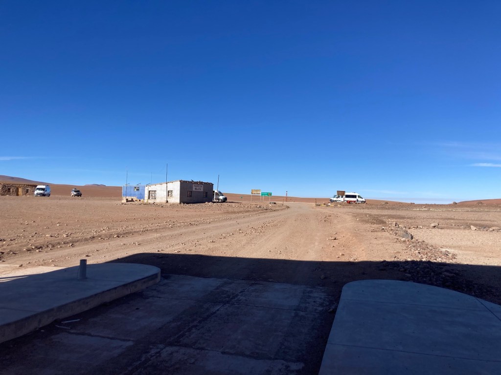
On we drove for at least 5 minutes before stopping at the Bolivian customs office where we all had to scan a QR code and fill out info about what we were bringing into Bolivia. Apparently cocoa leaves were fine but cash over $10,000 was not. We all passed, returned to our vehicle and drove another 5 minutes before stopping at the national park office and paying our national park fee. Now I’m sure you see where I’m going with this but why couldn’t the three bureaucratic agencies have shared a single building rather than requiring 3 separate stops? I don’t know but the whole mess took about 4 hours and was frustrating as heck.

Finally our tour started proper and our first stop was at the White Lake , created out of the volcanic craters of the Bolivian altiplano, the second highest on earth:

Me at the White Lake

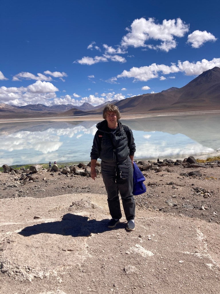
It’s beautiful but at 3500-4000 meters, the altitude can be problematic. I used the anti-altitude pills which prevented headaches but didn’t do a thing for the lack of stamina so I tried to avoid anything strenuous, like walking more than 50 feet.

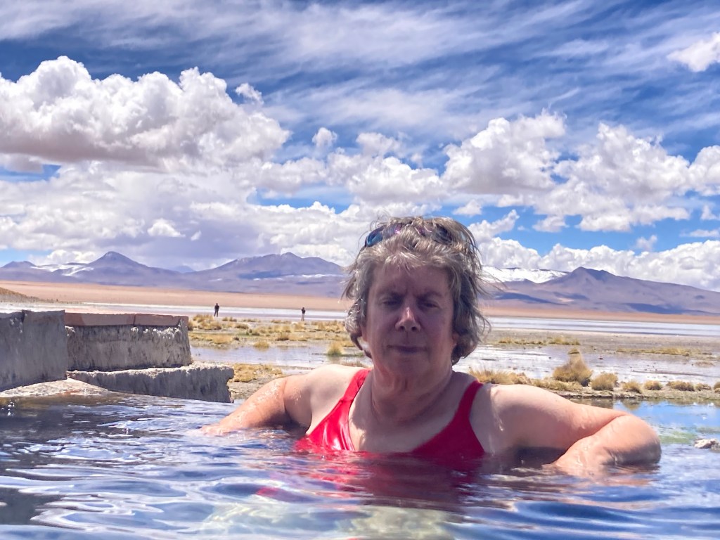
Since the whole area was formed by volcanoes, geysers and hot springs abound. Our tour stopped at a hot spring and I changed into my bathing suit and melted into the very hot water:

A few more lakes followed and even though we were at the end of the season, hundreds of flamingoes remained:

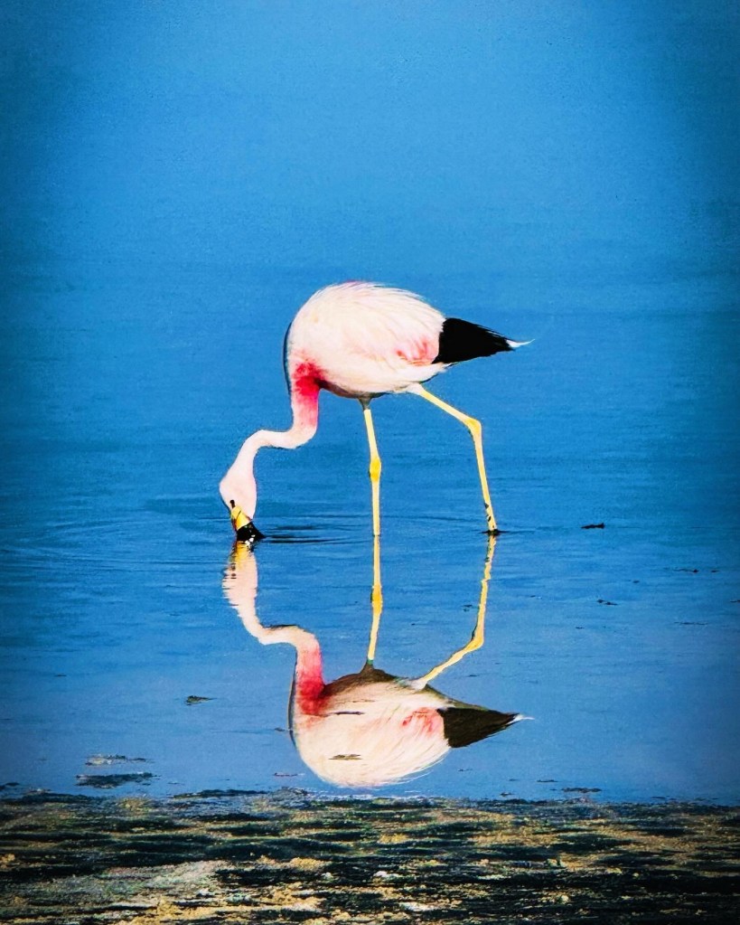
My thanks to my fellow traveller, Eward, for the photo- my camera isn’t that good.

Flamingoes weren’t the only wildlife. Wild vacunas, a relative of the llama, would bounce alongside our vehicle:

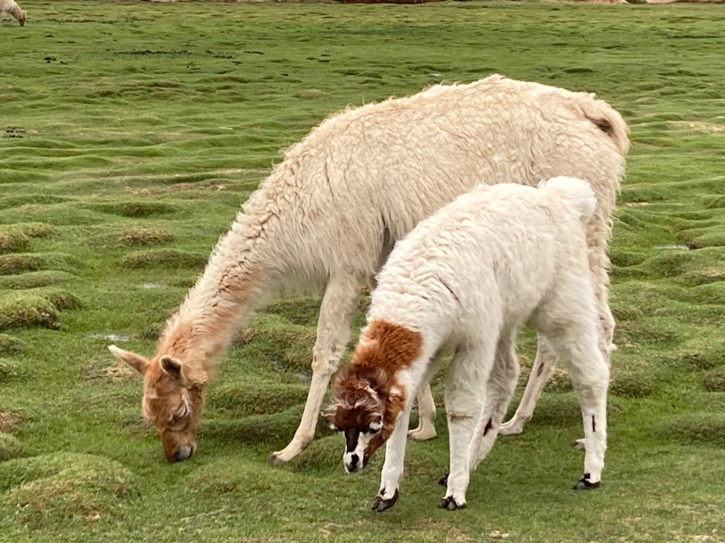
Later, llamas appeared, although they were probably not wild given the pink bows in their wool:

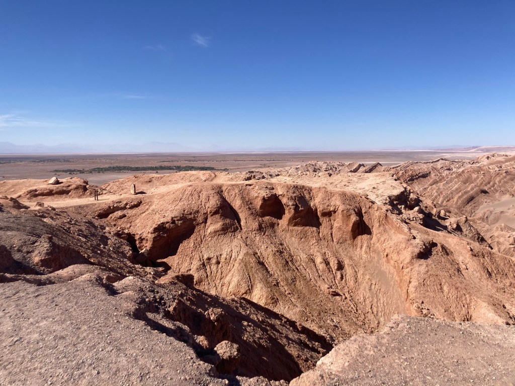
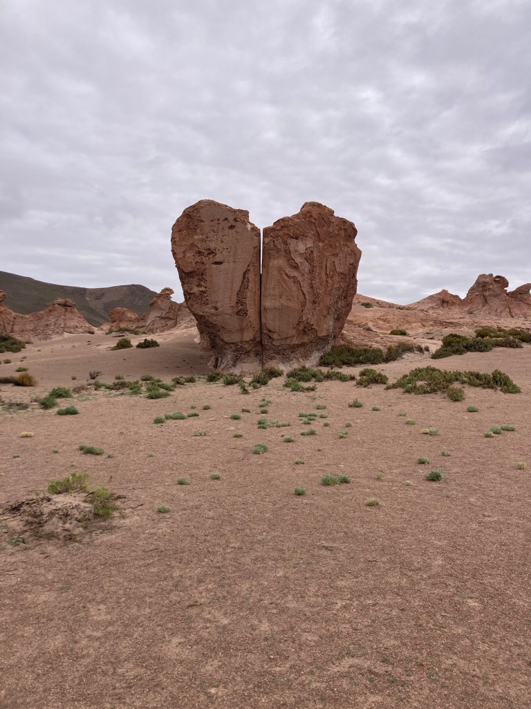
After a number of spectacular lakes and lots of vicuñas and llamas, the landscape turned to desert with interesting rock formations, created after centuries of winds eroded the rocks. My favourite was one called the broken heart:

Broken heart rock formation

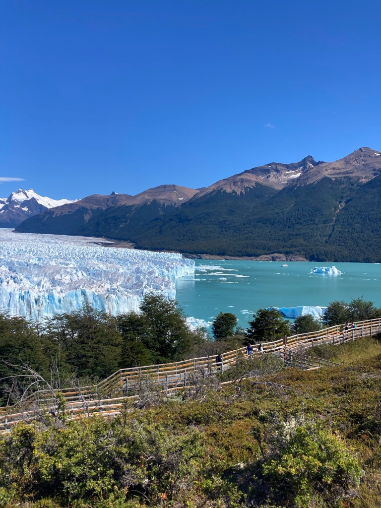
The highlight of the tour began the next day with a 4:00am wake-up and an hour drive to see the sunrise over the salt flats:

The Uyuni salt flats are the largest in the world, nearly 11,000 square kilometres of salt. I was there in the rainy season, so a small layer of water covered the salt, creating an interesting phenomenon so that discerning where the salt and water ended and the sky began was impossible:

Again thanks to Eward and his drone for the photograph.

Eventually we made our way to a dry spot, where we could enjoy the salt flats at its salty best:

A few hours later we drove to the town of Uyuni where we stopped at the train cemetery, a collection of rusty, dilapidated locomotives and other train carriages:

The Uyuni Train Cemetery

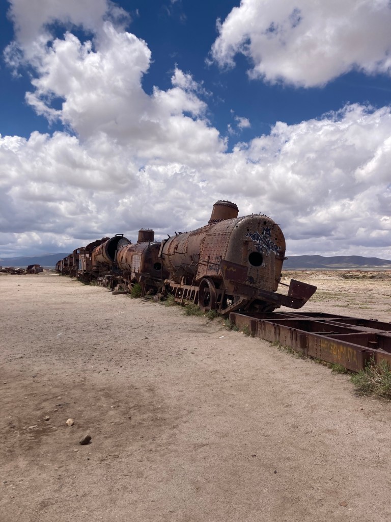
For a train fanatic, the ability to climb all over these decrepit beasts was quite wonderful.

Our return to San Pedro de Atacama, Chile took about 10 hours on the same bumpy road we had previously taken, coupled with another 4 hours at the Bolivian/Chilean border. But we all made it in one piece so I guess I shouldn’t complain.

A few days later, I flew into La Paz, Bolivia’s largest city and the highest city, at 3600 meters, in the world.

My walking tour started at the San Pedro prison, which became notorious some years back for its tours. Prisoners are required to pay their rent, and for some prisoners, it’s a bargain spot in central La Paz so they bring their families to live with them. In the more luxurious ( and higher rent) area, there are ensuites and jacuzzis. While some guards patrol the perimeter, the prisoners inside rule the place, with biannual elections etc. As security to get in and out was pretty lax, some enterprising prisoners started offering tours to curious tourists. Things went well for a number of years until authorities realized the tourists were frequently coming in to buy cocaine.

San Pedro Prison

The tours officially stopped but unofficial ones still continue. The problem is visitors are requested to give their passports to the guards as they enter and stories abound of the need to pay excessive bribes to get them back and leave. Needless to say, I didn’t try and visit.

But I did go to the witches’ market, so named for all the potions, amulets and other weird items for sale. The oddest, to my mind, are the llama infants and fetuses. Traditionally, they are buried for good luck at building sites; the bigger the building, the larger the offering should be:

Llamas for sale?

Again, needless to say, I didn’t buy any dead llamas.

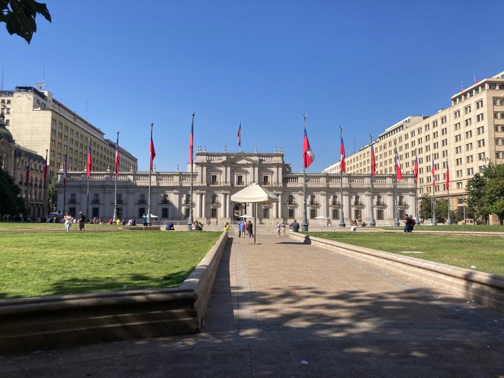
The walking tour continued, passing what I was starting to recognize as standard buildings in former Spanish towns: a Roman Catholic Cathedral, a National Congress, the Presidential Palace complete with a gruesome tale of a past president who was dragged out by an angry mob and hanged, the police station and the Justice building.

When my tour ended, I partook in what I consider to be one of the most interesting developments in La Paz: the proliferation of cable cars as a means of transport. La Paz is basically built in the bowels of a valley, with the center at the bottom and the residential buildings constructed on the slopes with wealth defined by how high up on the hills one’s house is. The roads are narrow and jammed with traffic. In 2010, cable cars were erected to provide alternatives to vehicles and by most accounts, have been well received.

A cable car

Ten different cable car lines connect much of the city. They are cheap, clean and efficient- it took me less than 10 minutes to get to the city center from my hotel for about $.40 but a cab ride would have cost $10 and taken 45 minutes. I spent a few hours riding different lines and seeing the city from different cable cars. It was a great way to see the city.

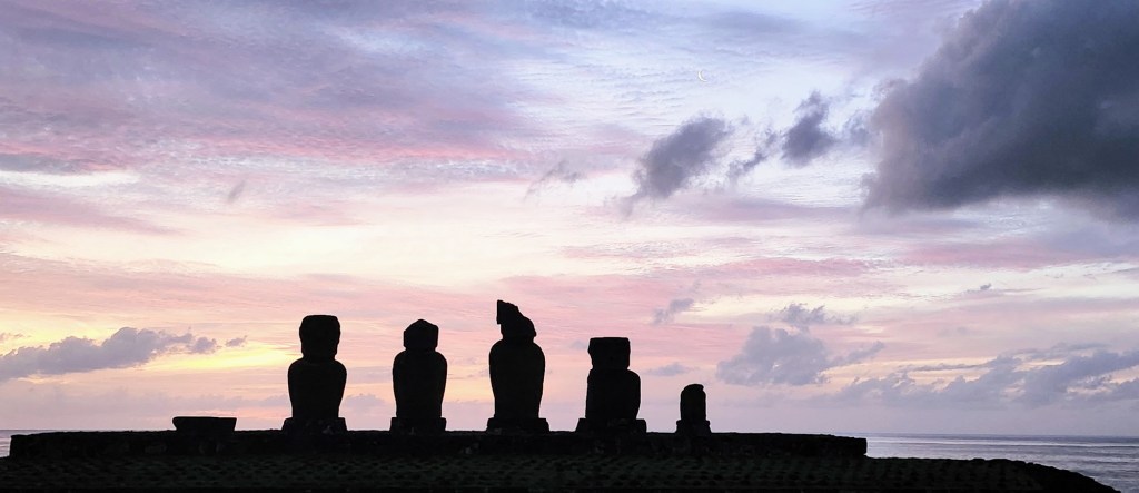
And so ends my 2024 South American journey.

Chilean adventures

I first visited Chile in 2006 with my son. We had focused on the south, visiting Punta Arenas at the very tip, Tierra del Fuego and sailing a Navimag ferry through the fiords.

It had been 18 years and a return visit was long overdue. I started in San Pedro de Atacama, the gateway to the northern desert with lots of hiking and trekking opportunities. I took a tour to the Uyuni salt flats, which I’ll describe on my post about Bolivia.

San Pedro does offer panoramic views of its otherworldly landscapes; it has acted as planets in the Star Wars movies:

Due to its relatively high altitude and low population, stargazing abounds in San Pedro. I took an astronomy tour where our guide pointed out the southern sky, many constellations, and through a large telescope invited us to look at three nebulae. He is also an expert photographer who sat me down for a few poses with the night sky as a backdrop:

From San Pedro de Atacama I rejoined my friend Cathy and we went to Valparaiso. Once the most important port on the Western seaboard, its importance, and wealth, diminished once the Panama Canal opened.

Valparaiso is famous for its murals, of which there are hundreds. UNESCO put the city and its murals on its heritage list. Some are commissioned by the local government, like that representing summer decorating the side of this building::

Others are done by local artists, some of whom look have become very famous for their mural art:

The murals run the gamut, from aliens, to indigenous representations to just for fun:

Valparaiso’s other claim to fame is its numerous funiculars. The city is built on 46 hills, so there’s lots of climbing up and down. Beginning in 1886, up to 30 funiculars were built to connect the businesses near the port with the residences high in the hills. They are being repaired and modernized, currently 7 are running:

Funicular station

Our time in Santiago was cut short by a cancelled flight from Rapa Nui, but we still managed to spend a day sightseeing. Our walking tour began in the Plaza de Armas, the center square of all former Spanish colonial towns. Founded in 1541 by the conquistador Pedro de Valdiva, its first 300 years were characterized by multitudes of wars with the local indigenous tribe, the Mapuche, earthquakes and fires. Chile declared independence from Spain in 1810 and after 8 years of war, was granted independence.

In 1805, the Presidential Palace was constructed although it was used as a mint until 1842 when the president moved in. It was here, on September 11, 1973, that the army, commanded by General Pinochet, surrounded the building, bombed it with Air Force jets and caused the death of the democratically elected, socialist president Salvador Allende.

The Presidential Palace

Thus began 17 years of cruel, dictatorial rule by Pinochet. The atrocities of his regime are documented in the informative, but sobering Museum of Memories and Human Rights:

The Museum
Photos of the disappeared

Ousted in 1989 by a referendum forced upon him by his own party and international pressure, Chile has since been ruled democratically and boomed economically, becoming the wealthiest country in South America.

Walking around the center of Santiago, we saw a multitude of buildings reminding me of its past- colonial gems, grandiose churches, ornate opera houses etc. but my favourite is Chile’s first stock exchange:

The stock exchange.

Built in a neo-classical style, its architecture resembles late 19th century New York. Not surprisingly, the area surrounding is known as little New York.

I’ll leave Chile with one piece of trivia learned on our walking tour. The name “Chile” has nothing to do with peppers or the temperature. Rather, it derives from an old Mapuche word meaning “ the ends of the earth”.

Next up: Bolivia

Rapa Nui (Easter Island)

Some places just evoke a sense of wonder and awe; Rapa Nui, in the middle of the Pacific Ocean, with its ancient statues standing guard over bygone villages, is one of them.

My friend, Cathy, and I literally plopped down here after an outrageously expensive flight from Santiago, Chile. We flew over the Pacific Ocean for 5 hours before landing on this isolated, small island in the middle of nowhere. Its nearest inhabited neighbor is Pitcairn, of Mutiny of the Bounty fame, some 2,000 kilometres away. Air Traffic Controllers don’t allow two flights at a time to be heading to the island; if one crashes and blocks the runway, the nearest diversion is 5 hours away in Santiago.

The airport is cosy, to say the least, although the runway is extra long, having been extended by the USA to act as an alternative landing spot for the space shuttle:

Rapa Nui airport

But enough about airports. Let’s talk about the Rapa Nui people. Originally from somewhere in Polynesia, perhaps Tahiti, they sailed here between 800 and 1200 AD, settled, farmed and constructed villages. Society was quite hierarchical and governed by a king, with 10 tribes, each descended from one of the king’s children, living fairly isolated. Although they were excellent sailors, there’s no evidence they traded with Polynesia and despite Thor Herydal’s theory that Polynesians could have originated in South America, there’s scant evidence of linkage between the two cultures save for one intriguing crop- sweet potato which is endemic to South America but the Polynesians somehow cultivated it also.

The Rapa Nui are most famous for the Moai they carved. Ranging from 1 meter to 20 meters high, they were carved from local tuff with features resembling a revered ancestor and placed on Ahus, or platforms facing the village to guide and protect the villagers:

The Moai were mostly carved from a single quarry; some which didn’t make it to an Ahu rest on the quarry’s slopes:

How they made it to the Ahu is hotly debated. Some suggest the Moai were rolled on logs, but the local legend is that they’ve “walked”, likely being rolled from side to side. The Moai on the quarry all have their eyes closed; it was only once the Moai made it to their resting place on the Ahu that their eyes were carved open and a piece of coral placed in the socket.

The golden age of Moai carving lasted until about 1700. Deforestation, caused by over logging, infestation by Polynesian rats and climate change wreaked havoc on the island. Agriculture became difficult, fishing was reduced by the smaller boats and water became scarce. The tribes started fighting over the limited resources, toppling their enemies’ Moai as a sign of disrespect for the villages’ ancestors.

The religion manifested by the Moais ended abruptly ( and without explanation we know of) to be replaced by the Birdman cult in about 1700. Every spring, a man was chosen from each tribe to compete in a race requiring descending a high cliff, swimming about 1.5 kilometres to a nearby island, retrieving the egg of a term and returning back to Rapa Nui, egg intact. The winner’s tribe would select the religious and political leader for the year.

The island on which the terns bred

But the Birdman didn’t resolve all the issues. The Dutch sailed by in 1722 on Easter Day and Christened the place Easter Island. The Spanish dropped by and in 1782, Captain Cook stopped on the island. He noted that many of the Moai had been toppled, but not all. By 1822, the largest and last Moai was toppled:

The last Moai standing

In the 1860’s, missionaries arrived, christianizing the Rapa Nui, eliminating the Birdman and re-instating the king. Peruvian slave traders kidnapped hundreds of locals and introduced disease to the island. In 1888, the king signed a treaty with Chile, ceding the lands to Chile.

Over the next 75 years things went from bad to worse for the Rapa Nui. The Chileans leased most of the land to a commercial farming enterprise, with the result that all the Rapa Nui were confined to the single town on the island, Hanga Rua, and subjected to a permit system which prevented them from leaving the island.

Things started improving in the late 1950s. A runway provided for better connectivity, the people were granted Chilean citizenship in 1966 and the permit system abolished. Thor Heyerdahl came and started re-erecting many of the fallen Moai:

Tourism has become the main economic focus. Certified Rapa Nui guides are required to visit most of the archeological sites, only Rapa Nui are permitted to own land, Chileans May only stay up to 30 days on the island and the Rapa Nui language is taught as a second language in the primary schools.

It’s a fascinating place. While it may have started as a paradise where innovation and hard work overcame local resource and environmental issues, the self-destruction of the Moai by the warring tribes is a stark reminder of how easily man can destroy what he has built.

I was going to end by saying after 4 days, we flew back to Santiago but, alas, our return flight had problems ( your guess is as good as mine) and the Chilean airline company, LATAM, the only airline flying here, left most of its 300 passengers in a lurch, simply telling us to find our own accommodation on an island notorious for limited hotel options, and to come back the next day for another flight.

Luckily, some cajoling, lots of tears and a kind hearted lady who offered to room with her son saw us with a room back at our original hotel. This despite LATAM having booked all the rooms there 3 hours before officially cancelling the flight! Needless to say. LATAM is quickly becoming my least favourite airline.

But alls well that ends well and so, back to mainland Chile.

Steak, pizza and lamb: Argentina

A five hour bus ride from Asuncion and a trek through three borders ( Paraguay, Brazil and Argentina) brought me to Iguazu Falls in Argentina, one of the most spectacular waterfalls in the world.

I met up with my friend Cathy and despite the late afternoon rain, we decided to try and see Iguazu Falls from the Brazilian side. Our driver did his best, but a line-up at the border, lots of construction and a miscommunication in Spanish involving Park vs Waterfall meant we missed the last entry so we returned to Argentina and what I was looking forward to most: steak.

I had visited Argentina twice before and my fondest memories had been of delicious, inexpensive steaks. This time did not disappoint. We found a restaurant and ordered the meat platter for two. Steaks, chicken, sweet breads soon arrived and we dug in:

Stuffed, we returned to our Airbnb to prepare for the next day’s journey to the falls.

Two circuits were open at the falls, the upper and lower with the former giving you lovely vistas of some of the falls:

The roar of the water was deafening but unfortunately drowned out by the constant whirling of helicopters ferrying tourists above the falls. We made our way to the lower circuit, where we got up close and personal with more of the falls:

Along the way we were entertained by the falls’ very cute rodents, the coaties:

Before flying to Buenos Aires, we were given a lesson in Argentinian economics. Hyperinflation prevails and the peso is constantly being devalued. If we exchanged US$ at the official rate, or withdrew cash from an ATM, we would receive about 850 pesos to the dollar. But if we used a credit card or went to a blue marketer, we’d received about 1050 pesos to the dollar. The blue market is not legal but is tolerated and we exchanged our dollars on the blue market, at shops which doubled as shoe stores:

Blue market cash machines

On to Buenos Aries, where we took a walking tour of the center, seeing the National Congress, the Presidential Palace where Evita had delivered her Don’t Cry for Me, Argentina speech, and the Obelisk, commemorating the city’s 400 anniversary but having nothing else to do with Argentina. More interesting are the painted white headscarves in the main square. When previous governments had disappeared many youth, their mothers would gather once a week, white scarves on their heads, and silently walk in pairs around the square:

Another walking tour took us to La Boca. Originally a port where millions of immigrants from Europe, mostly Italian and Spanish but also German and Eastern European Jews, arrived between 1870 and 1950. A few of the tenements in which they were originally housed have been restored, coloured brightly and now house souvenir shops and artist stores:

La Boca is also football mad and its favourite son is Diego Maradona, the Argentine great , whose image is everywhere but overshadowed only by Messi, the current Argentine football hero. His image dominates in La Boca including on a balcony where long lines form to take a photo beside him;

The large number of Italian immigrants brought some of their culinary traditions, including pizza, to their new country. Pizza places are ubiquitous but we ate in one of the famous old pizzerias, Bancheros ( since 1932):

We enjoyed a few more days in Buenos Aries, visiting the Japanese Gardens, the Evita Museum, the Opera House and indulging in a few more steak dinners before it was time to leave for our next destination, El Calafete, in the Patagonia region of the country.

A three hour flight gave us our first glimpse of Lake Argentino which dominates the area:

El Calafete is known for its great hikes. Not being much of a hiker, I satisfied myself with a day bus tour to one of the nearby glaciers, Perito Moreno. Ideal for non-hikers, the various metal trails offer different views of the glacier:

A boat ride offers a different view:

Beautiful yes, but having visited Antarctica in 2010, not overwhelming.

But the lamb was. El Calafete has good steaks but it is famous for its lamb. It’s also famous for its guanaco goulash, a relative of the llama, but I chose to stay with more familiar foods. I had lamb twice, both excellent and both relatively inexpensive:

And so I leave Argentina, stuffed with steak, pizzas and lamb.

Why Paraguay?

People ask why Paraguay exists. The short answer is that although it was the loser in the war against the triple alliance ( Brazil, Argentina and Uruguay) in 1860 to 1874, Brazil and Argentina thought it best to have a buffer state between them and, thus, Paraguay exists to this day. It has lots of jungle, cattle and the largest navy of any landlocked country in the world.

So why visit Paraguay people asked when I mentioned it. Good question since there’s not a lot of tourist attractions. The jungle creates a wealth of birdwatching opportunities and nature hikes, neither of which interest me. Asuncion, the capital, is largely devoid of architecturally interesting buildings as, so my guide told me, Paraguayans didn’t really care about that and destroyed most of them. The former governor’s house, where the Spanish governor surrendered to rebels in 1811, paving the way for Independence, was razed and a park now stands there.

One of the few colonial buildings still standing is Independence House. It’s a museum detailing Paraguay’ s road to Independence. It’s furnished as it was a few hundred years ago, with a mix of Indigenous wood furniture and imports from France:

Independence House
Inside independence house

Other than a few historical buildings and government offices, the center of Asuncion has largely been abandoned for the suburbs. 1960 era apartment buildings stand vacant:

An abandoned high rise

The new Parliament sits downtown. The funds to construct it were donated by Taiwan, one struggling democracy to another:

Other downtown highlights include the Presidential Palace, painted pink as it’s the second cheapest paint colour after white:

There’s the main cathedral and the Pantheon, both a church and a mausoleum housing the remains of many Paraguayan heroes. One person who is not there is the dictator, Alfredo Stroessner, who ruled with the help of the USA between 1954 and 1989. His legacy includes thousands of “disappeared”, child sex slavery rings and providing refuge to Josef Mengele, the maniacal doctor from the Auschwitz concentration camp. There are no memorials to him that I saw, but there is a memorial to the disappeared:

A small museum is dedicated to the railroad in Paraguay. Constructed in 1861, it ran between Asuncion and Encarnacion, until 1999. Powered by steam engines, the train was one of the earliest in South America. The museum is in the old Asuncion station and has memorabilia relating to the 1800 and 1900 train experience in Paraguay.

So, why Paraguay? I confess I’m counting countries and as I’d never visited Paraguay, it was hot and on my way to Argentina, it seemed like a good stop. Sadly, most of the tours I wanted to take, to ruins of Franciscans and Jesuit missionaries, were not running and all the wildlife tours wanted at least two people, not ideal for a solo traveller.

But I enjoyed my time in Asuncion. I walked to the Museo del Barro, which showcases both pre-Colombian artifacts and modern Art. The people were kind, prices cheap and the weather great. I won’t race back but I’m glad I spent a few days there.