No Bones About It: Pima Boneyard Tour

There are no bones on a Pima boneyard tour. It doesn’t involve a cemetery or a medical school anatomy class or even a skeleton. What it does have are airplanes, lots of them. A boneyard is where old planes go to live out the remainder of their useful lives, either as back-up planes or for spare parts, until they are deemed completely obsolete and are shredded (sold for scrap). One of the largest boneyards in the world, and the only one available for public tours, is located at the Pima Air and Space Museum near Tucson, Arizona.

Being allowed on the tour is no mean feat. Since getting to the boneyard requires going through the active Davis – Monthan Air Force Base, precautions are taken to ensure no undesirables are on board the tour bus. Pre-approval 2 weeks in advance is absolutely necessary. Ever so cautious, I had applied 4 weeks before providing all requested information, but heard nothing in the promised response time of 3 days. I sent another application and still heard nothing. “Maybe I was no longer a good security risk?” I wondered. Was it because I no longer had a job? Maybe I shouldn’t have told the customs officer I didn’t have an address when he asked where I lived.

Beginning to panic, I started to leave voice mail messages at the museum, but was never able to connect. Finally, 4 frantic phone messages later and 2 days before the deadline, I received a confirmation email. I was cleared to take a 5 minute bus ride across the Air Force base as long as I didn’t carry firearms, knives or backpacks and promised to obey all commands regarding photographs.

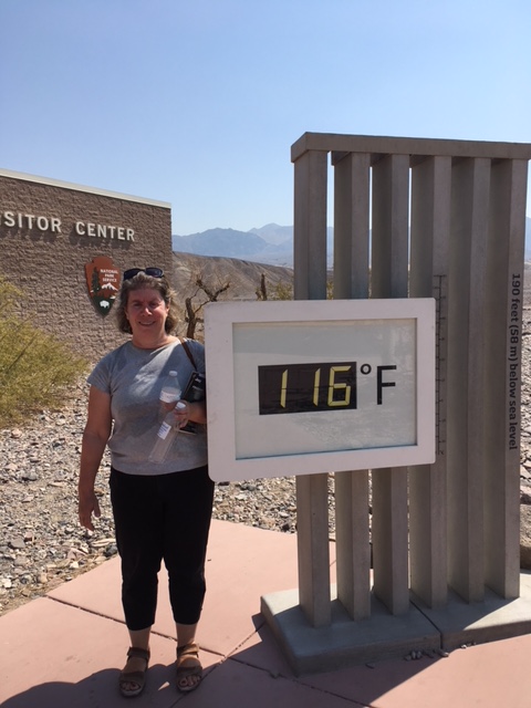
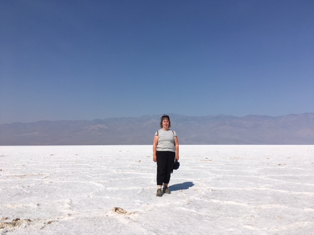
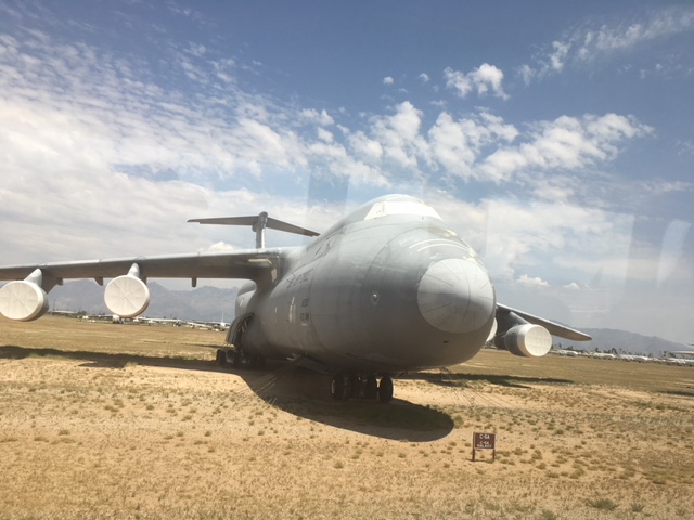
On the day of the boneyard tour, I arrived with an hour to spare at Pima. Although the boneyard  was my primary objective, the Air and Space Museum has plenty of other historic aircraft. Despite the heat being 43 degrees, I walked outside and looked at some of the planes. An Air Force One which had ferried Presidents Kennedy and Johnson was there, along with a B-36, a Blue Angel and some crazy looking NASA contraption.

The Museum was staffed by lots of volunteers – all pilots or persons with connections to the Air Force. Each was eager to share their flying stories with everybody. As I was looking at an early model Learjet, Mark approached me. He was in his 70s. He had contracted polio as a youth and been left with a bad leg (he was in a wheelchair). He had been rejected by the military, but still learned to fly and had been doing so for nearly 50 years. He asked if I wanted to fly, but I admitted my nervousness of flying. He said flying was the second best thing one can ever do. Suckered in, I asked him what was the best. He looked at me with a twinkle in his eyes, like he had probably done hundreds of times before, then replied: “landing.”

We boarded the bus for the boneyard tour with our confirmations and a 2nd show of our passports and purses (to make sure there were no guns in them), then drove to the base where we all dismounted and gave our passports (3rd time) over to an air force person. We waited in a hot, dark shed for about 10 minutes before he returned, gave us our passports back and reboarded the bus.

Our docent, Thomas, was a former air force pilot who had originally trained at the Davis-Monthan Air Force Base. Once he left the military, he had continued to fly for a state national guard. As the bus drove, he delivered a treasure trove of information. The boneyard contains 3400 mostly military aircraft, down from a high of 6,000. Upon arrival at the boneyard, each aircraft is inventoried by a specialized parts manager, then readied for its stay. It is first covered with a black sealant, then its windows, engine faces and nose sprayed with a white sealant, giving all the planes a ghostlike appearance.

IMG_0845

The white seals have the effect of maintaining the interior temperature 15 degrees cooler than the Tucson desert. The interior instruments can be damaged at about 120 degrees Fahrenheit, so the seals give the necessary cushion if it gets over 130 degrees.

One plane, of course, did not need the seals. It was the Stealth, which as everyone knows, is invisible. Here it is:

IMG_0852(1)

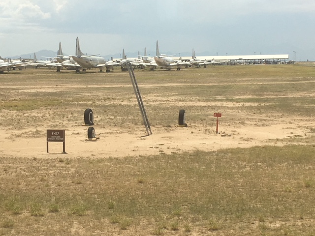
A little boneyard humour (courtesy of Thomas).

As we drove through the boneyard, seeing plane upon plane, Thomas narrated information about each plane. A common naming system meant the starting letter of each plane indicates its function, so an A plane is an Attack plane, a B (like in B-52) is a Bomber, C (as in C-36) is Cargo. The F-18 is a Fighter and Thomas added that he hoped when the sequel to Top Gun is made, Tom Cruise would play the grandfather.

Words cannot adequately describe the sight of thousands of planes sitting in the Arizona sun, so I shall end with pictures.

Probably hundreds of billions of dollars worth of planes lined up like toy cars in a store window. It was quite a sight.


A ghost town with ghosts: Rhyolite, Nevada

Numerous ghost towns dot the area near Death Valley, mostly abandoned mining towns. Rhyolite ( an igneous volcanic rock), is no different. It started as a two man mining camp in 1905, then quickly grew to be the largest town in the area due to its proximity to a nearby goldmine. By the end of 1905, its population had swollen to 2500 people, with 50 saloons, 35 gambling tables, a brothel, 19 lodging houses, 16 restaurants, half a dozen barbers, a public bath house, and a weekly newspaper, the Rhyolite Herald.

It was soon served by three different railways, ferrying passengers and borax from a nearby mine to Las Vegas. It had electricity, running water and concrete sidewalks. By 1907, a hospital, a school, a fire and police department, 3 banks, a public swimming pool and 2 churches served its 4000 inhabitants. The most prominent building was the 3 story Bank Building on its main street.

Its decline began soon after. Following the San Francisco earthquake in 1906, capital was diverted to other projects, limiting  funds for mine development and interrupting rail service. By 1910, all 3 banks closed and only 675 residents remained. The mine closed in 1911, the post office in 1913 and the train station in 1914. Electricity was shut off in 1916 and the rail tracks torn up and used in the war effort. Some buildings were moved to other locations. The town was all but abandoned.

My choice in visiting it was twofold. First, it is accessible from a paved road, no small consideration when not driving a 4 wheel drive in the middle of the day in Death Valley. Second, it has real ghosts.

I arrived shortly after noon and parked near the former railway depot. It is the best preserved building in the town.

IMG_0808

All that is left of the former star attraction, the 3 story bank building, was a few stones.

IMG_0811

Rusted out pieces of metal and dirt roads marking the once bustling streets reminded one of its former glory. A single house remained.

The ghosts are intact, however, in the form of sculptures by a Belgian artist.

IMG_0815

In 1984, Albert Szukalski created his sculpture The Last Supper on Golden Street near the entrance to the town. Death Valley was chosen by the sculpture due to its resemblance to the Middle East deserts.

IMG_0814

However, as the signage in the one room museum points out, the town that was intended to endure forever lasted a mere 10 years. The ghosts, intended to last only 2 years, have remained to this day, far longer than the town.

A Question of Degrees: Death Valley

Having tired of the lack of parking spaces in Yellowstone and Lake Louise, the large crowds of tourists in San Francisco and the cool weather that accompanied me from Oregon to San Simeon on the Pacific Coast Highway, I headed to the perfect antidote: Death Valley. In July….. During a heatwave……Temperatures were forecast to reach 50 degrees celcius (122 degrees Fahrenheit) at Furnace Creek, the main station in the park,   population 24.   I came to understand the furnace part, but no creek was visible anywhere near that I could see unless one counts the much appreciated flush toilets at the Visitor Center.

Let’s back up a little. I like hot weather. I also like deserts, so Death Valley National Park seemed like a perfect destination. Granted, travel there was not advised in the heat of the summer, but I followed all of the recommendations. I had extra water (a four litre jug in my car), sunscreen, sunglasses, a wide brim hat, sturdy walking shoes and a paper map, since GPS tends to lead one to the shortest route and going on non-paved shortcuts through the desert was a definite no-no. Google maps and most other cellular service were iffy at best. My car appeared in good shape – no warnings to check my tire pressure had occurred recently- and it was air conditioned. In any event, I would do as the literature said, if your car breaks down, stay in it and wait for help.

I left my hotel in Ridgecrest at 5:30AM, just as the sun was rising. Although Death Valley is supposed to have wonderful sunrises, the prospect of driving 90 miles on an isolated desert road to the park’s entrance at 4:00AM did not appeal. As it was, I did not meet another vehicle until well after I arrived at the park.

IMG_0769

Death Valley had been inhabited by native American Indians for over 10,000 years (and still is today), but the first white men to visit were miners eager to get to California in 1849 to join the gold rush.. They were stranded in Salt Lake City and warned not to go further west during the winter months (remember the Donner party). Impatient, 125 pioneer wagons set off for the south, seeking a short cut to California. Arriving at an impassible cliff in Nevada, most of the wagons gave up, but some continued on, reaching Death Valley in December, 1849. They wandered aimlessly through the desert for three months,  eventually sighting the Sierra Mountains, where they headed south before finally arriving at civilization. Upon leaving the desert, one miner turned back and said “good-bye death valley” to the place he thought would be his final resting place. The name stuck.

Death Valley is as intimidating today as it must have been in 1849, but at least air conditioning in commonplace and there are well marked pave roads leading through the park to the major sites. I followed the route, stopping first at the Golden Canyon.

IMG_0775

The hiking trail was rated moderate, but at 5 miles it would take half a day, going well beyond the 10:00AM “Do not hike” warning time. Besides, no one else was in the parking lot. I decided against the hike, took a picture and carried on to the next highlight.

If the Golden Canyon looks familiar, it is because it and two other Death Valley landmarks (the Artist’s Drive and Dante’s Peak, a viewpoint overlooking the valley) were locations used as Tatoonie, Luke Skywalker’s home planet in the original 1977 Star Wars and four subsequent Star Wars films, along with other locations in Tunisia.  To think, I walked the same ground as R2D2 and C-3PO!

The Artist’s Drive is described in the brochure as a “dipping, diving, curving, one-way road that weaves through striking ravines and colorful rock formations. The highlight of the nine mile loop occurs at the Artist’s Palette, where sea green, lemon yellow, periwinkle blue and salmon pink mineral deposits are splashed across the barren background like brilliant dabs of paint…The effect is most intense during the evening…” It wasn’t evening and, although it was a bright sunny day, the heat created a blanket of haze that covered the valley. The Artist’s Drive did dip and dive and curve, but it looked mostly brown to me.

IMG_0785

The highlight, or rather lowlight, of Death Valley is Badwater Basin, the lowest point in North America at 282 feet below sea level. By comparison, the lowest place on this planet is the Dead Sea, straddling Israel and Jordan, at about 1450 feet below sea level. In bygone years, the Badwater Basin was a salt water lake which had long since evaporated, leaving a layer of salt 1 to 5 feet thick.

Badwater Basin is also the hottest place on earth, having registered a temperature of 56.7 (134 degrees Fahrenheit) early in this century. On the day I visited, the temperature was a cool 50 degrees and only 116 degrees at the Visitor’s Center.


IMG_0801

I arrived at Badwater Basin shortly after 9:00AM. The salt flats were about a mile from the boardwalk. As I walked out, the few tourists who had been there earlier returned to their cars. I was along except for a teenage boy. He took my picture, then I turned around to gaze at the vast, salt lake. There was complete silence. No other tourists, no hawkers trying to sell t-shirts or bike rides. Just me, the salt and miles of desert as far as the eye could see. Much as I would have loved to stand there admiring the vista before me, it was 50 degrees, the sun was beating down and I was hot as hell. Death Valley had lived up to its reputation.

IMG_0793