The drive from Oklahoma City to Memphis takes less than 7 hours, but it was like crossing into a different country. Gone were the flat prairies of the Midwest, replaced by lush greenery and rolling hills marking the tentacles emanating from the Mississippi River. It wasn’t just the scenery which changed; strong-willed pioneers opening up a new land were replaced by civil rights advocates and cowboys became music legends, setting the stage for blues and rock and roll and soul.
Memphis has a lot of stories to tell and I spent 4 days trying to understand this city. Commencing with a walking tour, our first stop was the now absent statue of Jefferson Davies, the one and only president of the Confederacy, whose secession from the United States of America started the Civil War in 1861. Memphis deals with its treatment of African Americans more fairly than the other places I visited. Our tour guide, a retired white man and long time resident of Memphis, boasted unashamedly about the great man, Martin Luther King Jr. and the sorry legacy of Memphis’ place of his assassination. We walked past the radio station WDIA, the first all black radio station in the US, Lansky’s clothing, costume maker to the stars like Elvis Presley and Sun Records, where early R&R singers recorded.
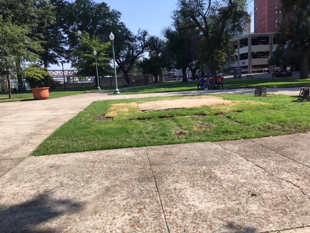
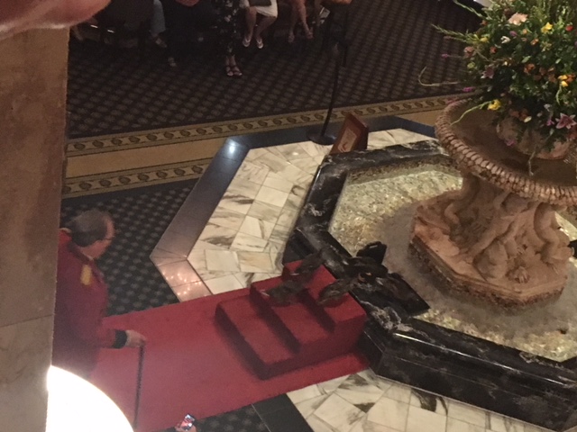
Peabody Hotel’s Duck Walk
The tour was timed to enable us to watch the 11:00 AM parade of the ducks at the Peabody Hotel. 5 ducks (4 femaIe and 1 male) march from their roosts on the roof of the hotel, into the elevator and down the red carpet to a fountain in the lobby precisely at 11:00AM every day. They spend the day there, until they march back up to the roosts in an equally pompous ceremony at 5:00PM, both waddles loudly announced by the Duckmaster and enjoyed immensely by the appreciative audience. A number of videos of the duck march are available on YouTube-search Peabody ducks. This is one of those events that had no deeper meaning- it is just fun and cute.
The National Civil Rights Museum
Situated on the premises of the Lorraine Motel where Martin Luther King Jr. was assassinated in 1968, the museum charts the failure of the Reconstruction period after the Civil War, to the rise of the Jim Crow laws and the separate but equal results to the seeds of the civil rights movement. The exhibits and commentary, with news clip videos and mock-ups of burning buses and drugstore counters, recount in vivid detail the struggles of black Americans for voting rights, equality and integration. Pivotal events – the March from Selma to Montgomery, the murder of civil rights workers in Mississippi, the Memphis sanitation workers strike- and the people –Rosa Parks, Martin Luther King Jr. – were documented with photos, personal recollections and informative commentary about their impact. Of the many civil rights museums I visited, it was by far the most thorough and thoughtful.


Rock & Soul Museum/Beale Street
Memphis has a plethora of musical museums and iconic places pivotal to soul and Rock & Roll. The Rock & Soul Museum traces the origins of soul music and its influences on rock & roll with plenty of opportunities to hear past songs.
To experience the music, Beale Street is the place to be. Lined with restaurants and bars, the pedestrian only street is home to the Memphis music scene. Carrying alcohol from bar to bar is permitted, so I grabbed a large Margarita, indulged in barbeque ribs and fried chicken, and walked from place to place, listening to the bands playing everything from Elvis to Otis Redding to Jerry Lee Lewis.


Graceland
I couldn’t leave Memphis without visiting Graceland Mansion, Elvis Presley’s home and mecca for Elvis fans. I like Elvis’ music, but I was never a hard core fan. Thus, I opted out of the Ultimate VIP Elvis tour for $169 which includes an expert guide, Elvis’ plane, a meal voucher and access to a private lounge and went cheap, for only $39, I would receive only the basic Mansion tour with audio commentary.
Upon arrival, I was forced to pay anther $10 to park my car. I waited in a line for my timed entry (every 15 minutes) and was shown a short video about Elvis. From there, our 11:00AM tour was herded to a compulsory photo in front of a cutout of the Mansion and put into a line for the shuttle to the actual mansion. We stood in line for 20 minutes, to take a 5 minute shuttle ride across the street. After leaving the bus, we stood in yet another line waiting for a briefing on the do’s and don’ts of visiting inside Graceland. Finally, about noon, the 11:00AM tour entered the Mansion.
Graceland is furnished as it was when Elvis died in 1977, with added Elvis memorabilia and photos of Elvis at home. I am not sure what I was expecting, but my overwhelming impression was that Elvis had really bad taste in home décor, culminating with green shag carpeting on the floor and ceiling of his recreation room. Every room is a shrine to Elvis, which I am sure his diehard fans appreciate, but I could not look past the decorating faux pas. After touring the building and visiting Elvis’ grave on the grounds, I left after yet another long wait for the shuttle.


After 4 days in Memphis, it was time to drive to the deep south. Mississippi and Alabama were next.