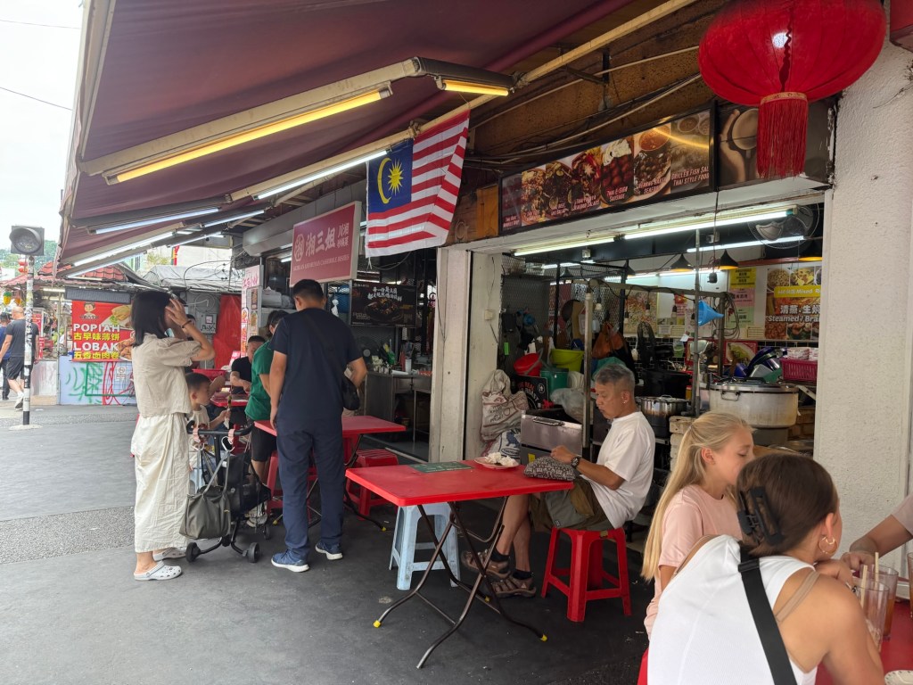
I am spending a few months in Merida, Mexico in an attempt to avoid the worst of the Canadian winter. While many attractions are in, and around, Merida, a friend, and I decided to fly to the West Coast of Mexico for a five day tour of Chihuahua and the Copper Canyon, with the highlight being a ride on the Chepe Express train.
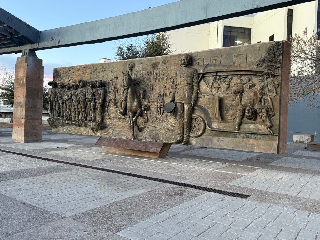
Our visit started in the capital city of Chihuahua, home to the famous Francisco Pancho Villa, an early 20th century revolutionary. Born into a peasant family, he developed a reputation as a modern day Robin Hood, trying to obtain justice for the dispossessed indigenous tribes who lived in the area. He was, at various times, a bandit, the governor of the state of Chihuahua, a potential candidate for the presidency of Mexico, the leader of an invasion into Columbus, USA, and a movie star who insisted upon acting in the title role of the movie made about him. Despite all these activities, he managed to have at least 25 wives. He was assassinated (by whom it is not clear) in 1923 and is revered in numerous monuments around Chihuahua, including three murals in the main square:
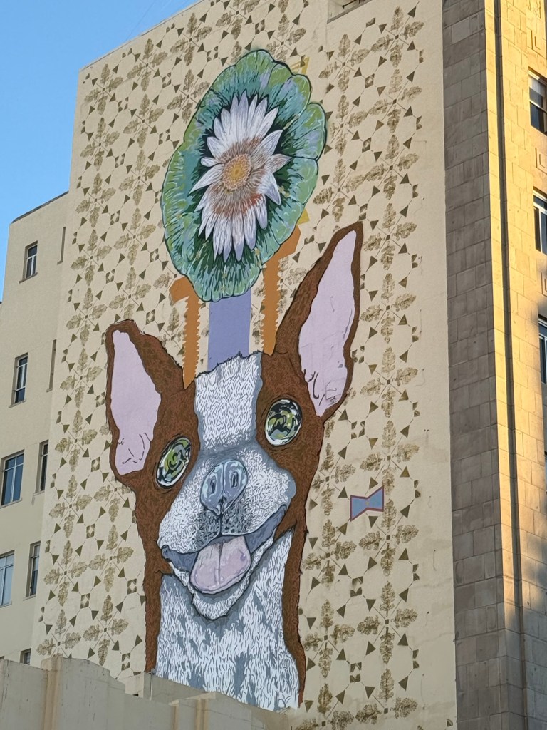
We had no luck seeing a live Chihuahua in the city of Chihuahua, but did satisfy ourselves with a mural of one:
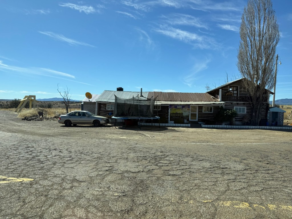
Our tour guide, Ivan, picked us up in Chihuahua to begin the long drive to the Copper Canyon. Our first stop was at a Mennonite museum. The Mennonites first came to Mexico in 1922 from Canada after the Canadian government threatened to require them to serve in the military and teach their children in English. They managed to purchase large tracts of land in Chihuahua and to this day, have some of the most successful produce farms and cattle ranches in the country, teaching the locals about irrigation, crop management, and trading.
Today, there are about 100,000 Mennonites, mostly in Chihuahua, but scattered throughout the country. The museum used to be a working Mennonite farm, but has evolved into a museum which highlights some of the traditional farming methods and implements used by the Mennonites in Mexico.
The Mennonite Museum
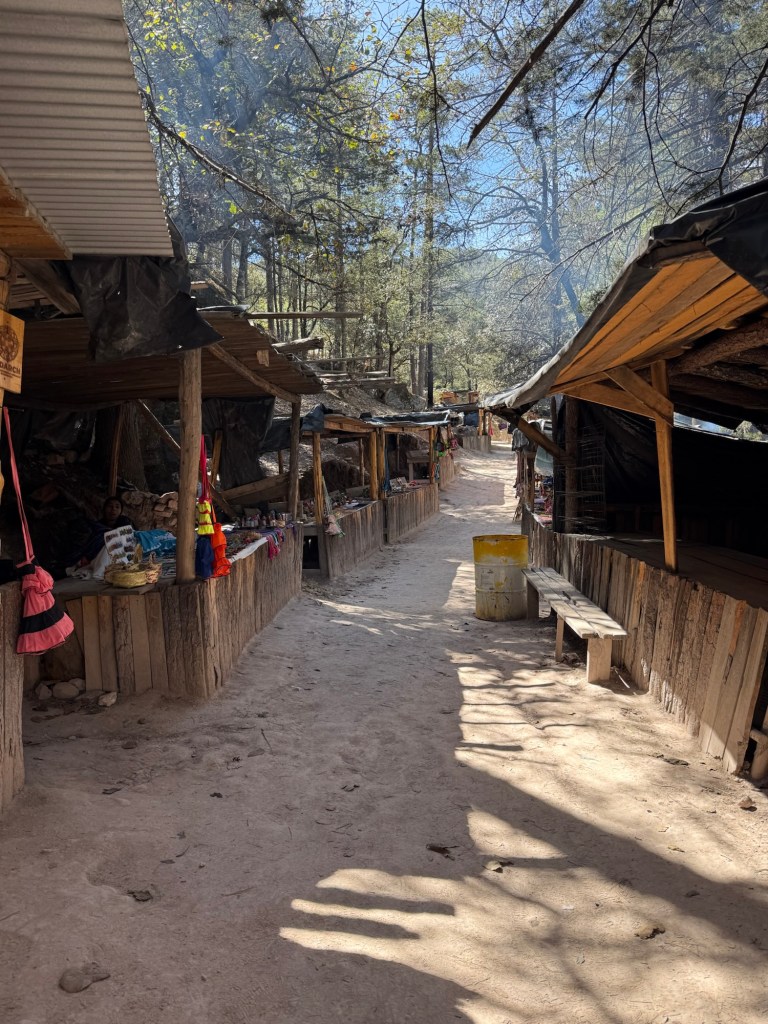
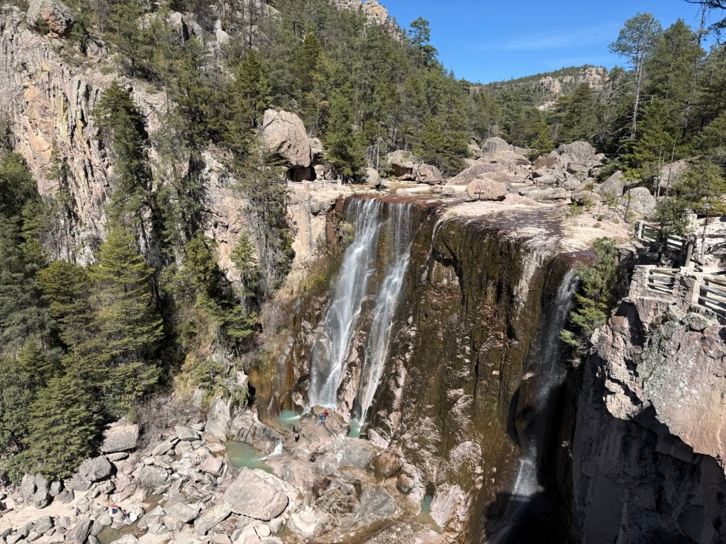
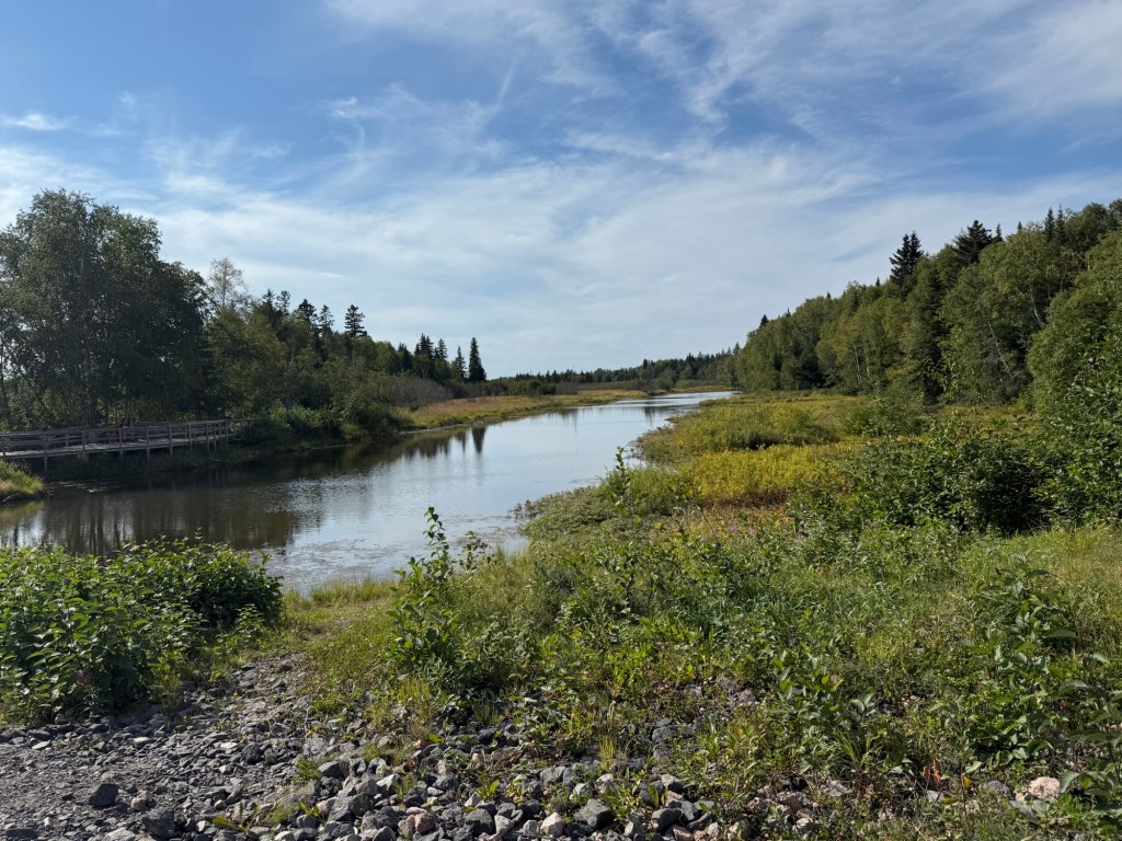
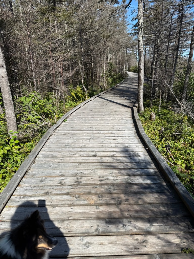
From the Mennonite Museum, we drove south through the Sierra Madre mountains towards a small Indian reservation, whose primary attraction is the pretty waterfall of Cascada de Cusarare. We walked the 500 m to the waterfall through a gauntlet of small stalls where the local indigenous tribal women were selling their handicrafts.
The WalkCascada de Cusarare
From there, we entered a small Indian reservation and drove to what the white settlers referred to as the valley of the Praying Monks. The Indians refer to it as the valley of the sacred penises:
You can decide which description is more apt.
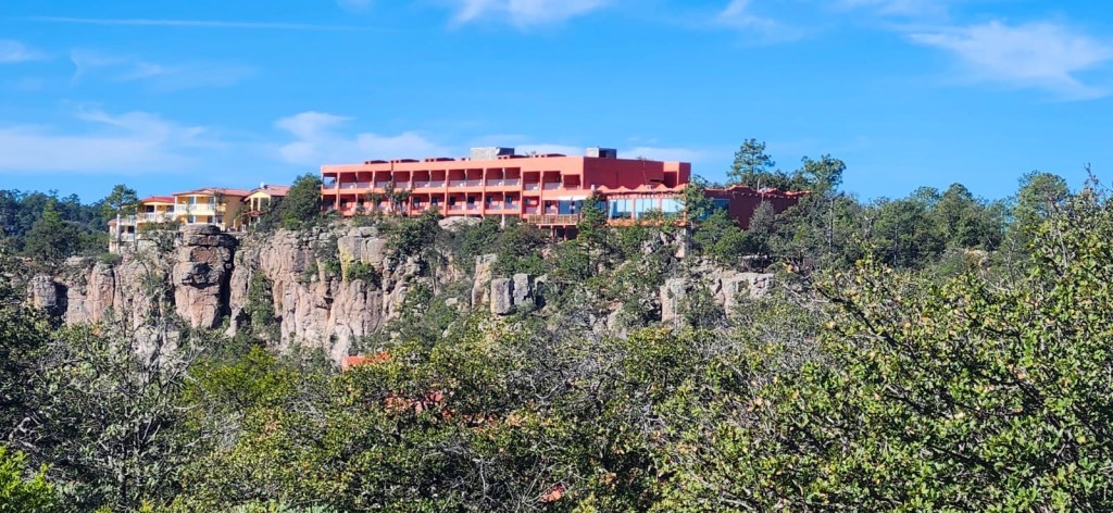
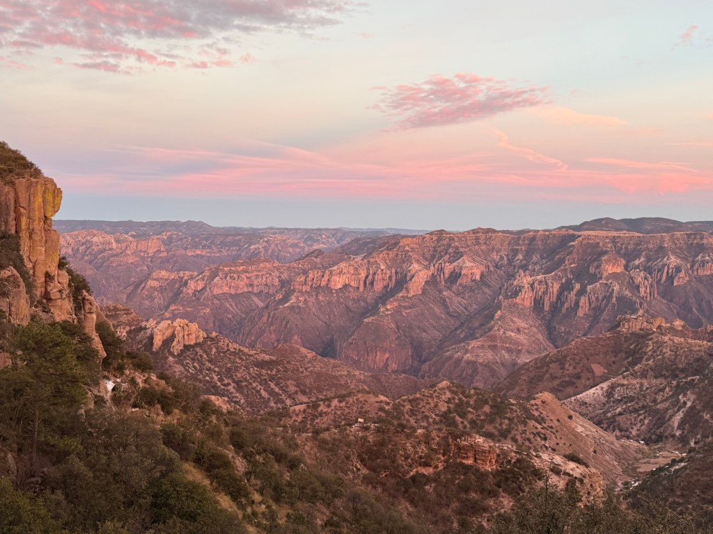
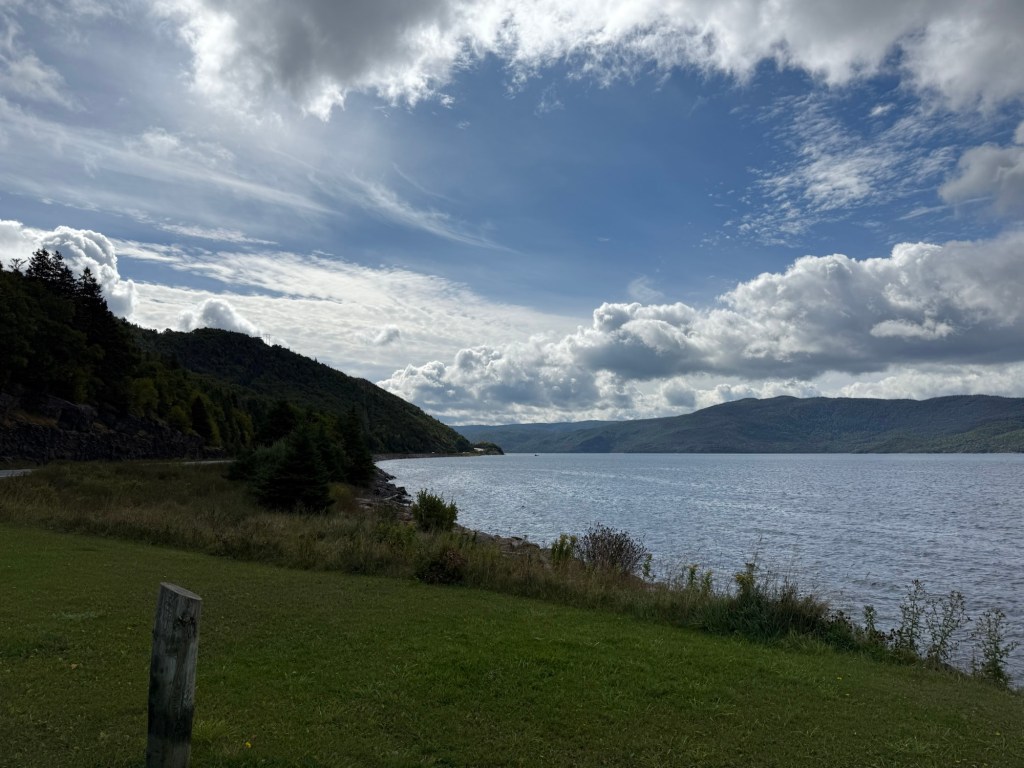
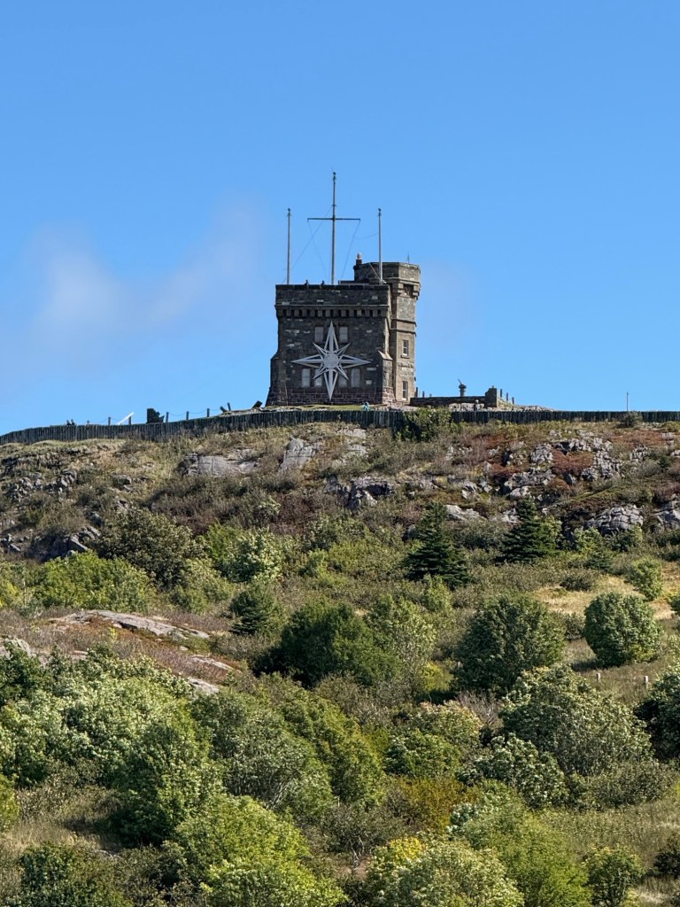
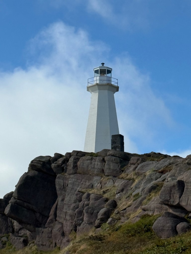
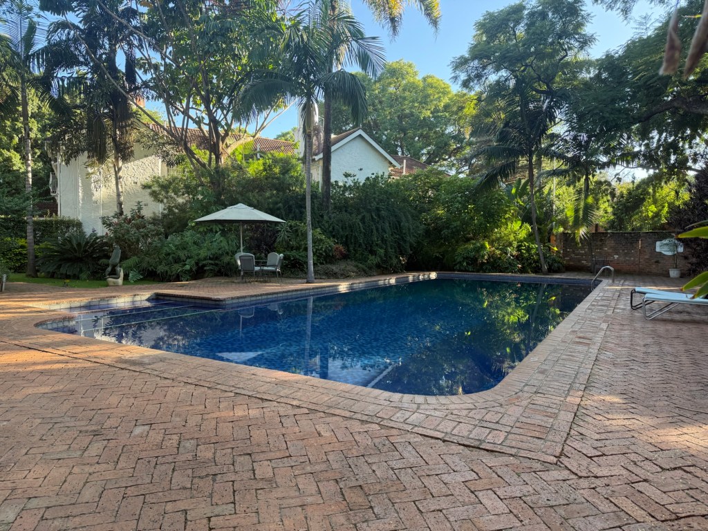
We arrived at our hotel for the evening, called the Mirador, one of many luxury hotels constructed by the Balderrama group in Mexico. The Mirador is renowned for its famous views of the Copper Canyon:
The MiradorThe Copper Canyon
The government has constructed a nearby adventure park in the Copper Canyon, which offers cable car rides and zip lining across the canyon. As both my friend and I dislike heights and suffer from vertigo, we declined and satisfied ourselves with the beautiful views from the hotel.
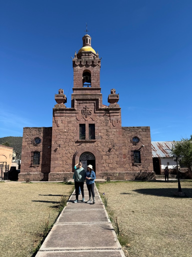
The next day, we set off on a windy road through this Sierra Madres to our next stop, the Hotel Mision, another Balderrama hotel, this one in the town of Cerocahui. The hotel was a Spanish mission style retreat, complete with its own winery, and the only grapevines in the Sierra Madres. We had a very short tour of the town, including the catholic run school for girls next-door to the hotel, and, literally across the road from the hotel, a pretty, but well guarded little church.
The Cerocahui Church
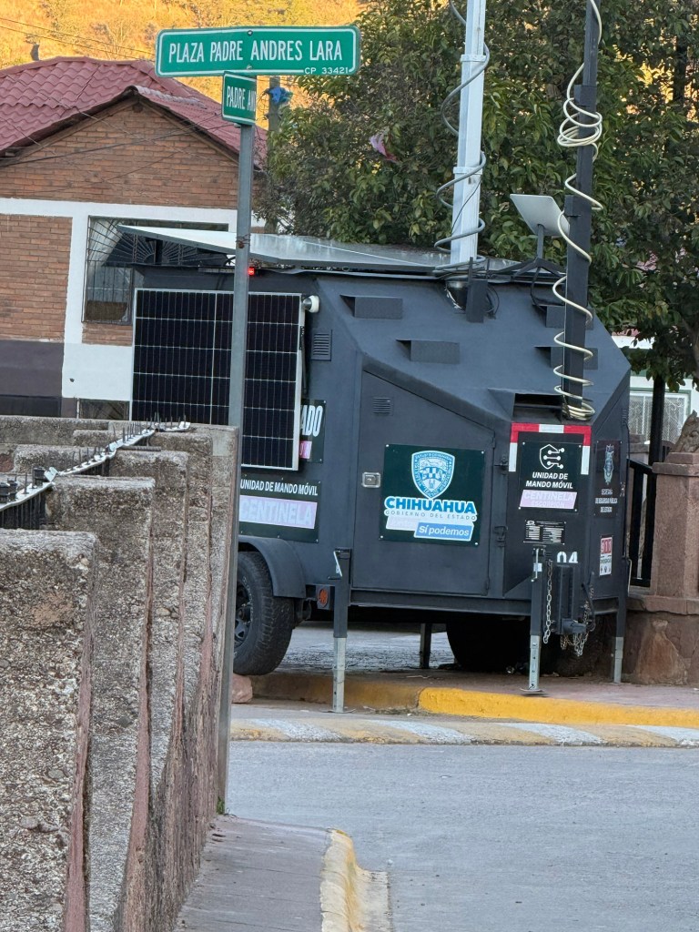
The reason for the heavy security in the church was explained by the guide who told us that in June, 2022, cartel members burst in and killed two priests and two bystanders. To this day, the murderers have not been caught. In the grounds are memorials to those killed. Across the street and beyond the fence was a Mexican military vehicle:
Guarding the Church
Today was February 21,2026. The Canadian government has had a long-standing advisory regarding travel to the Chihuahua province, putting it at a level four “do not travel“ with the exception being on the well-trodden tourist trail we were taking. The area had previously been very popular with foreign hikers, but in 2011, the cartels kidnapped a number of foreigners and killed them. The area has been the subject of travel advisories ever since.
Our guide from the previous day, Ivan, had been very optimistic about tourism returning to Chihuahua and thought that much of the stories about the cartel violence was overblown.
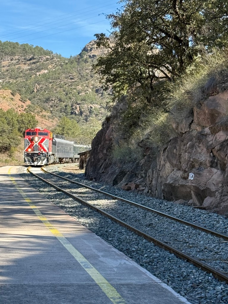
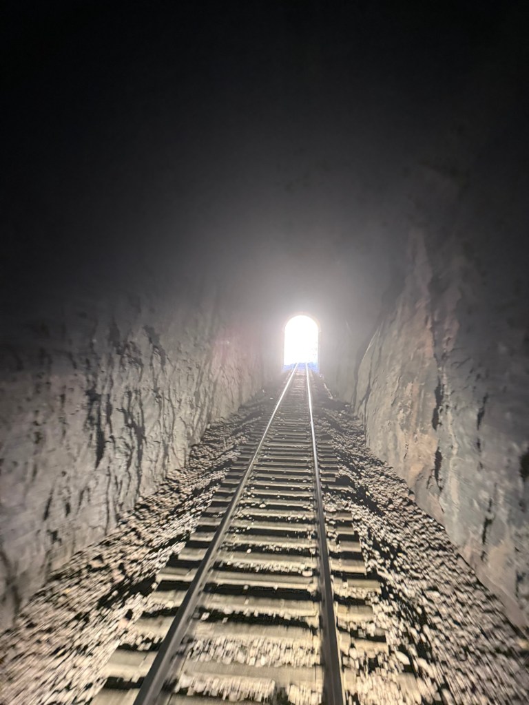
So, the next day, we were driven to the small train station at Bahuichivo to catch the Chepe Express train. The line was originally envisioned in the mid-19th century to run from Mexico’s Pacific Ocean all the way to Kansas City, USA. Politics, economics and the engineering difficulty of constructing a railroad in the canyons and mountains quickly thwarted this dream.
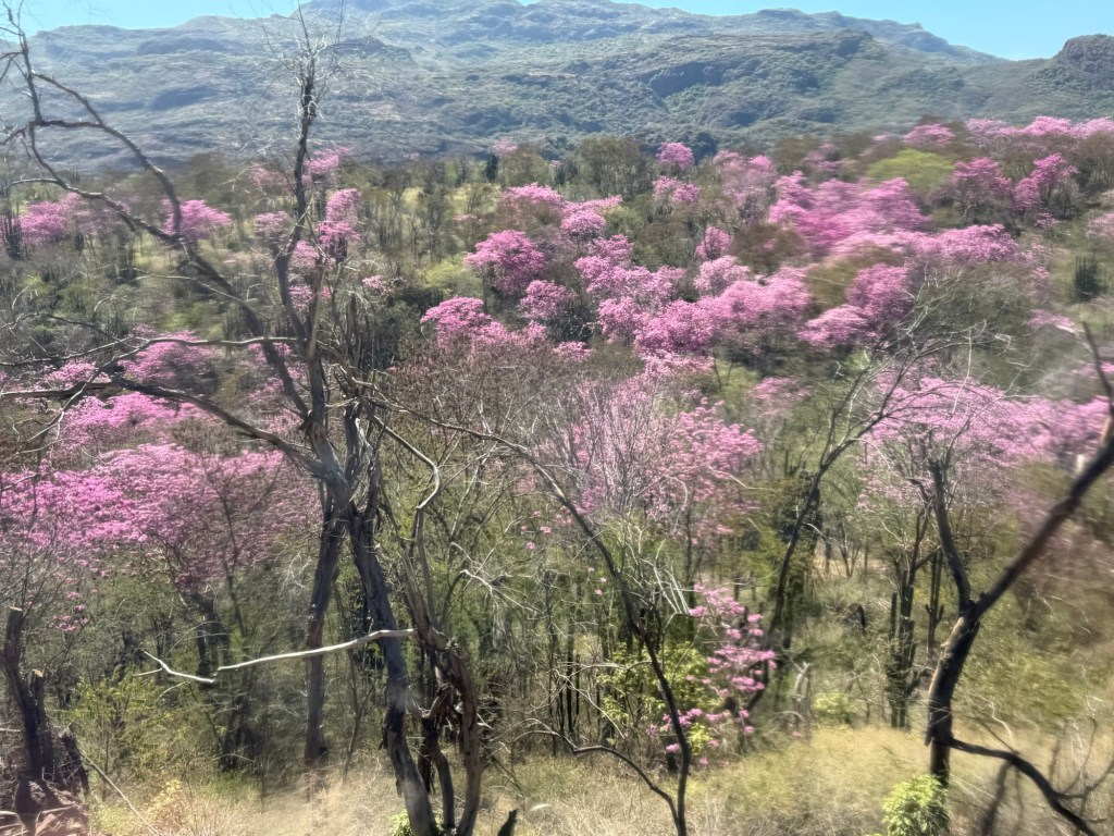
Construction on the railroad did begin at the turn of the 20th century and took over 60 years to complete, running from Chihuahua to Los Mochis. It encompasses 87 tunnels, 39 bridges and a 180° turn:
The trainA TunnelThe TurnThe Scenery
As we were enjoying the train ride, our phones started pinging, texts from friends and families asking if we were okay. Following the killing of a Cartel boss by the Mexican government in Puerta Vallarta, the cartel had responded with gunfire, blockading roads and burning vehicles. A “shelter in place” order was in effect for the region.
Although we were in cartel country, we were 1,000 kilometres north of Puerta Vallarta. While no signs of cartel activity was present, there was a tension in the air, even amongst the mostly Mexican tourists we met.
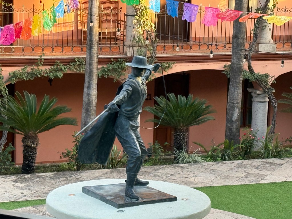
After a 4 hour train ride, we arrived at our final Balderama Hotel, the Posada Hidalgo in El Fuerte. It is famous for being the birthplace of Don Diego de la Vega, a wealthy merchant son who moved to California and was at the forefront of the revolution against the Spaniards and their treatment of the poor. It is said he often donned a mask and was the inspiration for the fictional Zorro. A statue of Zorro is in one of the courtyards at the hotel:
El Zorro
Our tour to the Copper Canyon thus ended. I loved the scenery of the Sierra Madres mountains, riding the Chepe Express and visiting a part of Mexico I knew nothing about. Learning about the history, going to the Indian lands and meeting a lot of Mexican tourists made the trip memorable.
I will be enjoying another five weeks in the heat and relative safety of Merida before returning home. If all goes well, I should be heading to France in May.
I just completed a 5 day tour in Iraq; yes, that Iraq where Saddam Hussein ruled with an iron fist for 20 years, the USA invaded in 2003 and ISIS/Al Quaeda/ ISIL and other Islamic fundamentalist groups have wrecked havoc for a decade.
But it’s also a country with a fabulous past – Uruk is considered the first city, Babylon with its famed Hanging Gardens and Samarra, the capital of the Abbasid Empire, whose golden age of Islam between 750 and 1200 is responsible for advances in mathematics, medicine and astronomy which grounds much of Western science today.
Both the USA and Canada warn against travel to Iraq, with it garnering the highest Level 4 “ Do Not Travel” rating due to risk of terrorism, protests and kidnapping. However, I had done my homework. No terrorist attacks have occurred since 2022, terrorism was not geared towards tourists/ foreigners and I wasn’t planning to go near the borders with Iran or Syria. Besides, I reasoned, homegrown terrorists had recently killed worshippers at a church in Michigan, a synagogue in Manchester and football fans in Tennessee. Iraq didn’t seem much more dangerous.
But I wasn’t completely ignoring the warnings. I arranged for a private guide to pick me up at the airport, take me only to “safe” places, tell me all the rules to follow (no photos in a lot of places, no painted long nails, cover my shoulders and knees at all times) and basically, to hold my hand for the duration.
Obviously, as I’m writing this, everything worked out fine. Now let me take you through my journey.
I needed an e-visa, which can be acquired on-line apparently but a finicky website to navigate made it impossible for me, so I sent my tour guide a photo of me and my passport page and he got it within the hour. On arrival, I went to the passport line, which sent me to the visa line to get a photo ( even though there was one on the visa), back to the passport line, a few stamps and I was in. It took only about half an hour, despite the to-ing and fro-ing.
My tour guide, Twana Burhan from Wander Iraq, met me the airport and, as we drove into Baghdad, I encountered the first of what would seem to be hundreds of checkpoints. The security guard asked the guide for my passport, he checked that I had a visa and away we went. There are checkpoints before every city and major shrines. As my guide explained, the checkpoints were to ensure that ISIS types would not be able to enter cities to cause destruction. While I viewed the checkpoints, sometimes up to 10 a day, as a nuisance, they were also reassuring that the government was trying to stop undesirables from entering major urban areas.
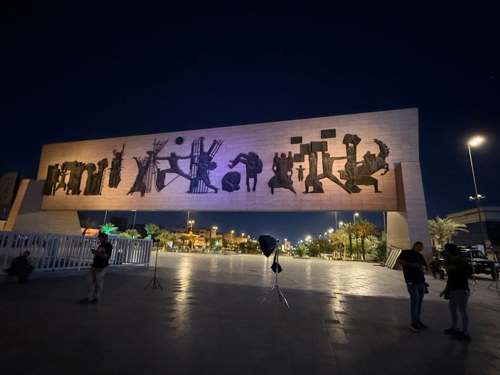
Our first stop was to see the Freedom Monument, commemorating Iraq’s independence and the overthrow of the king in 1958:
The Freedom Monument
Baghdad was founded in the 750s, by the Abbasid empire, the second grest Islamic Empire- the Ubbayid empire being the first. Presumably, at one time, Baghdad was a city filled with glorious mosques and buildings, but successive invaders, particularly the Mongols in the 11th century, destroyed the city, and few vestiges of its glorious past remain.
One building which does remain is the Al-Mustansiriya University, begun in 1227 and serving as a learning centre for philosophy, mathematics, astrology, and medicine. Although largely reconstructed, one can get the sense of how it looked in its heyday:
The Al-Mustansiriyia Univerdity
Baghdad rose again after the Mongol invasion, but was ruled by the Ottoman Turks for centuries, then became a British mandate until 1932. A monarchy was established, but was overthrown in 1958, when the republic began.
Saddam Hussein, Iraq’s notorious dictator, came to power with his Ba’ath party in 1973 and ruled with an iron fist until his overthrow when the USA invaded in 2003. He was executed in 2006.
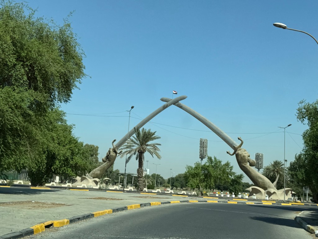
But he left his legacy in numerous ways, aside from using tear gas on the Kurds, sending millions to their death in the Iran-Iraq wars, and the futile invasion of Kuwait, his suppression of all opponents and the complete lack of freedom permitted to Iraqi citizens. He had a penchant for monuments, including the Victory Monument, a pair of hands, each holding swords, commemorating the Iran-Iraq war:
Victory Monument
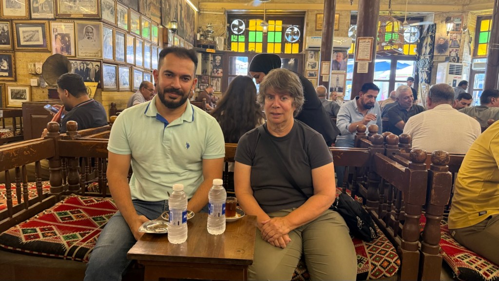
In Baghdad, Twana and I visited the Shabandar Cafe, a popular place serving lemon tea. In 2007, a car bomb destroyed the place, killing over 100 people, including the owner’s sons. He vowed to reopen the cafe as a testament to resilience:
Twana and I in the Shabandar Cafe
Just two hours from Baghdad is the site of the ancient city of Babylon. As Twana drove, I experienced Iraqi roads for the first time. Drivers, nearly all men, generally had a cigarette in one hand and their cell phone in the other. Red lights, lanes and one-way signs were routinely ignored. Roads were continuously under construction. Google Maps didn’t work properly; it would indicate a particular drive should take three hours, but was unaware of road closures, detours and traffic slow downs, so the real driving time was five hours.
As noted, security checkpoints were ubiquitous, located on most streets entering a city and streets entering a shrine or mosque. Soldiers, carrying AK-47s, always would stop our car with the foreigner in it. But after handing over my passport, and concluding that my visa was in order, most of the soldiers welcomed me to Iraq as they handed back my passport. On one 3 hour drive I counted 10 check stops. Photography at checkpoints was strictly forbidden, so there are no photographs.
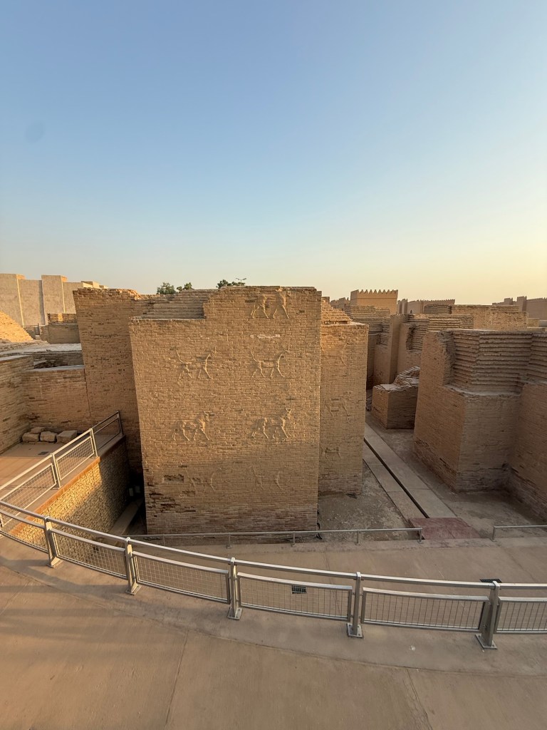
The old Babylonian empire ruled Mesopotamia from the 19th to 16th century BC, but it is the new Babylon which ruled much of the Middle East in the 6th and 7th century BC that is known to most of us through the Bible. The tower of Babel was apparently located here, as was one of the seven wonders of the ancient world – the hanging gardens of Babylon. The old Babylonian code of Hammurabi is considered the first law code and Nebuchadnezzar’s capture of Jerusalem and his destruction of the temple there made him notorious in Jewish history. Once housing over 200,000 people, Babylon declined and was eventually abandoned by the 2nd century BC, after the nearby Euphrates river changed course.
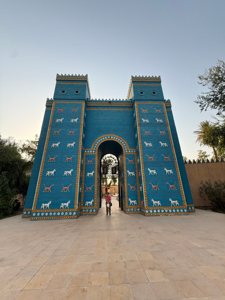
Today, the ruins are in the middle of the desert. At its entrance is a replica of the Ishtar Gate, which once stood proudly near the palace. The real Ishtar Gate was disassembled by German archeologists after World War I and reassembled in the Pergamon museum in Berlin where it stands today. Although I have visited the actual gate in Berlin, the photo below shows the replica in Babylon.:
Ishtar Gate Replica
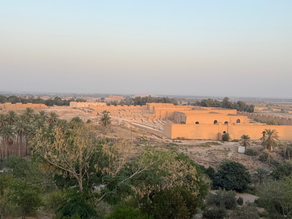
Saddam Hussein, in addition to his war mongering and use of tear gas, liked to reconstruct ancient monuments. I’m of two minds about this program. Although some of the reconstruction definitely provides structural support to crumbling buildings, it takes away from my sense of awe I usually get when looking at ancient ruins. Much of Babylon was reconstructed by Saddam, including its walls and palaces:
View of ancient BabylonReconstruction inside Babylon
We saw neither the hanging gardens of Babylon nor the tower of Babel, which isn’t surprising as many historians and archeologist do not believe either ever existed.
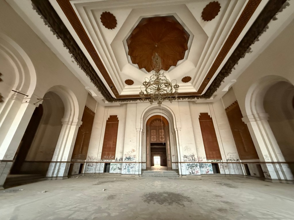
Saddam Hussein‘s building program did not end with reconstructing ancient sites. He built himself numerous lavish palaces all over the country, including one on a manmade hill overlooking Babylon. Following his overthrow, , this palace was stormed by the people and stripped bare. Today, only a shell of the building remains:
The inside of one of Saddam’s palaces
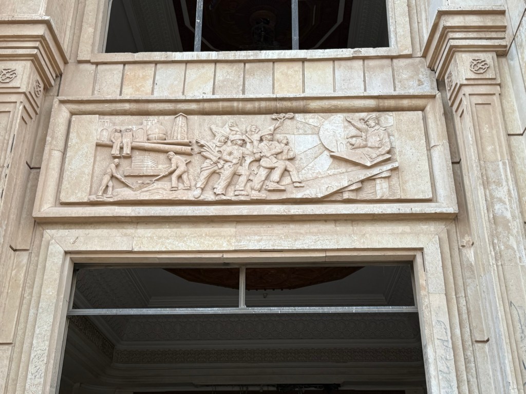
Saddam had quite the ego and fancied himself to be the equivalent of the ancient rulers of Babylon. His face adorns a bas-relief above one of the doors at the palace
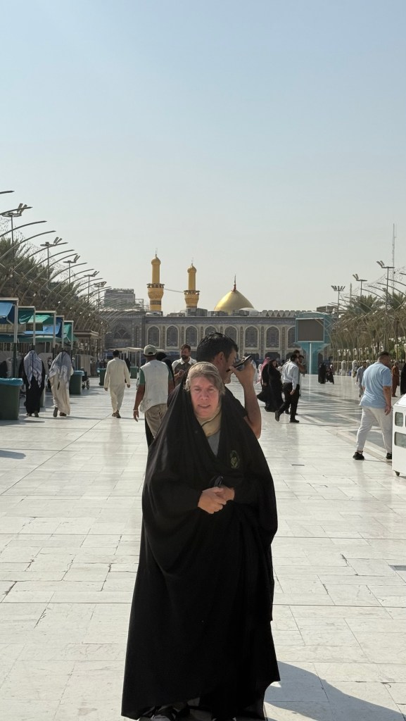
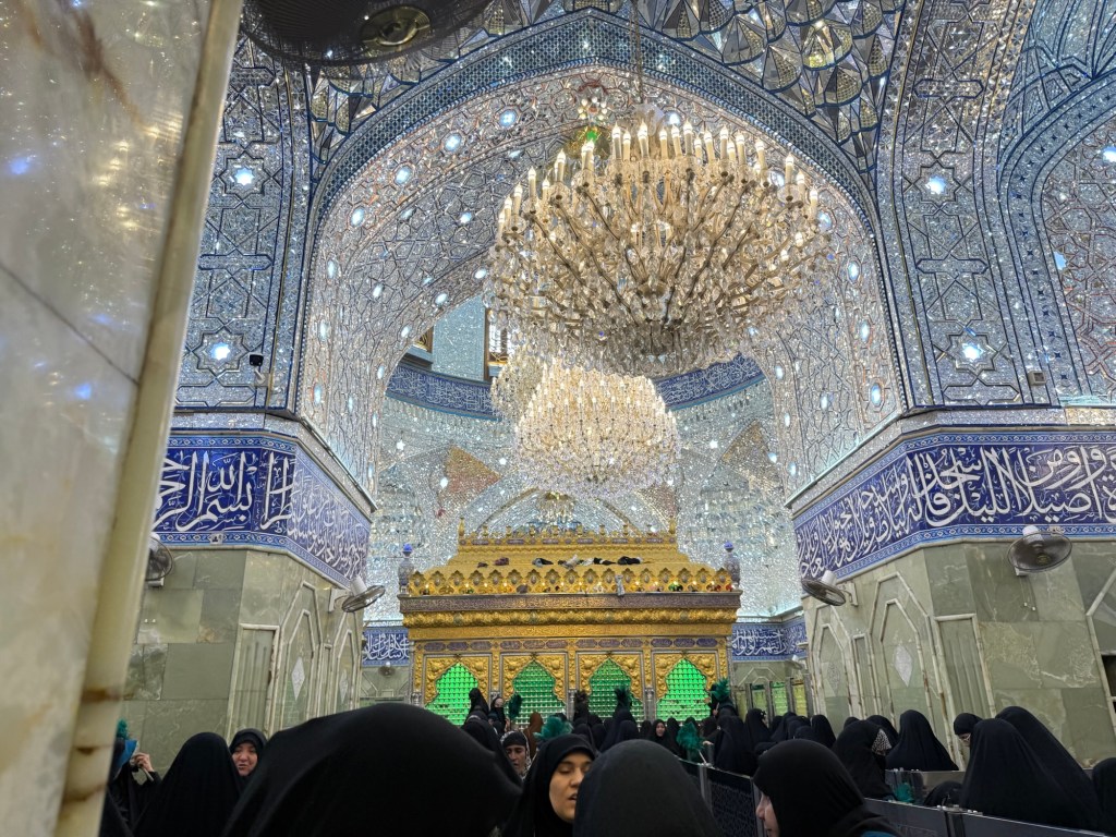
From Babylon, we made our way to the holy city of Karbala, for a visit to the shrine of Imam Hussein, grandson of Muhammad, who died in battle in 680 fighting against oppression. His shrine, inside a mosque, is considered one of the holiest places in Islam. Women are required to wear an abaya. Twana rented one for me and put it on:
Me in Karbala
I had to pass through three or four checkpoints, separate ones for women and men, where I was searched for weapons and my attire inspected. Some helpful ladies helped me tie my scarf back properly so no hair would show, laughing at my incompetence at wearing the abaya.
Inside, the shrine was beautiful. Again, the sexes were segregated. Although I had understood that Muslim women do not like to have their pictures taken, this seems to have gone by the wayside as many women were taking selfies. I didn’t take a selfie, but here’s a picture of the shrine:
Shrine of Imam Hussein
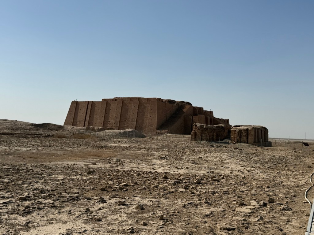
From Karbala, we made our way to the ancient Summerian city of Ur. One of the first cities, founded about 3800 BC, it was most famous for its Ziggurat, a giant temple built of bricks and held together by bitumen. Though only the lower level is visible today, it didn’t escape Saddam‘s reconstruction program:
The Ziggarut at Ur
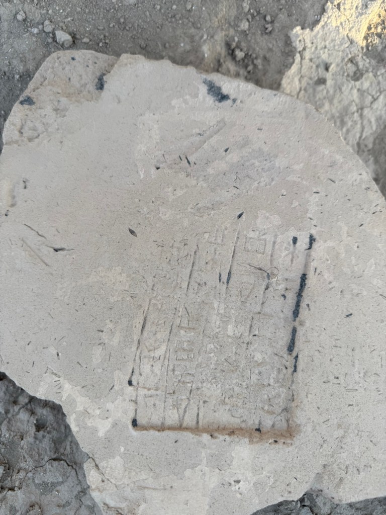
Just an hour away are the ruins of the city of Uruk, another ancient Sumer city, considered the first place where writing was discovered. Bricks with cuneiform wedges are visible along with millions of pieces of pottery shards.
Cuneiform writing in Uruk
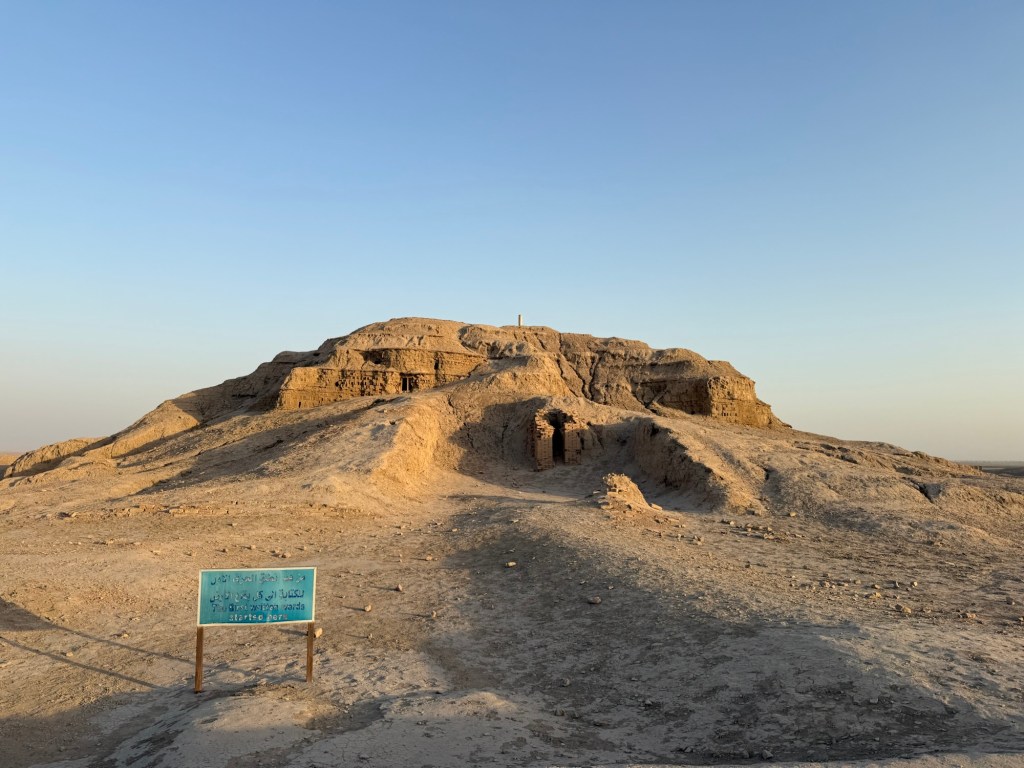
Uruk had escaped Saddam’s reconstruction efforts, so it felt much more real to me:
Uruk
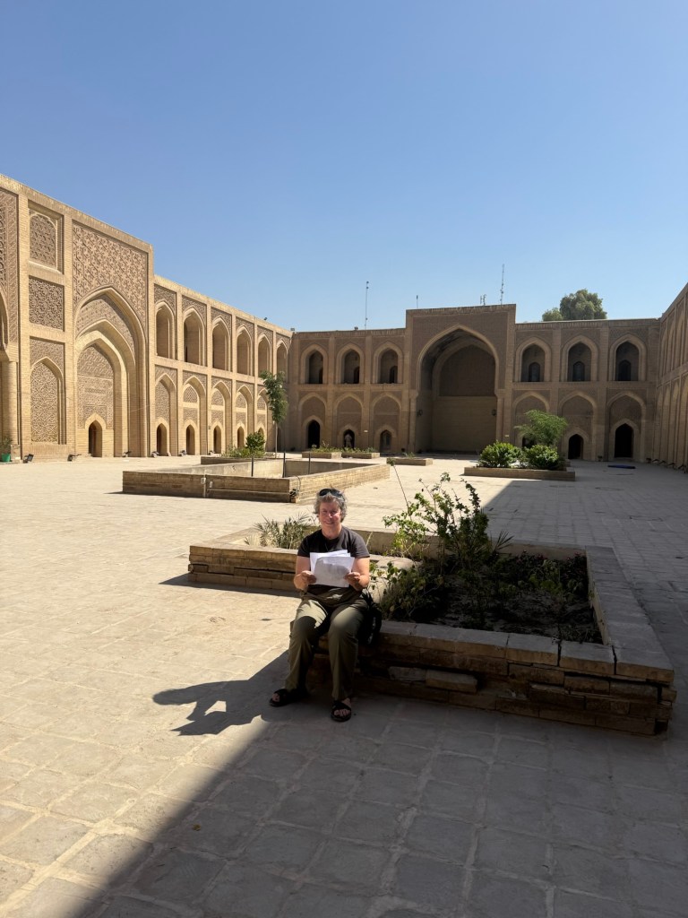
Nearby, is the place generally accepted to be the birthplace of the prophet Abraham. A brick located there contains this words.”House of Abraham” . Like many of the archeological sites in Iraq, it is officially closed and can only be viewed after a guard unlocks the gate. Unfortunately, on the day I was there, the guard had a family emergency, and, therefore, we were unable to see the site. In the same vein, the Iraqi museum in Baghdad was also closed, but entering it was near impossible without much higher pull than my guide had.
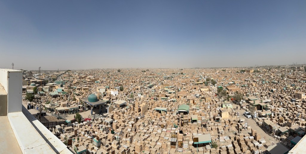
We made our way to Najaf, famous for having the largest cemetery in the world, with more than an estimated 10 million burials there:
The Cemetery
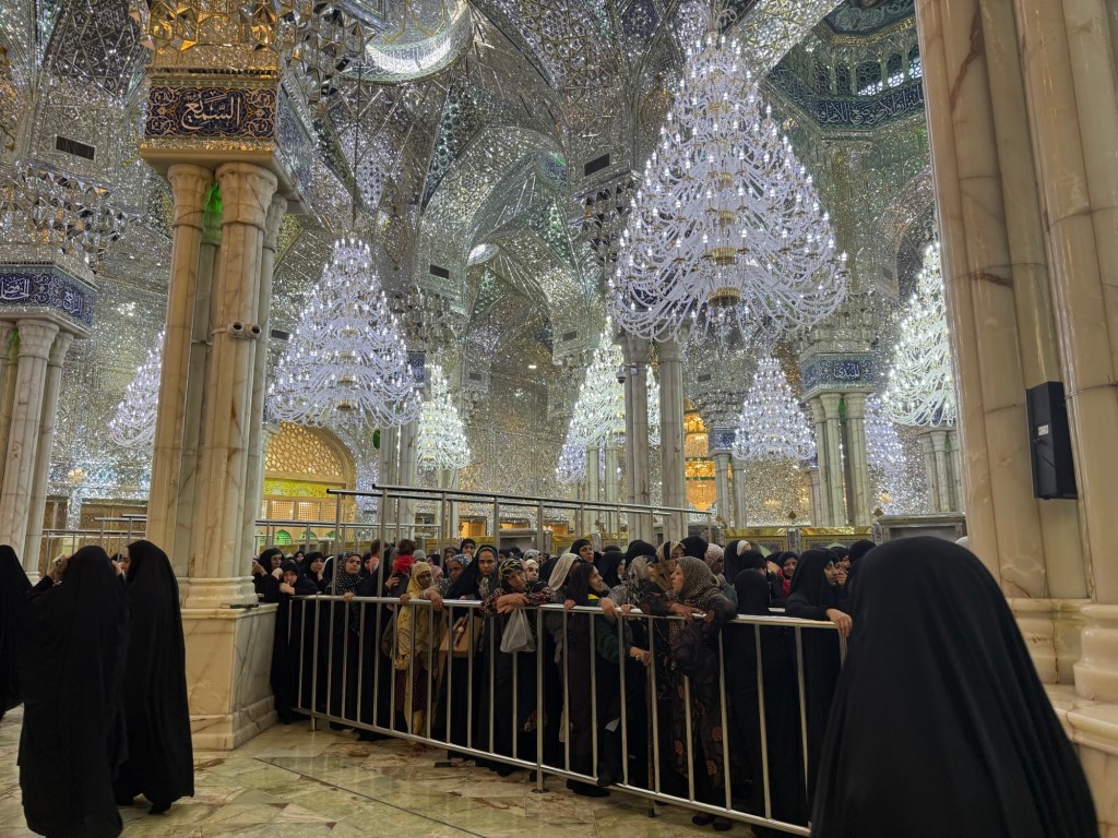
Also in Najaf is the shrine to Imam Ali. Constructed starting in the eighth century, it is considered to be one of the largest and most expensive mosques in the world. I again donned an Abaya and entered the women’s section of the mosque (after duly being inspected for clothing infractions). While the mosque and shrine are beautiful, my overwhelming memory is of being pushed into a sea of black abayas, herded like a sheep and stuck there with no way out for nearly 45 minutes, as the crowd of women made their way towards the shrine:
Inside the Shrine of Imam Ali
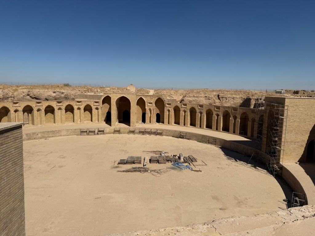
Far less crowded was the former palace of the Abbasid king at Samarra. Built in the ninth century, (and reconstructed by Saddam ), its most impressive feature is the giant circular pool in the centre of the building. The entire structure is built below ground, so when the pool was filled with water, the hotter air rose and the palace cooled:
Samarra Palace
We visited a few more sites, but I had seen enough shrines, mosques, monuments, and reconstructed ruins. On my fourth day in Iraq, I finally saw another tour group, about 12 people from Czechia.
I also partook of Iraqi food, similar to most Arab and Mediterranean countries. Hummus, baba ghanoush, tomato and cucumber salads, pita bread, kebabs, and grilled meat were all fresh and tasty. In Baghdad, I did see one of the countries two KFC‘s and a Pizza Hut, but for the most part, there are no western chain restaurants. No McDonald’s can be found in Iraq.
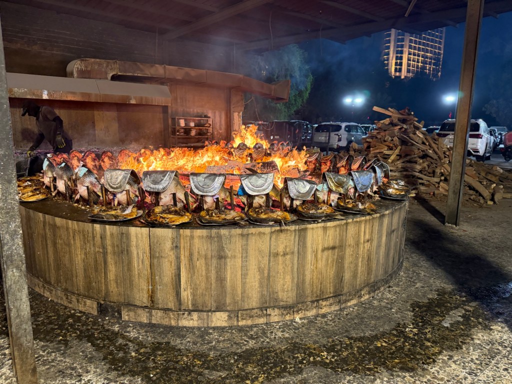
My favourite meal was at Baghdadi’s, a restaurant famous for its fish, carp caught in the Tigris River and cooked by standing it near the fire:
Fish cooking at Baghdadis
Overall, the food was excellent. Bottled water was available everywhere; alcohol, although legal, was not offered at any of the restaurants I went to, and most of the bars served only coffee and soft drinks.
So, what are my overall impressions of Iraq? It has plenty of ancient archeological sites to satisfy this history lover. Evidence of successive empires, from Sumer to Babylonian, to Greek, to Persian to Abbasid, Ottoman and the 20th century exists and, to me, are fascinating but the widespread reconstructions causes me concern, as did the lack of seeing any ongoing archeological excavations.
The food was excellent, the hotels were adequate ( AC, hot water, WiFi, bottled water and no bugs), but those advertised as four stars were optimistic. Most of the rooms were a little rough around the edges and in need of renovation.
The poor state of the roads was disappointing, as was the closure of many ancient sites and museums. On the plus side, there were no crowds at any of the tourist sites.
At the end of the day, I’m not sure what to make of my time in Iraq. I certainly enjoyed visiting the ancient Mesopotamian cities, seeing the Islamic shrines and learning about its more recent history. People everywhere were polite, and I encountered no difficulties in that regard.
But my final impression of Iraq was when trying to depart from the Baghdad airport. Getting to my gate was a prolonged affair that involved two different sets of dogs sniffing the car and my luggage, five different scans of me and my luggage, taking my shoes off two times and being patted down twice by lady guards. I suppose all of these security measures are intended to reassure me that everything is safe, but for me, it was just a reminder that this country is not far removed from its violent past, and in some ways, is still at war.
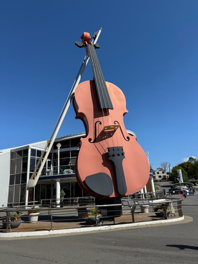
A smooth, 6 hour ferry ride from Port aux Basques, Newfoundland took me to Sydney, Nova Scotia, where I encountered the world’s largest fiddle, conveniently located right at the cruise port terminal:
Sydney, Nova Scotia
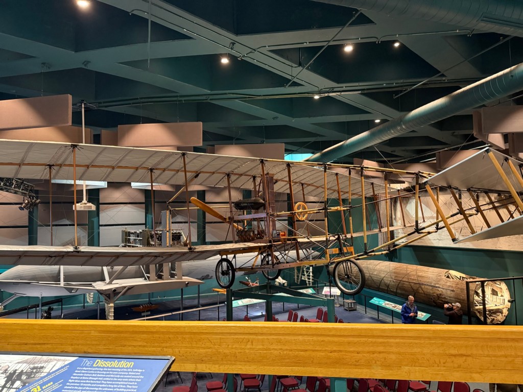
A short drive away is the town of Baddeck, famous as the gateway to the Cabot Trail and the summer home of Alexander Graham Bell. I toured the museum devoted to him, learning he was a teacher of the deaf, a member of the society which brought the first airplane flight to Canada and the inventor of the hydrofoil boat, in addition to being credited with inventing the telephone:
Inside the Alexander Graham Bell’s Museum
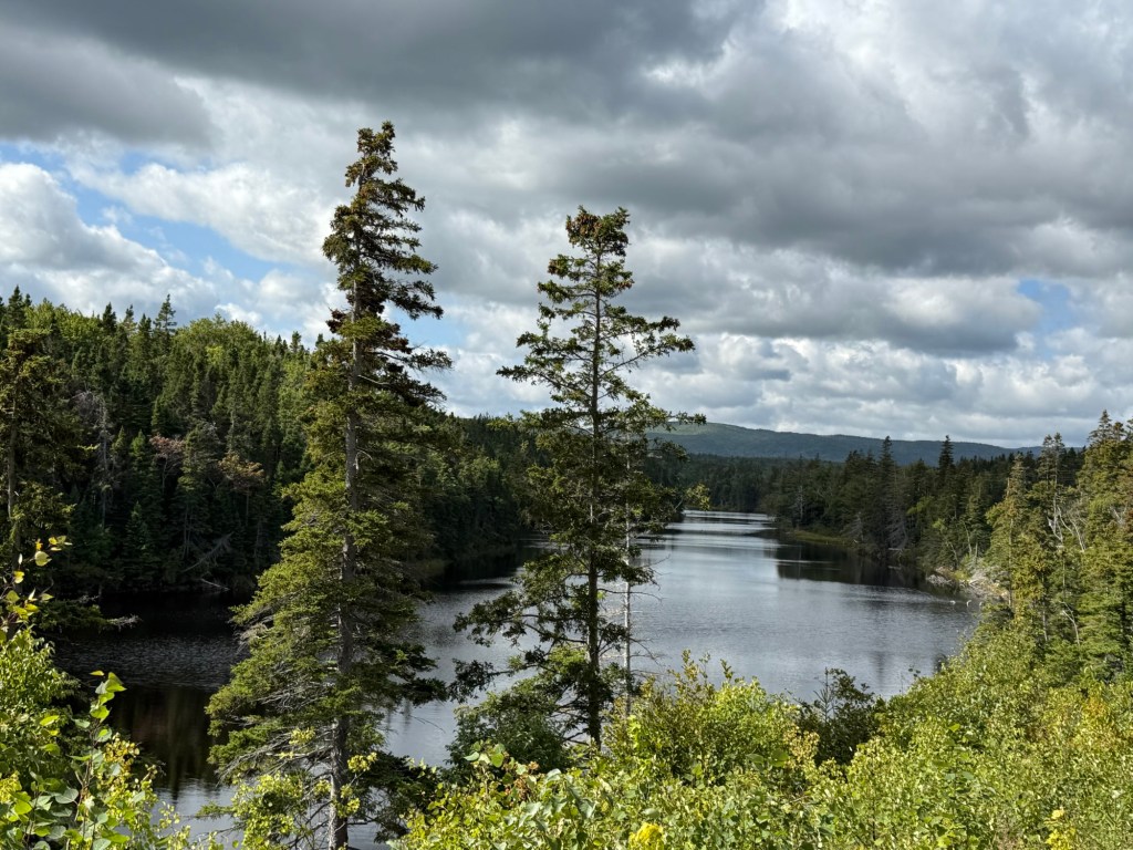
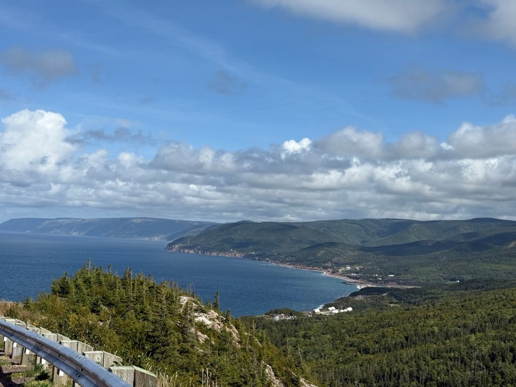
From there, we drove to the Cabot Trail, a 300 kilometre circuit around Cape Breton. Craftspersons, bakers and artists dot the circle, offering all sorts of goodies from glassblowing to chocolate, but the real star is the fantastic views of the coastline:
Cabot Trail
We meandered our way counterclockwise for 5 hours, enjoying the drive and scenery before setting off to Halifax.
Halifax’s deep water harbour is one of the world’s finest. It never freezes and has served as a port for explorers, fishermen, whalers, military convoys, container tankers and cruise ships. The boardwalk is one of the longest- at over 4 kilometers- and is a charming mix of restaurants, souvenir shops, children’s play areas and museums:
The Boardwalk
The Maritime Museum showcases Halifax’s contributions to all things naval-related. Information about early ships explains life at sea. The Titanic exhibit showcases mostly the rescue effort and the transport of many of the corpses to Halifax; 150 are buried here. During WW2, Halifax was the meeting point for the convoys of merchant ships travelling across the Atlantic, another exhibit in the museum.
As well, an Exhibit devoted to the Halifax Explosion, on Dec 6, 1917, explains how it occurred (a French ship laden with explosives was hit by a Norwegian vessel, causing a fire leading to the blast). The ultimate explosion was the largest man- made explosion until the Hiroshima atomic bomb. 2,000 people were killed, 20,000 injured and 25,000 left homeless. The city was flattened and, to make matters worse, a nasty snowstorm began that evening.
One odd benefit from the explosion (aside from increased safety in ports) arose because many people rushed to their windows following the first blast, trying to figure out what was going on. When the big blast occurred a few minutes later, the window glass shattered, damaging thousands of eyes. In the aftermath, Halifax became a leader in ophthalmological medicine, which it maintains to this day.
A walking tour took me through some of the highlights- the Government House, the Public Garden, a Clock Tower constructed on Prince Edward’s commands (frustrated by the lack of synchronized timing), but most of the pre-1917 buildings had been destroyed in the explosion, so there wasn’t a lot to interest me.
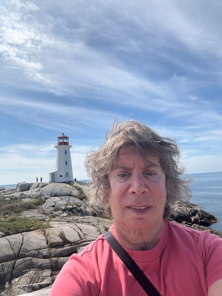
Nova Scotia has two iconic sites; the first is Peggy’s Cove, located about an hour south of Halifax. I drove there, considered myself fortunate to find a parking spot, walked to the famous lighthouse, took a picture, looked around the town and left.
Peggy’s Cove
The second must-see site is the Bluenose schooner in Lunenburg. It’s only about an hour away from Peggy’s Cove, so I drove there, parked and made my way to the harbour, looking for the famous ship. I couldn’t find it and was sad to learn that it was away for the day, not expecting to return until well after dark. I consoled myself with an ice cream cone, and some pictures of the very colourful town of Lunenberg:
Lunenburg
My last two days in Nova Scotia was spent in Digby, a pretty little town on the Bay of Fundy. It had the requisite lighthouse, boats which rose and fell with the tide, and lots of seafood restaurants, featuring its scallops, for which it proclaims itself The World’s Scallop Capital. But I was getting a little tired of pretty little seaside towns, so I mostly just relaxed.
Digby
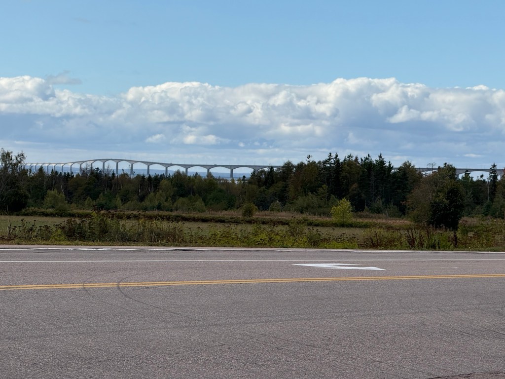
The next province I visited was Prince Edward Island (PEI), which had been a true island until 1997 when the Confederation bridge, linking it to the mainland, was opened. It’s an engineering marvel, spanning 12.7 km and taking 10 minutes to drive across. Vehicles with high walls are prohibited from driving it when winds exceed 80 km an hour; all vehicles are stopped if the winds hit 90 km an hour. Luckily, I traversed it on a clear, windless day. An interesting sidenote, no toll is collected on the way to PEI, but the $20 toll is collected at the foot of the bridge when leaving PEI:
Confederation Bridge
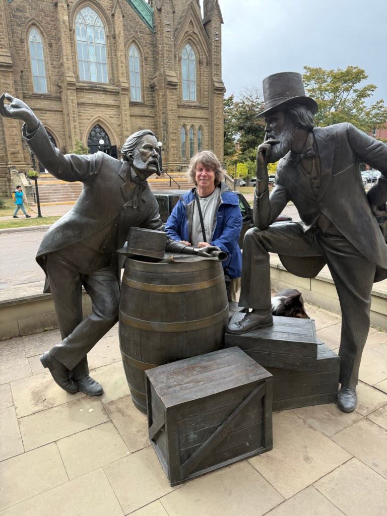
Charlottetown, the capital of PEI, is famous for holding the confederation conference in 1864, which led to the joining of six British colonies and the eventual creation of the country of Canada in 1867. This meeting is commemorated in many spots, including the statues of two Newfoundland delegates whose names escape me, but I had to have my picture taken with them:
Me and some confederate fathers
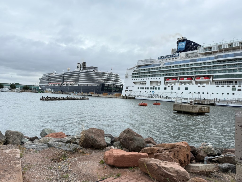
Charlottetown’s heyday was in the mid -19th century, when it was a centre of shipbuilding. But that industry doesn’t last and today, its main industries are agriculture, tourism, and fishing. Tourism was evident from the two giant cruise ships in port the day I was there:
Charlottetown has its share of pretty seaside houses and buildings, most post-datinga devastating 1892 fire, along with a slew of seafood restaurants. But it’s a city of only 40,000 and one day there was certainly enough.
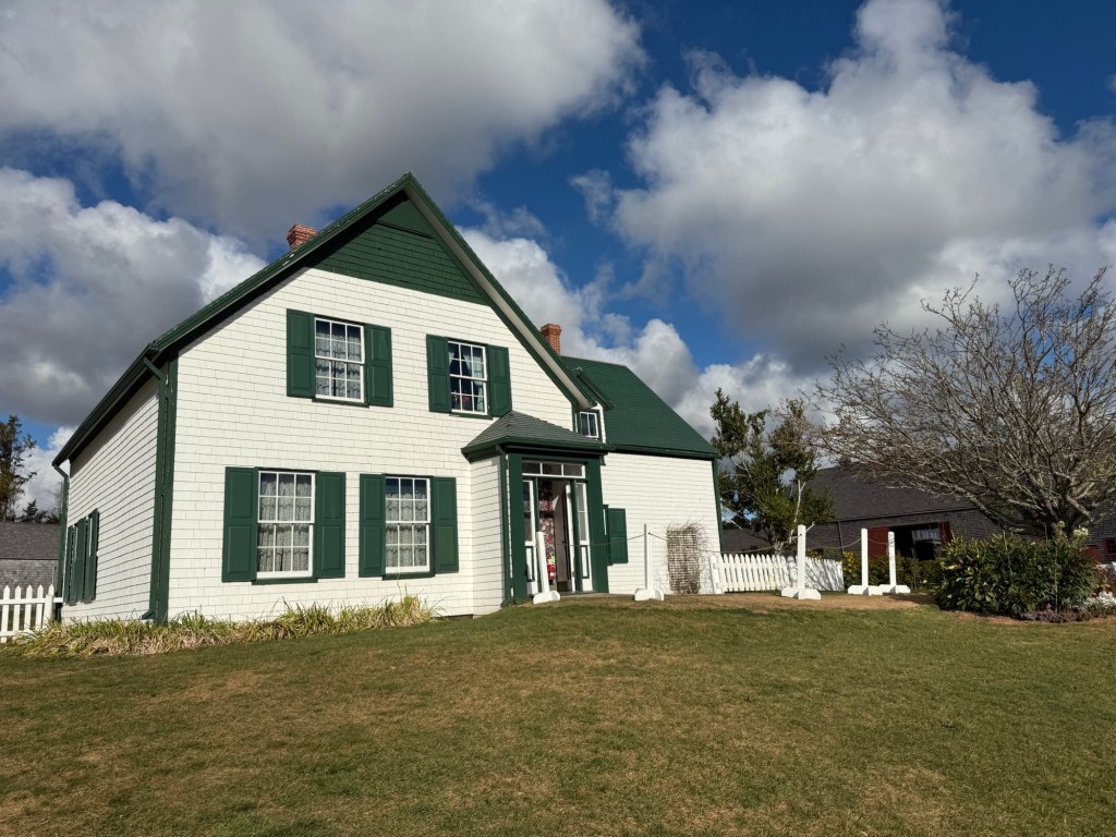
Less than an hour away from Charlottetown is the Anne of Green Gables Heritage Park. Maintained by Parks Canada, it features a visitor center, which traces the life in career of Lucy Maud Montgomery, the author of Anne of Green Gables, and the impact the book has had on it its many readers. Interestingly, all the signs in the visitor centre are in English, French and Japanese.
Outside the visitor centre is Green Gables, a farmhouse owned by the Lucy Maud Montgomery s brother and sister-in-law and their farmland. Guided tours are available, but not with the dog, so pup and I walked around the house, took a few pictures and left:
Green Gables
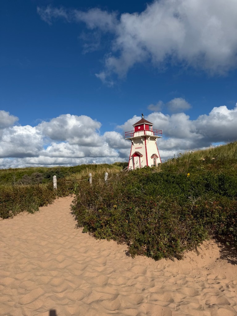
I had planned to circle PEI and visit a number of lighthouses, but after stopping at two, and seeing how much they looked alike, I decided on a different plan and returned to the mainland and New Brunswick having only seen three of PEI’s 81 lighthouses:
Covehead Lighthouse
I was only spending a day in Moncton, New Brunswick, so I decided to focus on its to-do items. First stop was Magnetic Hill, a hill, which either through magnetism or optical illusion, lets you drive uphill backwards. I drove there, slightly disappointed at the theme park atmosphere surrounding it, but was pleased to see there was nobody on the hill at the time. I read the instructions, which are to drive down to the white Pole, and put your car in neutral. You then drive up the hill in neutral, backwards! So I did and have to admit it was quite fun to feel like I was reversing uphill. As I finished, another vehicle came and did the same thing so I was able to take this photograph:
Magnetic Hill
It loses something in the photo, but I really did feel like I was going upwards in neutral.
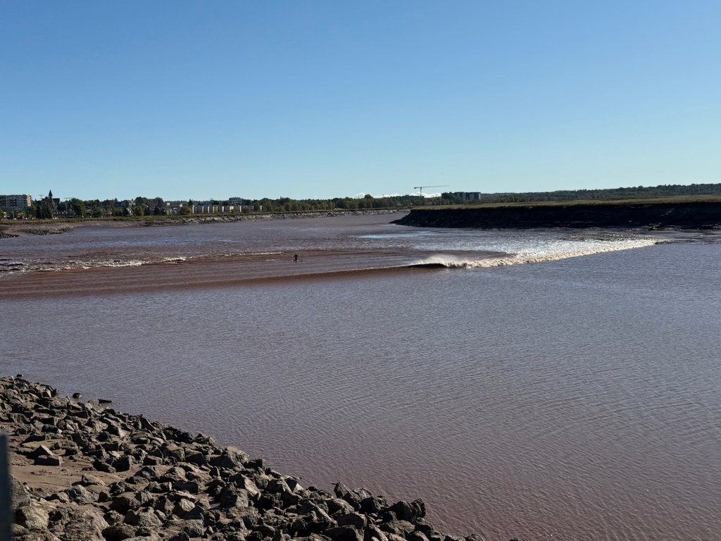
Moncton is located near the Bay of Fundy, a 150 km stretch of water between New Brunswick and Nova Scotia, famous for the highest tides in the world, sometimes exceeding 12 m. The tides create some unique phenomena, including the tidal bore. Twice each day, the strong tides from the Bay of Fundy create a wave so strong it sails up the Petitcodiac River, against its current. I went to see it one morning:
The Tidal Bore
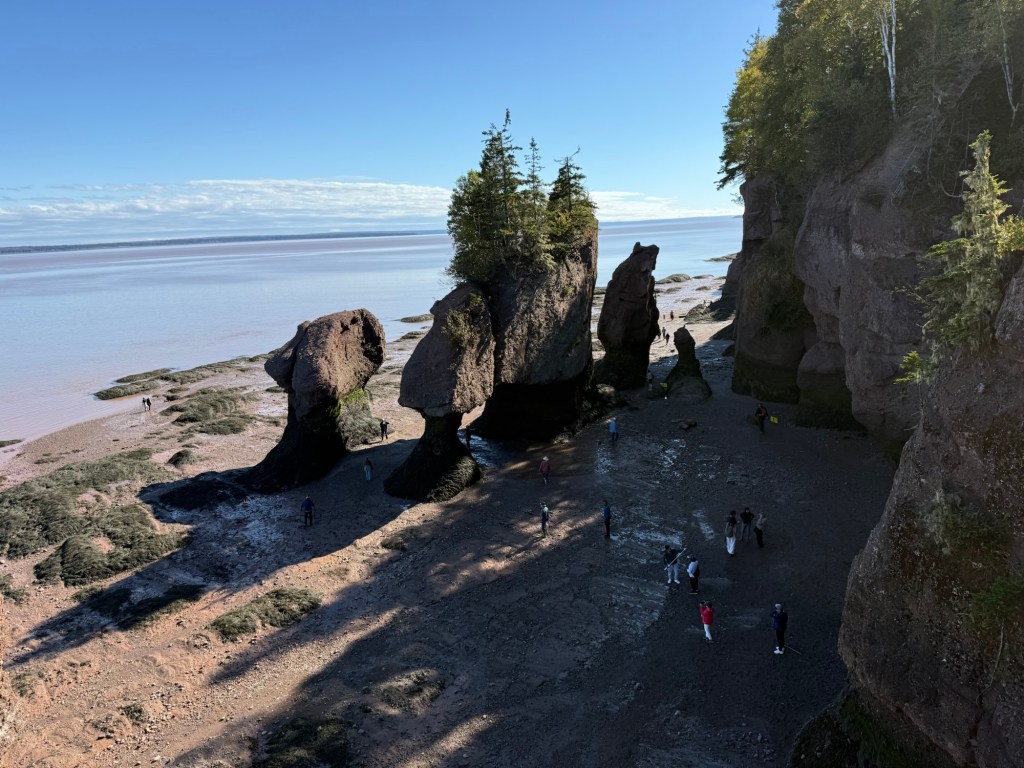
Next step was the Hopewell Rocks, an interesting rock formation on the Bay of Fundy, where the tide covers the rocks at high tide and allows you to walk on the ocean floor at low tide. Pup and I enjoyed a 15 minute walk through the woods to get to the rocks, but looked at the multiple staircases leading to the ocean floor and decided a few pictures from the top would suffice as I didn’t want to have to walk up those stairs:
The Hopewell Rocks
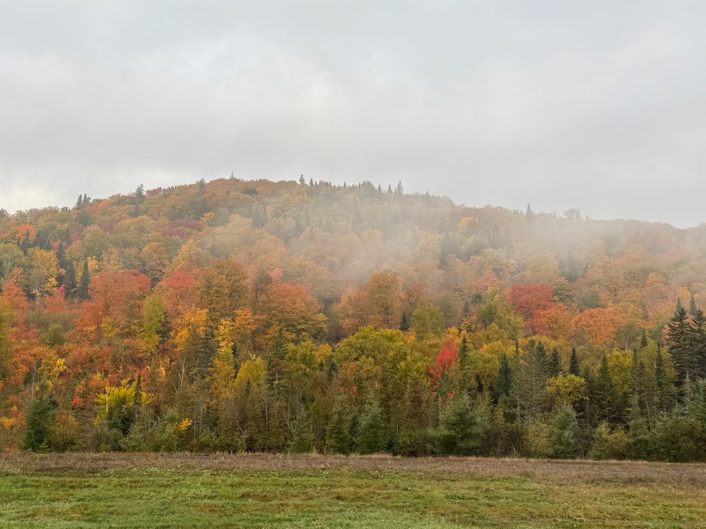
After three weeks, I’d had my fill of pretty coastlines, dramatic lighthouses, and charming seafood restaurants. it was time to begin the long drive home. One last delight awaited me. It was late September and, all along the highways from New Brunswick to Quebec, the trees had started to turn to their magnificent autumn colours:
Although I have travelled to 134 countries ( and still counting), I haven’t been to vast tracts of my own country, Canada. So, in the fall of 2025, I packed a few clothes and my Sheltie pup and set off for the Atlantic provinces.
As I enjoy highway driving, I decided to take the long way to the island of Newfoundland, traversing the 1,149 kilometers of the trans-Labrador highway from its border in Quebec to its end in Red Bay. Completely paved in 2023, it cuts through swarms of forests, lakes and pretty rivers:
Somewhere in Labrador
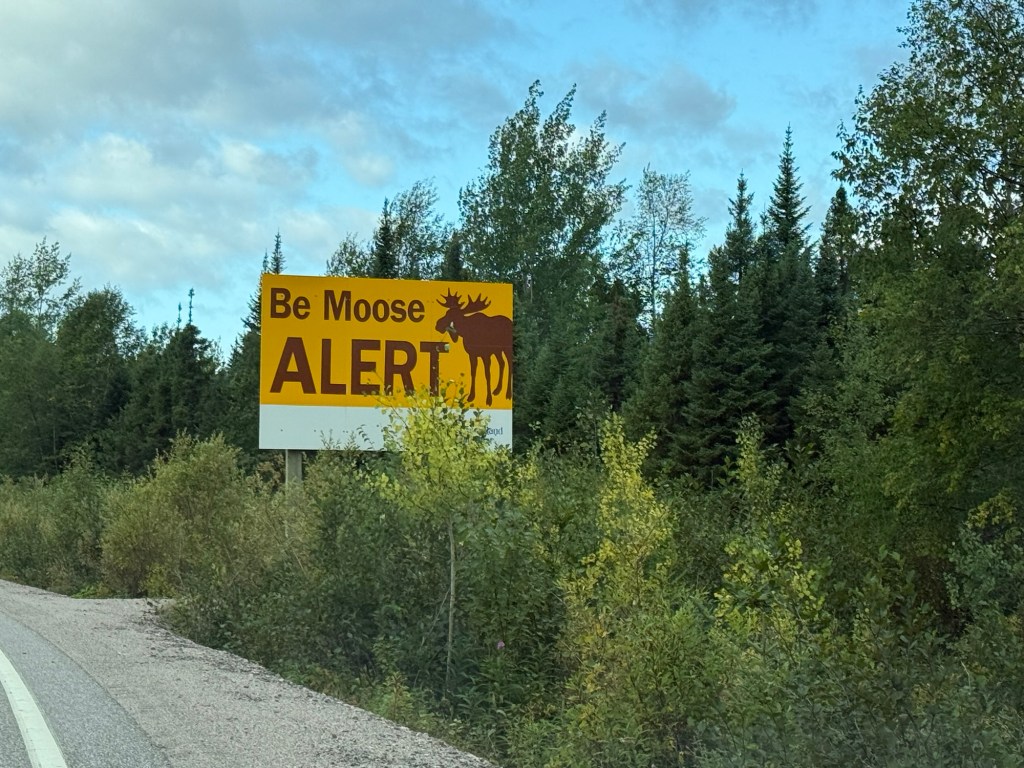
Animal life abounds, with constant reminders to watch out for moose:
I was fortunate to see, but not hit, 2 moose and a black bear. The possibility of hitting moose limited my driving to the daylight hours, but with the hour and a half time difference from Quebec, dusk came late. Why an hour and a half time difference? Newfoundland is exactly 3 1/2 hours from Greenwich, and the Newfoundlanders insisted upon keeping their time thus.
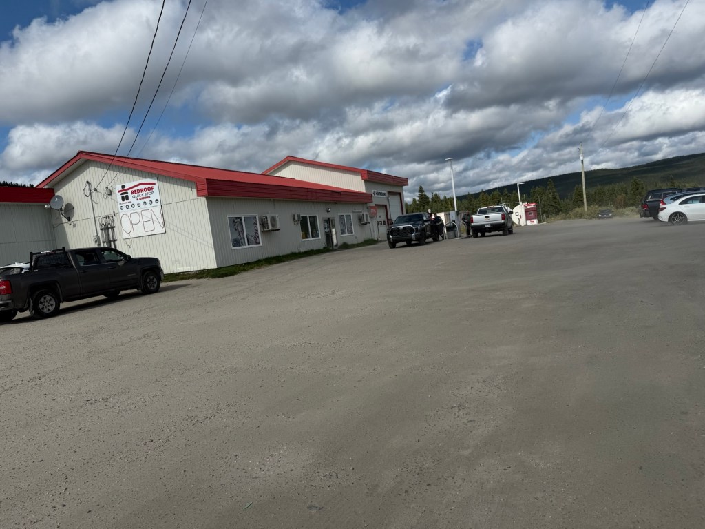
Labrador is remote, with only 40,000 inhabitants, mostly Inuit and workers in the iron ore mines. Driving through Labrador requires care be taken with the distances. I saw only a single gas station in the 529 kilometres between Labrador City and GooseBay/ Happy Valley and, on leaving Goose Bay/Happy Valley, a sign warns the nearest gas station (and flush toilet) is 394 kilometres away. Nonetheless, the isolation is a large part of Labrador’s attraction.
Only gas, toilet and restaurant for 100’s of kilometers
After 3 days of driving through Labrador, millions of trees and thousands of lakes, I arrived in Blanc Seblon, Quebec, where a 90 minute ferry ride took me to the island of Newfoundland. My highlight was discovering that my dog doesn’t get seasick.
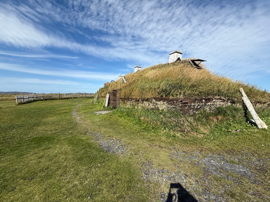
Driving north, I headed to L’Anse aux Meadows, the first known European site in the Americas. Leif Ericsson sailed here from Greenland in about 1,016AD and established a small community. Over the course of 10 years, the Vikings constructed houses, forges and boathouses where they chopped trees, smelted iron and repaired their ships. The Vikings abandoned the site, likely due to its distance from Scandinavia, but archeologists rediscovered it in 1960. Today, a visitor center, tour guides and reconstructed buildings greeted me; the original buildings are buried under the mounds for preservation reasons:
L’Anse aux Meadows
3 hours south is Newfoundland’s jewel, Gros Morne National Park, with spectacular fjords, numerous walking trails and glimpses of pretty seaside coves:
Having the dog limited my hiking options to dog friendly walks, so we circled Bear Head’s pond;
Gros Morne
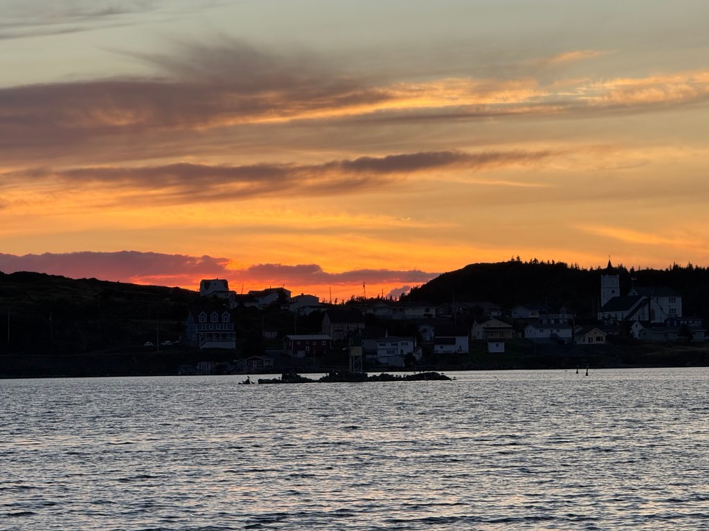
We next drove to Twillingate, a pretty seaside town best known for its ferry to Fogo Island and its high priced resort ($4,000 per night). We stayed in a much more affordable Airbnb ($160 per night) on the water and enjoyed the sunset:
Twillingate sunset
After a five hour drive, we arrived in the provincial capital of St. John’s, with a greater population of 210,000. A narrow strip of water ( called unimaginatively “the narrows”) separates the harbour from the Atlantic Ocean;
The Narrows
Some history here: St. John’s and Newfoundland had been settled for thousands of years by the Beothuk indigenous people, but the last one died in 1829, mostly due to the arrival of Europeans. The first non-Viking European, maybe John Cabot (no one is certain where precisely he landed), came in 1497. Portuguese, Basques, French and English followed, but it was the Irish who first settled about 1630 after decades of coming each summer for the cod fishing, returning back to Ireland for the winter.
The Irish heritage is evident everywhere in St. John’s, with Irish music constantly playing. The Irish penchant for enjoying a pint or two also prevails, with George Street said to have the highest density of bars in North America, surpassing even New Orleans.
St. John’s grew and was the subject of battles between the French and English during the 7 year’s war; the Treaty of Utrecht saw the French cede Labrador and Newfoundland to the British, except the small islands of St. Pierre and Miquelin which were retained by the French for their fishing rights.
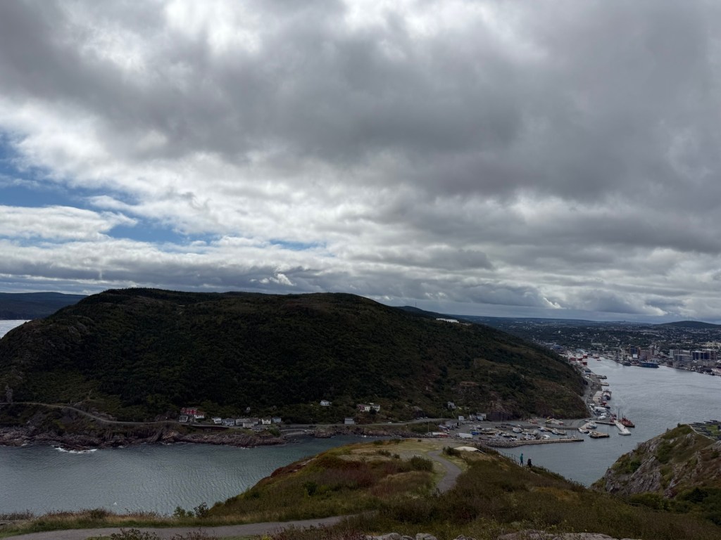
During the War of 1812, the British and French fought again, with the French being defeated at Signal Hill:
Signal Hill
Signal Hill is also famous as the place where G.Marconi received the first Atlantic wireless signal, in 1901, but the impressive tower commemorates Queen Victoria’s 50th jubilee and Cabot’s arrival in 1497.
Newfoundland continued to grow, again mostly with Irish immigrants, but always dependent on cod fishing. The question of whether it should join another country, Canada or the US, lingered but in 1907, it became an independent country, the Dominion of Newfoundland, with its own currency, government and railroad.
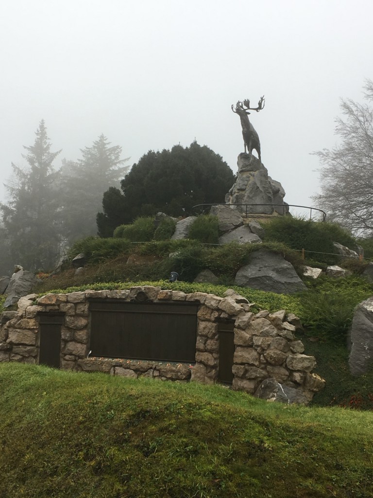
During WW1, it raised a volunteer regiment to fight alongside the British. This regiment was at the battle of the Somme. On July 1, 1916, over 800 of the regiment sought to capture a hill at Beaumont-Hamel. It did not go well and the next day, only 68 were able to answer roll-call. I had visited the memorial at Beaumont-Hamel, in France, some years earlier:
Beaumont-Hamel memorial
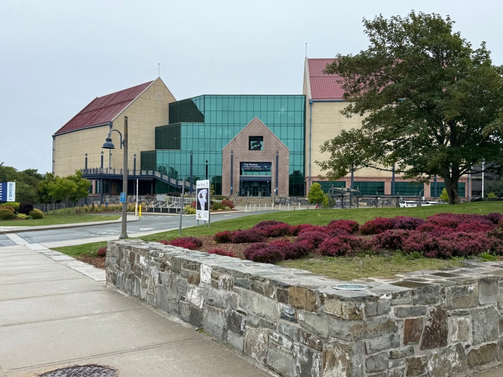
The loss of so many lives was devastating to the island. Their contributions, as well as the efforts of the islanders-nurses, factories, transport- was detailed in The Rooms, a museum dedicated to different aspects of Newfoundland’s culture and history;
The Rooms
The post WW1 years were hard on the Dominion; the Great Depression devastated it. In 1934, it relinquished its sovereignty and again was governed by Britain.
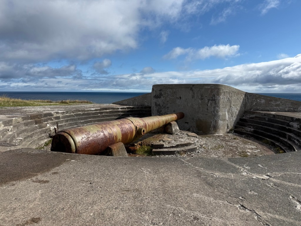
WW2 saw Canadian and US money pour into Newfoundland, building barracks for troops, fortifications against the German U-Boats and buying both manufactured and farmed goods. We visited one of the old fortifications, at Cape Spear:
Cape Spear
Cape Spear also has a traditional lighthouse, the first I had visited in St. John’s:
Cape Spear
In 1949, fed up with the British government and optimistic about the promises Canada was proposing, Newfoundland narrowly voted to join Canada as its 10th province and has remained so until the present. The closure of the cod fishery in 1992 was a disaster, but jobs arising from off-shore oil projects and tourism have helped.
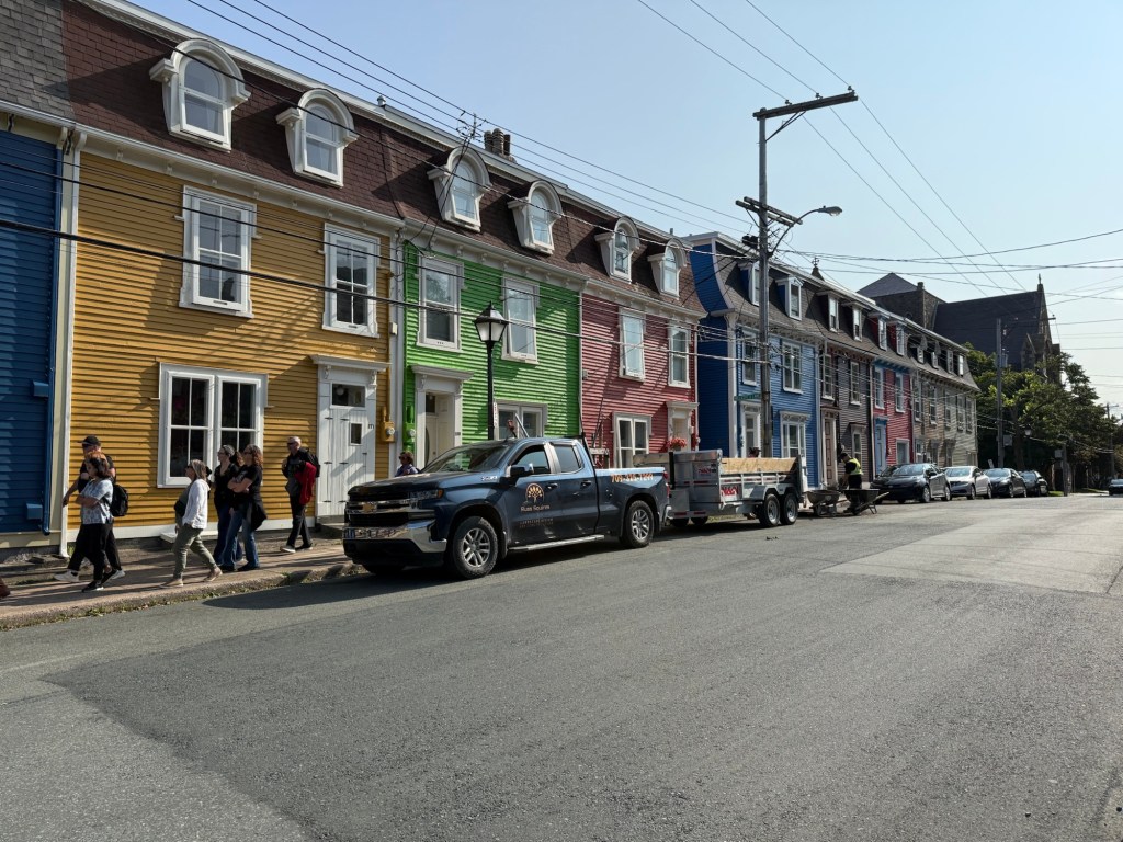
Another highlight was a visit around Jelly Bean Row, blocks of brightly coloured houses:
The only rules pertaining to the paint are a maximum of 3 colours and the colour cannot be the same as your neighbours. It would be nice to attribute the bright colours to old sailors’ lore but the truth is more pedantic- a few years ago, the mayor thought it would brighten the city up. He was right!
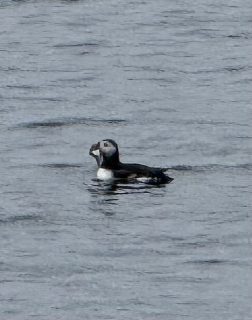
Other highlights of visiting Newfoundland are whale watching and iceberg spotting. Unfortunately, mid-September is too late for both, but I was able to take a boat cruise to visit the last of the puffins at the Witless Bay Ecological Reserve, where millions of puffins breed every summer. They’re hard to photograph from the boat; here’s the best I got:
A Puffin
Despite the poor pictures, it was delightful to watch these birds fly through the sky.
On my final day on the island, I drove the 904 kilometres of the trans- Canada highway, from the tip of St. John’s to Port aux Basques where I’d catch the ferry to Nova Scotia. But it was the highway which impressed. Fully paved in 1966, it transformed life on the island. Prior to its construction, the thousands of little coves only transport to hospitals or schools was by boat, something impossible in the harsh Newfoundland winter. The highway changed all that; communities could now access medical care, higher education and distant employment year round. It was a pleasure to drive, even if it took 10 hours!
And so ended my time in Newfoundland and Labrador. I come away with 2 lasting impressions. First, its rugged beauty, from the endless forests countless lakes and charming seaside towns all over the province. Second, the independent spirit of everyone I met- Newfoundlanders first, then Canadians, with a proud, independent history.
It started innocuously enough, with a post on a Facebook page I follow. Turkish Airlines announced a promotion to celebrate that it would now be flying to six continents, Antarctica excepted. Anybody who flew to all six continents on Turkish Airlines from Istanbul would be awarded 1,000,000 Miles & Smiles reward points, to be used within three years on Turkish Airlines.
My initial thought was “who would be crazy enough to do this?” But the promotion lingered in my mind, and after a few days I started looking at the math. It would cost about.CDN $10,000, ($US7,000) but 1 million reward Miles would garner about 10 business class flights, worth roughly $50,000. All of a sudden, it didn’t seem so crazy.
Of course, it would only make financial sense if I did it in economy, and this would entail four or five very long, overnight flights, something I do my best to avoid. There’s also the small problem of me not being a good flyer, really not enjoying turbulence. But I had a few weeks to spare, and I was getting itchy feet to travel again, so I threw caution to the wind and signed up.
It was a good thing. I booked a few flights quickly because less than 10 days after the promotion was announced, Turkish Airlines changed the criteria to limit the promotion to persons who had already booked at least one flight by July 8. I suspect this was because there was too much interest and Turkish Airlines got nervous about the amount of points it would have to give away.
So having decided to do it, the next dilemma was where to go. Sydney, Australia was easy as it was the only stop Turkish Airlines makes in Australia. For South America, the airline flies to Caracas, Venezuela, which was enticing. However, I needed a visa to visit Venezuela and neither the consulate in Toronto, nor the Embassy in Ottawa were issuing visas or even accepting phone calls. I read on the Internet it was necessary to go either to Panama City or Mexico City to get a visa, which seemed a bit excessive. Thus I settled on flying to São Paulo, Brazil to meet the South American component of the promotion.
As the promotion only required me to fly from ( not to) Istanbul, I decided to book an Air Canada flight to London, England for August 16, where I would spend the night, before taking a Turkish Airlines flight first to Istanbul, then to Sydney, via Kuala Lumpur, Malaysia. As I have visited Australia a few times, I wasn’t inclined to spend much time there, so I booked an inexpensive Scoot flight from Sydney to Kuala Lumpur, where I planned to visit a new country (Brunei) before touring and relaxing in Kuala Lumpur for a few few days.
Obtaining an ETA for both the UK and Australia was simple, but Brazil proved to be challenging as its E-visa software is atrocious. Not even my son, the computer expert, could figure it out and only a phone call to the helpline enabled me to finally submit an application, which was approved within hours.
So, armed with my Brazilian visa, my UK ETA, my Australian authorization, lots of downloaded videos and a good attitude about extended flights in economy, I prepared for my journey. What could go wrong?
Well, Air Canada’s flight attendants announced they were going on strike on August 16. By August 14, Air Canada cancelled all of its flights, including the one I had planned to take to London. Fortunately, I had read about the potential of a strike earlier and had purchased a fully refundable ticket on Air Transat for August 16, just in case.
So, it was to be Air Transat. I have a credit card which gives me free lounge visits, so I decided to use one at the Premium Plaza lounge in terminal 3 at Pearson Airport. The lounge was full of ruckus kids and noisy adults and had the nerve to charge $10 for a glass of wine and $5.00 for a bottle of water. I was already missing Air Canada‘s Maple leaf lounge. However, the seven hour flight to London was uneventful.
I arrived at Gatwick airport about 11 AM, breezed through the E-gates, which facilitate immigration, then walked through a parkade to get to my hotel. The clerk was nice enough to allow me an early check-in at 1 PM, which I took advantage of.
I awoke the next morning at 1 AM, which was not a bad thing as my flight to Istanbul left at 5 AM. Gatwick airport is very easy to navigate at 3 AM and I was through immigration, check-in and security in a matter of minutes. The 737 max flight to Istanbul was full and boring.
After 5 hours in a lounge in Istanbul, I boarded the completely full flight to Kuala Lumpur, didn’t get a wink of sleep, deplaned in Kuala Lumpur, reboarded then endured the 8 hour flight to Sydney. I arrived to 8 degree weather and a rainstorm but luckily my shuttle to the Travel Lodge arrived quickly.
The next day, I returned to the airport and boarded Scoot Airline for Kuala Lumpur, via Singapore. Scoot is a low budget subsidiary of Singapore Airlines, and is notorious for not permitting any outside food on board. Water must be purchased, as must Wi-Fi and charging for your devices. A Scooty, as they call their flight attendants, berated the passenger sitting beside me who was eating a meal purchased at a fast food restaurant. She was sternly told to put it away.
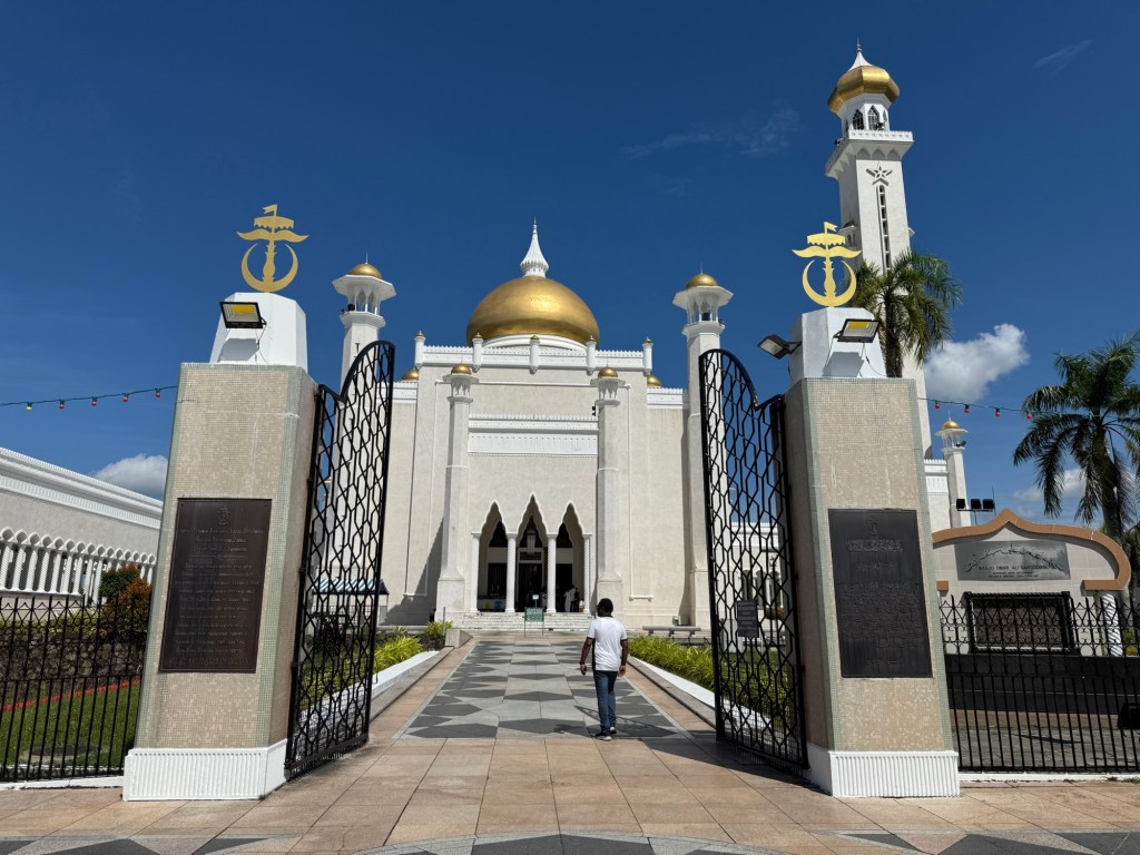
In Kuala Lumpur, I spent the night before taking another budget airline, Air Asia, to Brunei for a few days. As I am counting countries, I was anxious to visit one I hadn’t been to before, and Brunei was a quick two hour flight from Kuala Lumpur. I then returned to Kuala Lumpur and relaxed and did tourist things there for three days.
The longest of my journeys was from Kuala Lumpur to São Paulo, Brazil. Originally, when I book the flight, it was to be done on a Boeing 787, with the Istanbul to São Paulo portion requiring a stop in Cuba for refueling. When the plane switched to an A350s, the refuelling stop was eliminated.
Sadly, my 11:00 pm flight back to Istanbul kept getting delayed; finally departing ( without explanation) at 4:00am. I managed some sleep, but my anticipated nice relaxing time at Istanbul turned into a race to the next gate with the agent hurrying me on board as the last passenger.
A wonderful sight awaited me as I made my way to my assigned seat 34A-an empty row! For the next 13 hours, I was able to stretch out, throw my stuff all around and enjoy the solitude of 3 seats
I spent a few days in São Paulo before embarking on my direct flight to Toronto. The Air Canada strike only lasted a few days and my scheduled flight took off on time and landed 4 minutes early.
I’d been to Malaysia 25 years ago, to a lovely beach resort, but my time in Kuala Lumpur was limited to a few minutes at the main train station. As was going to be in the area, I thought it would be good to spend a few days in Kuala Lumpur.
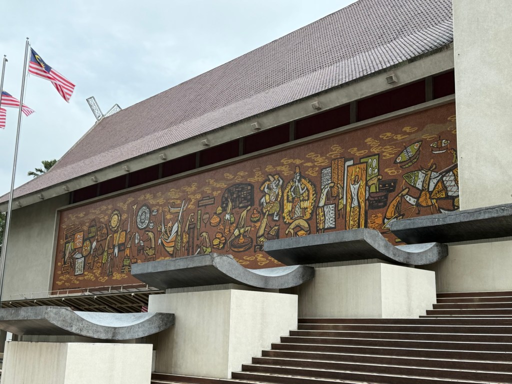
My bus tour began with a stop at the National Museum, originally a wooden structure with indigenous artifacts. The indigenous tribes were overrun by the Malays, from Indonesia and, as early as the 3rd and 4th centuries, by Chinese and Hindus. Unfortunately the museum building was bombed by the USA in WW2, with everything destroyed. The current concrete structure only houses artifacts post 1945, but a mural outside pays homage to the original peoples:
The tour guide gave a brief history of Malaysia. Both Hindu and Chinese empires governed areas of current Malaysia since the fourth century. In the 12th century, Islam arrived and became the dominant religion amongst the Malay.. The Dutch and Portuguese came in the 16th century, seeking spices, but it was the British in the 17th century who colonized it. They imported Chinese to construct railroads and Indians to work on the rubber plantations after they secreted rubber seedlings out of Brazil in the early 1900’s. Today, the Chinese make up about 22% of the population and Indians about 10%.
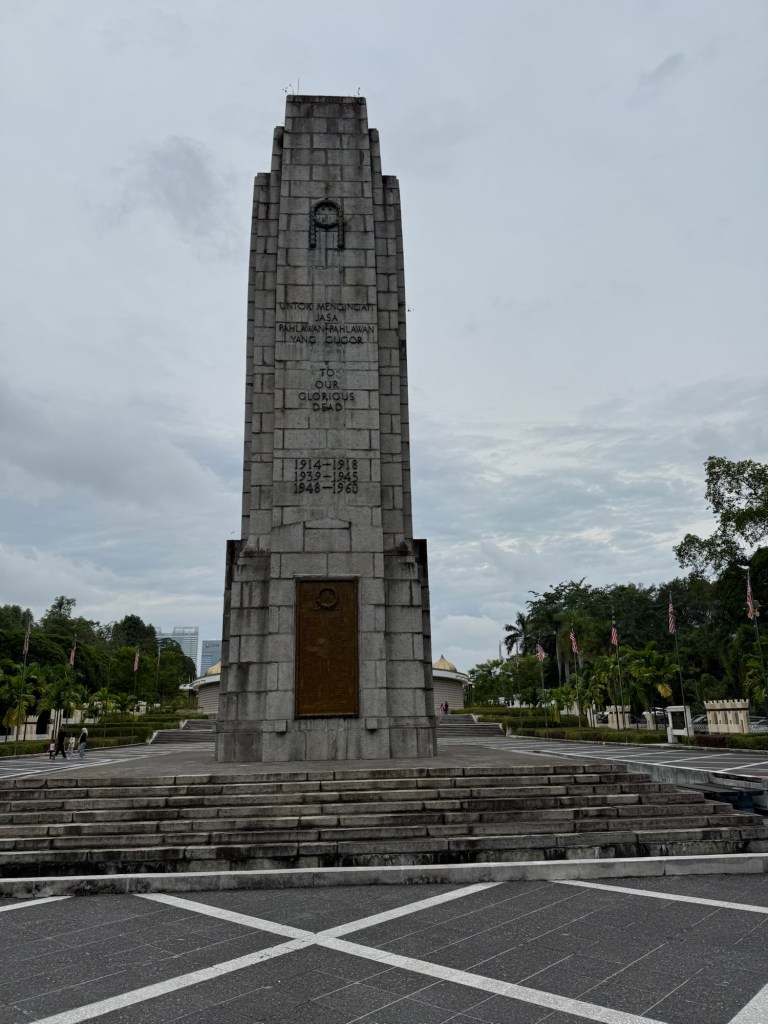
The second stop on the bus tour was at the National Monument, where respect is paid to the dead of World War I, when Malaysia fought with the British, World War II when Malaysia was occupied by the Japanese and a period called the Emergency, between 1948 and 1960 when a state of emergency was declared to combat the perceived communist threat:
The National Monument
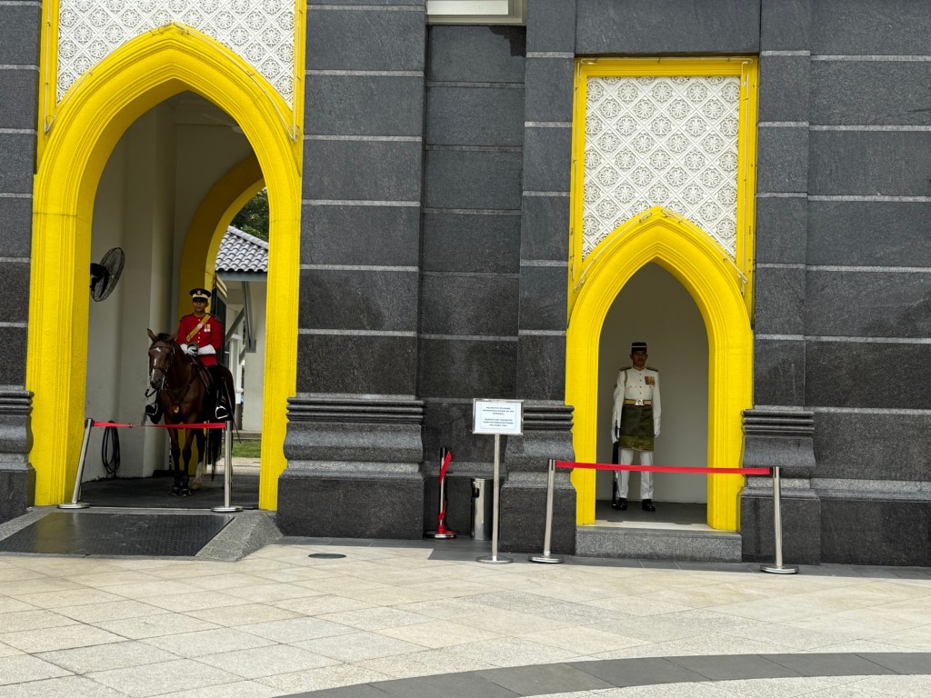
The third stop on the tour was at the Royal Palace, where sentries ensured tourists would not go beyond the gates. So below is a picture of the gate with the sentries. Malaysia has a king, who is elected to office every five years from one of the nine Sultanates in the country. A sultan may only serve as King once, unless he lives another 45 years, in which case he is allowed to serve again. Needless to say, I didn’t see the King or get a better view of the palace.
The Royal Palace
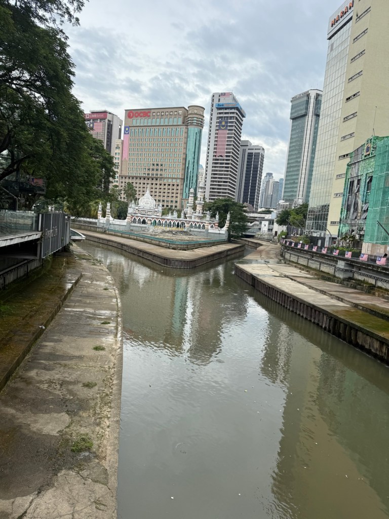
We stopped at the place where the Klang and Gombak Rivers meet. A few hundred years ago, two tin minors met at its confluence and founded the city of Kuala Lumpur, which means where the muddy rivers meet. Today, it’s quite polluted and low, fairly underwhelming.:
The confluence
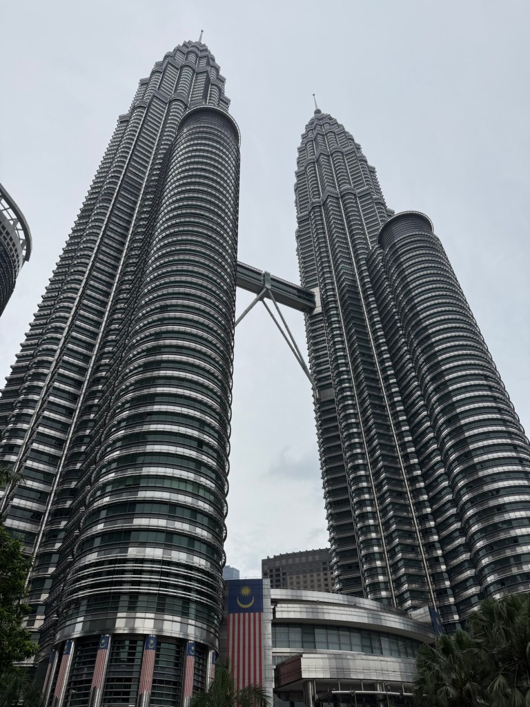
Our last stop was at the Petronas Towers, the iconic symbol of Kuala Lumpur. constructed in the 1990s, The president was anxious for it to be completed quickly. He appointed a Japanese firm to construct one tower and a South Korean firm the other. Not surprisingly, a race to the finish ensued with the South Koreans winning by approximately six hours, but the whole project finished two years ahead of schedule.
Petronas Towers
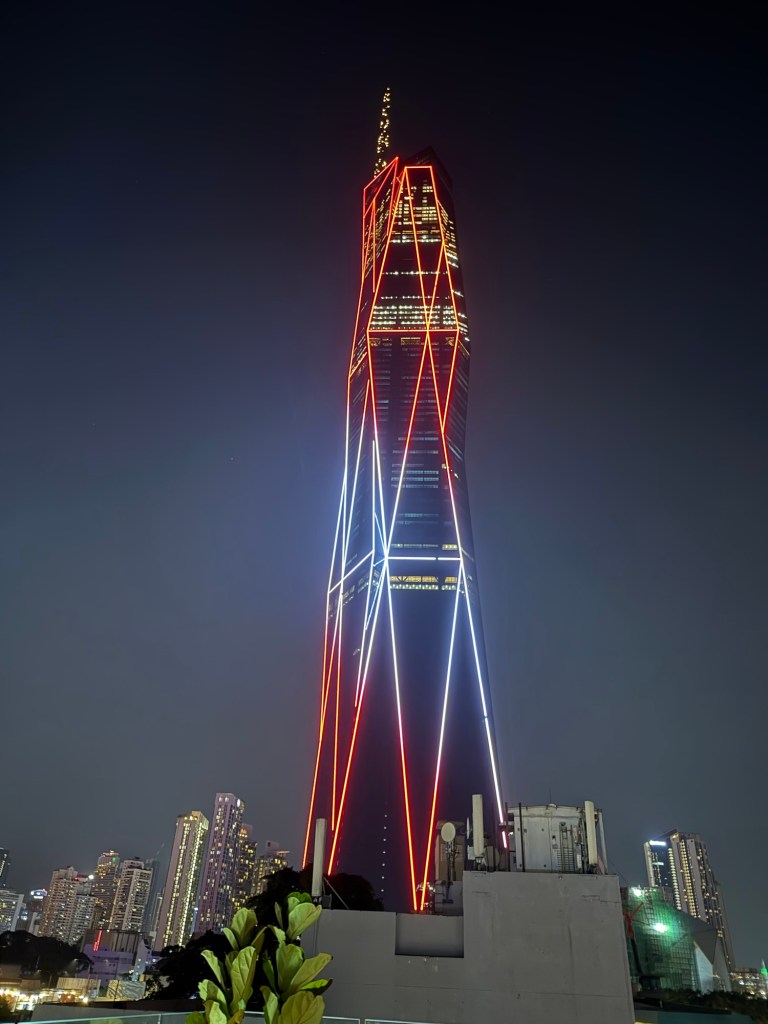
They are the highest twin towers in the world. Nearly finished construction is the Merdeka 118, which will be the second highest building in the world behind the Burj Khalifa in Dubai. Its shape symbolizes a pointed finger, the gesture used by the president on August 31, 1957 to declare independence from Britain. i had a great view of the building from my hotel’s Terrace:
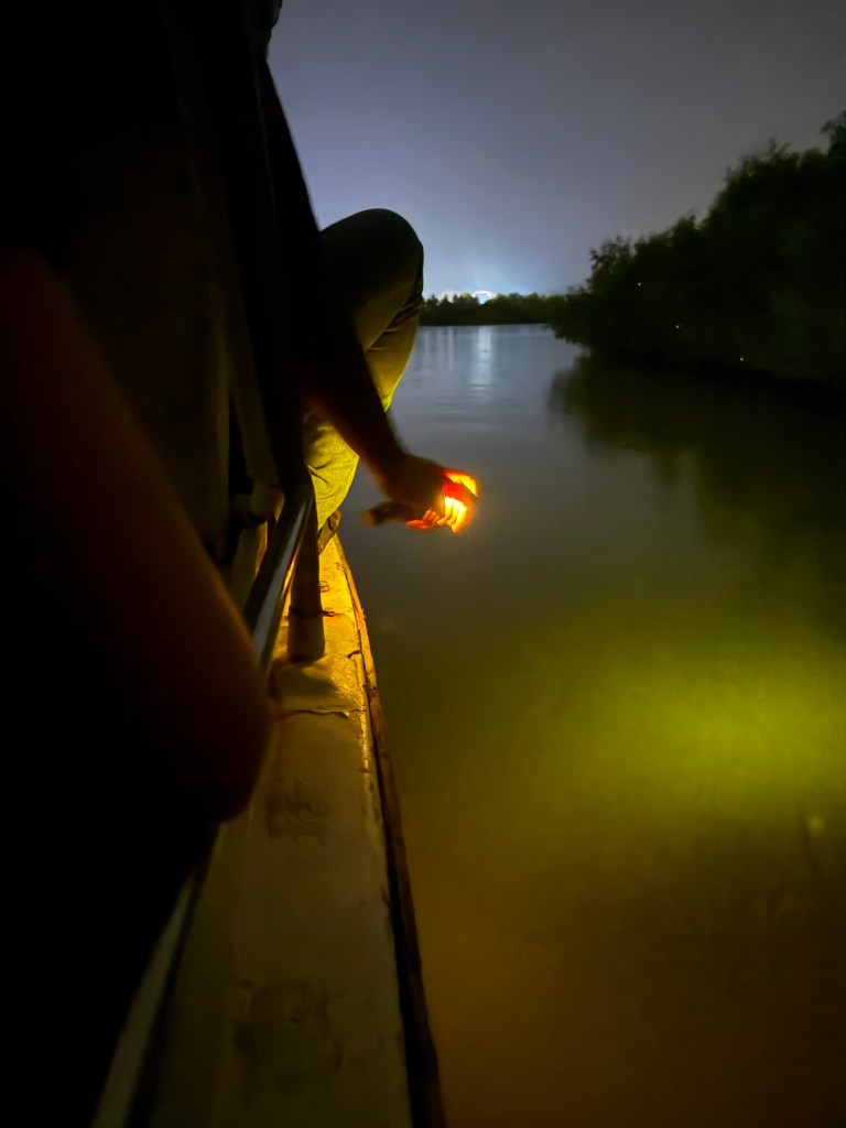
I took another tour to visit the fireflies on the nearby Selangor River. A boat drives close to the trees, where the fireflies flicker in the night sky, but they are impossible to photograph. The boat’s captain did catch one and it glowed brightly for a few seconds in his cupped hands:
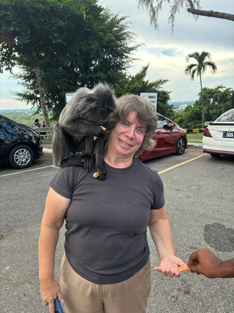
I also had a fun encounter with some silver leaf monkeys, so named for the distinctive feature on their crowns. They are very friendly, and if you hold a banana or a piece of sweet potato in your hand, high above your head, they will climb up and eat it while sitting on your shoulder.:
For me, the highlight of Malaysia is its food, a fusion of Malay, Chinese, Indian and Islamic, always fresh and delicious. My hotel was in Chinatown and I dined on stir fries and dumplings sitting on the plastic stools at the hawker centres:
A hawker center
I took a foodie tour led by Kieran, where I sampled at least 15 different dishes. Keiran emailed me a list of everything we had tried:
Ralmbutan, Mini pineapple, longan, salak, Roti Canai, Mee Goreng Mamak, Limui Ais, Tarik, Chendal, Miguel Sup Baksu, Mi Ayum, Ayum Penyat, ikan Bakyer, Nasi Lemuk , Nasi Kerabu and some satays.
It was also the first time I sampled some Dorian, the stinky fruit which is banned in many places. However, the Malaysian version is less smelly and is considered a delicacy. Durian stalls abounded in the city, along with Dorian ice cream shops. I tried some fresh fruit, and found the taste a bit ho-hum, like very mild caramelized onions with garlic, but a jelly texture. I didn’t hate it, but I certainly wouldn’t spend a lot of money to buy it.
Durian
And so I passed three pleasant days in Kuala Lumpur, mostly eating my way through the visit and relaxing before the next part of my journey.
ChatGPT, when asked what the most boring country in the world was, used to respond with “Brunei”. Now Brunei has been supplanted with other countries like Liechtenstein according to ChatGPT, but Brunei has not completely escaped its reputation for being boring, or, according to YouTube videos and bloggers, strict, least favourite and oppressive. It was hardly on my Must-See list. However, as I was going to be in the region, and as I am unashamedly counting countries (134 to date, although Kosovo and Taiwan are debatable), I thought I would visit for a few days.
Despite its website indicating Canadians do not need a visa, I was met on arrival by an immigration officer waving me to a desk where I had to fill out an E-Visa form. Paper and pencil were not acceptable, but only a computer with a mouse, something I hadn’t used in a decade. I was required to create an account to register, which necessitated verification by email, something impossible as I had no Wi-Fi. Another immigration officer temporarily gave me Wi-Fi so I could verify the account I had just created on their computer. I then proceededto fill in a ridiculous amount of information, including specifics of every single currency I had on me. Finally, the immigration officer accepted the form and I was through.
However, my bureaucratic nightmare was not over. As Brunei is a dry country, alcohol may only be brought in by non-Muslims over the age of 18. And, not surprisingly, there was another form to fill out on the computer with a similarly ridiculous amount of information needed, most of which was duplicative of the information I had just entered on the other computer. Eventually, the customs officer was satisfied with the information I provided and let me and my bottle of wine into the country.
I knew, going in, that Brunei has a large number of restrictions. Alcohol cannot be purchased in the country, nor consumed in public. Cigarettes cannot be sold in the country and smoking is prohibited in all public places. Drug dealers are hung, homosexuals stoned to death, and adultery results in jail time. Commenting negatively on the Sultan is against the law and freedom of the press is curtailed. Wearing yellow, the national color, is prohibited unless you are royalty. In a similar vein, according to some news reports, most of the prohibitions do not apply to the royal family, and the Sultan is known to enjoy drunken parties with very young western beauty queens invited to attend.
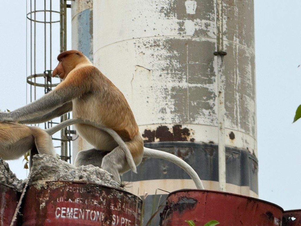
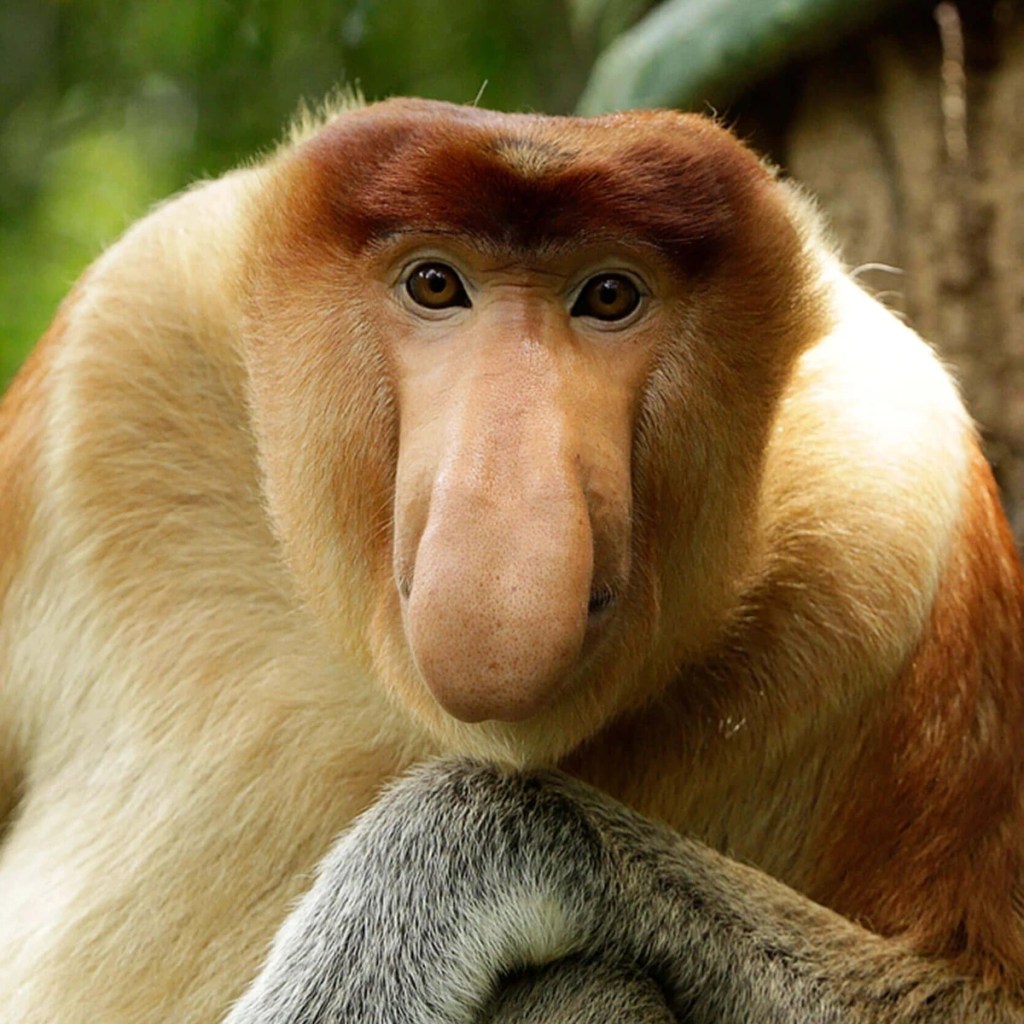
That being said, Brunei does have some attractions. As it is on the island of Borneo, it has probiscus monkeys. My tour guide, Sobre, escorted me on to a small boat, and we motored our way down the Brunei River into the mangroves in search of these shy primates. Sobre knew where to go, and we quickly spotted a female, which lacked the prominent nose of the males. However, a male with a few babies soon appeared, and I was able to see the probiscus for which the monkeys are named:
A better picture, lifted from the Internet, gives you an idea of the size of their noses:
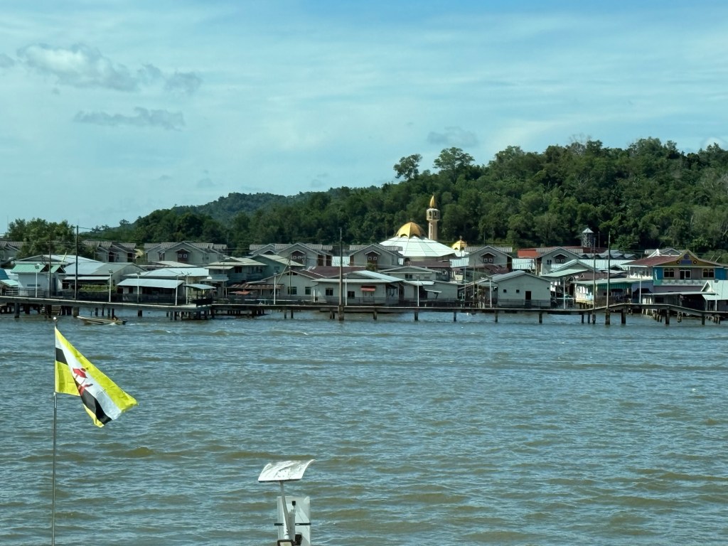
The other interesting attraction is Kampong Ayer, a village built completely on the water. Its beginnings go back over 500 years when fishing was the primary industry and the river was the only practical means of transportation in the dense jungles. It was the capital of the Brunei Sultanate until the British arrived in the mid 19th century and moved the capital to land after finding a maritime city difficult to live in.
Today, Kampong Ayer is still home to about 15,000 residents, complete with three schools, a hospital, a fire station, mosques and jetties for the water taxis that transport people to the mainland.
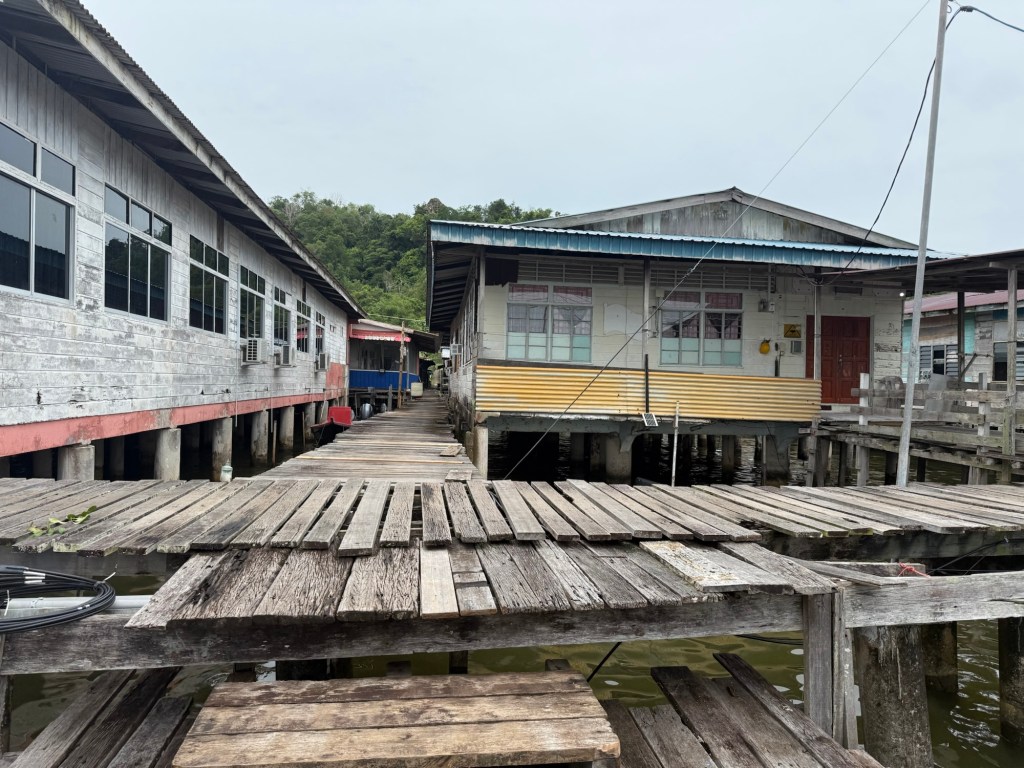
The buildings are joined by rickety walkways:
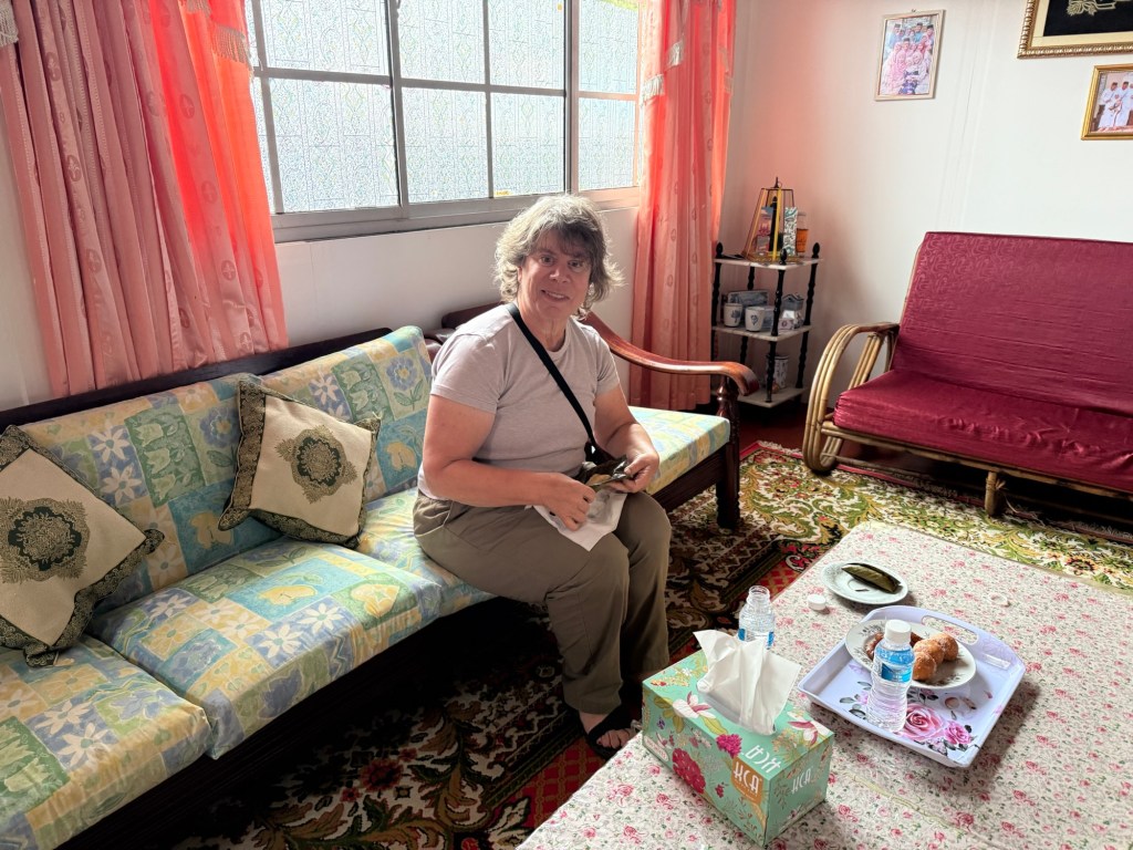
Sobre invited me into his house, where his wife greeted me with a trio of local treats and offered me a tour of their house. It is quite large, my guess is about 2000 ft. , with a living room, lounge, full-size kitchen, dining room, and three bedrooms, along with electricity, running water and AC. The only concession to the water is in the bathroom where, instead of a toilet, there’s a hole and a drop. The government is constructing new homes in Kampong Ayer and, apparently, these have toilets.
Inside Sobre’s house
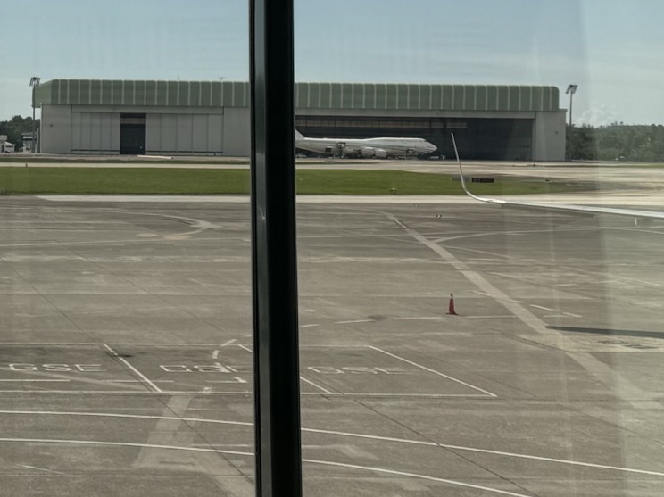
Brunei is home to at least 4 museums; I visited the National Museum and the Energy Museum, the latter detailing how oil was discovered in 1889, with the first well drilled in 1929. This oil has given the Sultan of Brunei extreme wealth. He lives in a 1,788 room palace and has about 600 Rolls Royce’s. Peasants like me are not allowed into the gates to see the Royal Palace, but I was able to photograph his private jumbo jet at the airport:
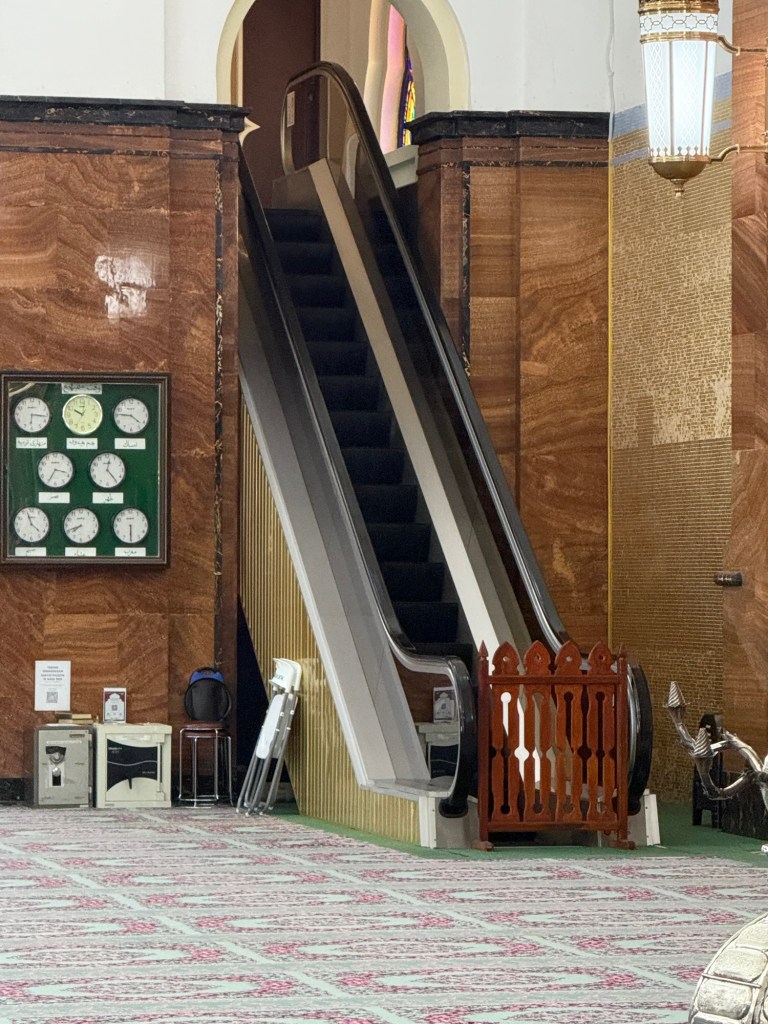
The National mosque and the King’s mosque are both open to visitors wearing properly, attired robes with hoods covering the head of females. The mosques are beautiful and, in the jungle heat, the AC was much appreciated. I also noted the nod to modernization in the escalators leading to the higher floors:
The National Mosque…and its escalator
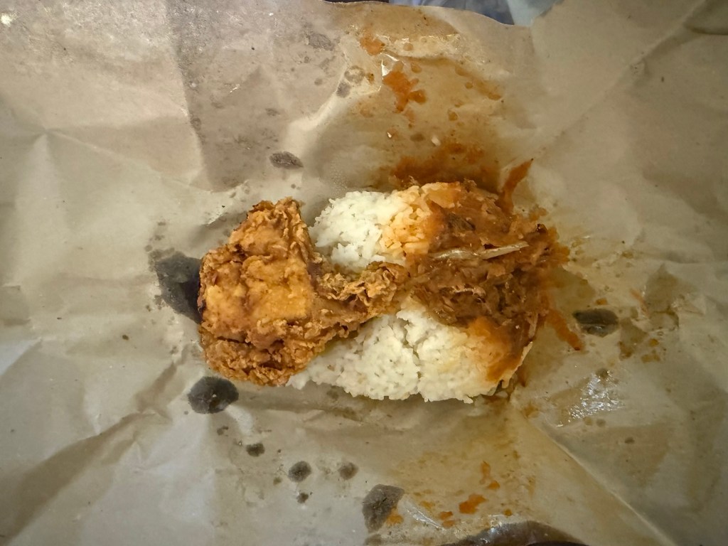
Another thing I enjoyed in Brunei was sampling the local food at the night market, which appeared nightly at dusk across from my hotel. The vendors sold a variety of local foods very similar to Malaysian food. I tried the local specialty of chicken and rice, which local name I cannot recall:
It was all delicious and fairly inexpensive.
I was staying on the mainland in the capital city of Bandar Seri Bendawan, at a Radisson Hotel. On arrival, I was surprised to see a Canadian flag outside of the hotel. I later learned the Canadian consulate occupies a room on the ninth floor of the hotel. So if I had needed help from the Canadian consulate, it was very close by.
And so ended my two nights in Brunei. Ir wasn’t boring, but I’m not sure I’d race back. Meanwhile, I am looking forward to Malaysia and a glass of wine in a bar.
I just spent 4 nights in Lilongwe, the capital of the African country of Malawi, the last of my lesser visited southern African countries. And, to be honest, I was a little tired of travelling but wasn’t able to change my airline ticket home without huge fees, so I arrived in Lilongwe.
I stayed in the country’s best, and only, 5 star hotel: The President’s Hotel, with all my necessities: AC, a swimming pool, hot water and a bar that served overpriced South African wine. Adjoining it, what every poor African country needs ( Malawi is ranked as the fourth poorest in the world ), is a go-cart track offering 10 laps for $50:
Go-cart track in Lilongwe
I walked the few minutes to the town center, filled with government buildings and not much else. Sadly, for the first time in my 3 weeks in Africa, I was pursued by groups of children begging for food. They didn’t look malnourished and when I said “ no” they laughed and went away.
Malawi is known for its friendly people ( except the begging children) and its lakes, including Lake Malawi which was spotted by Dr. Livingstone a few centuries ago. Unfortunately drivers were asking $200US for the 3 hour round trip to see a lake so the cheapskate in me declined. Besides, I live right beside a lake in Toronto (Lake Ontario). I did console myself with an excellent chambo fish dinner, caught from the lake.
As usual, I was mostly interested in the history, politics and economics of the country, but it was becoming pretty routine. The Malawians arrived in the great Bantu migration 2,000 years ago, battled with the arabs post 1,000 which explains why 20% of the country is Muslim, was exploited by the Portuguese for its minerals and slaves in the 16th century and became an English colony/ protectorate in the 1800’s, adopting both Christianity and English.
The country gained independence in 1966 and was ruled by the dictatorial Hastings Banda until he was voted out of office in 1994 by an equally corrupt, but perhaps not quite as oppressive, regime. Malawi is proud of the fact it has never endured a military coup and its leaders have peacefully relinquished power after electoral defeat, but it doesn’t make them less corrupt.
A news article I read indicated 30% of Malawi’s annual budget is lost to corruption and the signs of a government failing to provide infrastructure necessaries was evident: potholed roads, non-working traffic lights, garbage everywhere. And the Malawians I spoke with all identified corruption as the most significant problem hampering Malawi’s economic growth. 80% of the population are subsistence farmers and many are reeling from last year’s El Niño inspired draught. USAid cuts threatens its HIV and tuberculosis medical campaigns.
I’d like to end on a more upbeat note. Aside from the begging kids, people were very friendly. Travel was easy and all my necessities taken care of . Maybe I’m short shrifting the country because it was my last, but unless you like looking at beautiful lakes, I couldn’t find much else to do here.
But my highlight, was, sort of , seeing the president, or more accurately, his motorcade as he left the Convention Center beside the President Hotel. It had been preceded by four hours of drums, yelling and general hoopla surrounding his visit. Many of his supporters were dressed in traditional clothes, with a photo of the president prominently displayed:
How I would love to walk around with a photo of the current US president on my rear…….
With that happy thought, I begin the long journey home.
I had never been to Zimbabwe, but had seen it from across the bridge in Livingstone, Zambia in 2007. In those days, the consensus was Zimbabwe was not a good place to visit. Super -inflation was rampant and out-of -country buses and cars carried their own petrol since it was impossible to purchase any in the country.
Things have improved since then. The US dollar is the principal currency and inflation is under control. Everything a tourist needs is available. The main roads are paved, Internet works everywhere, credit cards are accepted, and English is an official language.
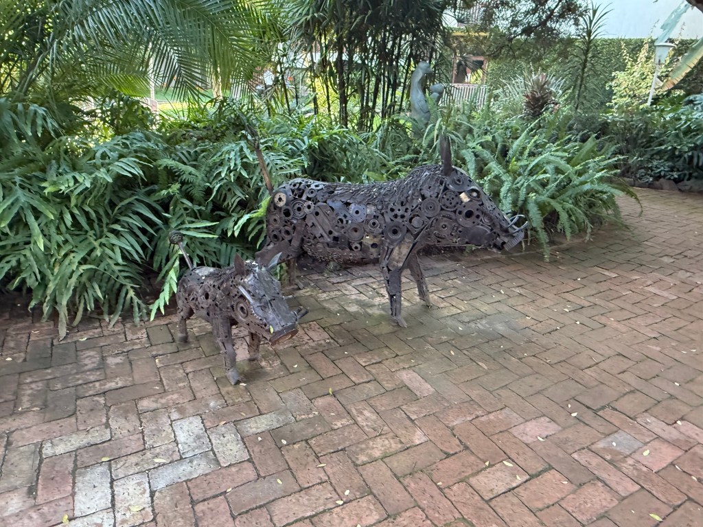
I arrived in March, 2025 and quite enjoyed my time in the country. Much of this was due to the hotel in Harare where I stayed. The Brontë Hotel is an old colonial hotel with decent, but not spectacular rooms. What set it apart are its gardens, with inviting swimming pools, beautiful flowers, and lovely sitting areas situated amongst the fauna;
Bronte Hotel Garden
Scattered about the garden are numerous Shona sculptures, the Shona being the principal tribe who inhabits Zimbabwe:
Shona sculptures at the Bronte Hotel
Interspersed amongst the sandstone sculptures were fanciful metal animals:
Some warthogs at the Bronte Hotel
I confess to spending many hours just sitting in the gardens, relaxing, and drinking $US 3.00 glasses of South African wine.
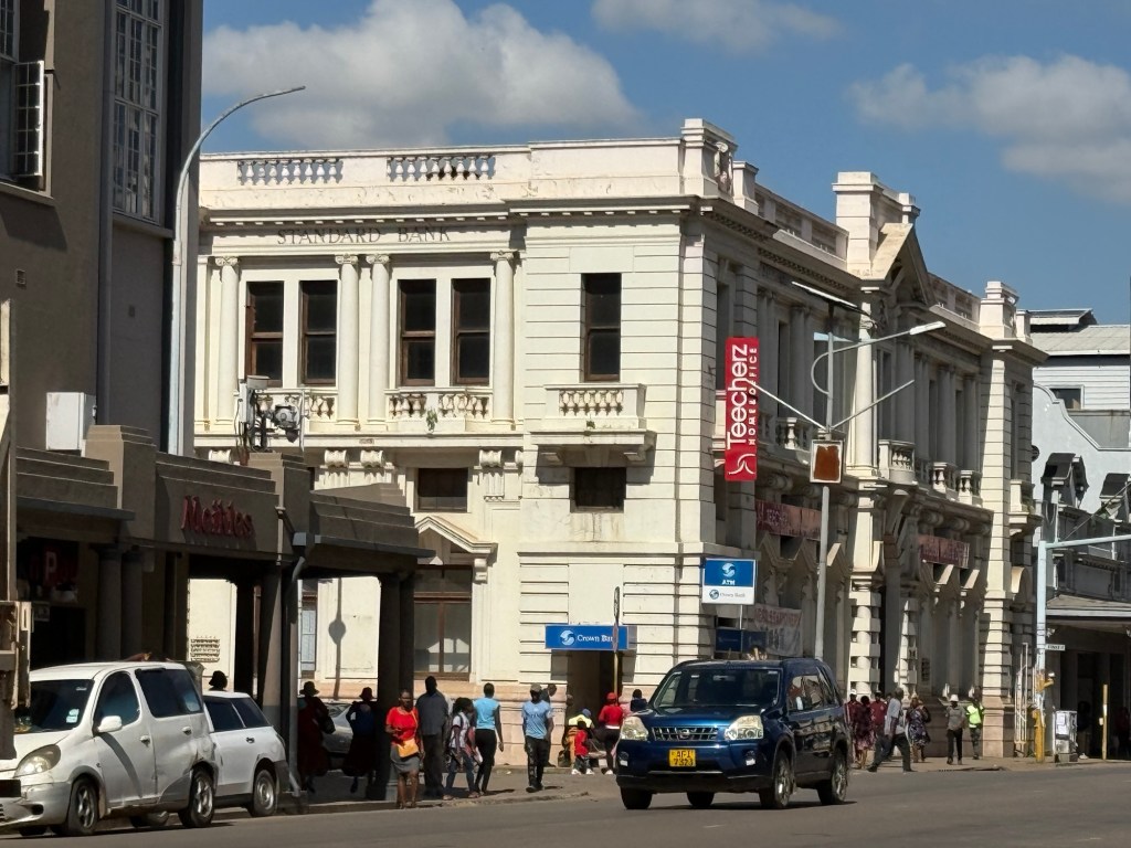
I took a city tour of Harare, seeing much of the art deco style buildings favoured when the country was a British colony:
Harare
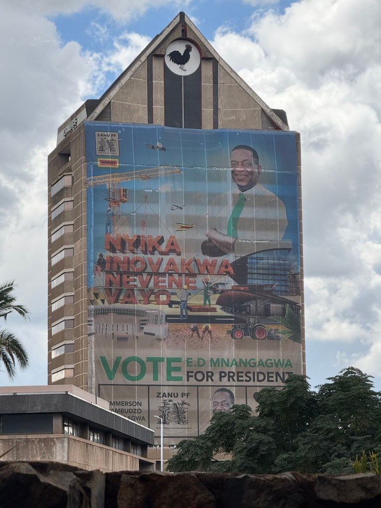
The new government seems to prefer western style, high-rise skyscrapers, including the one with a gigantic mural urging people to vote for the current president:
Vote for Mnangagwa
This should not be difficult in the 2028 elections as there are no opposition parties.
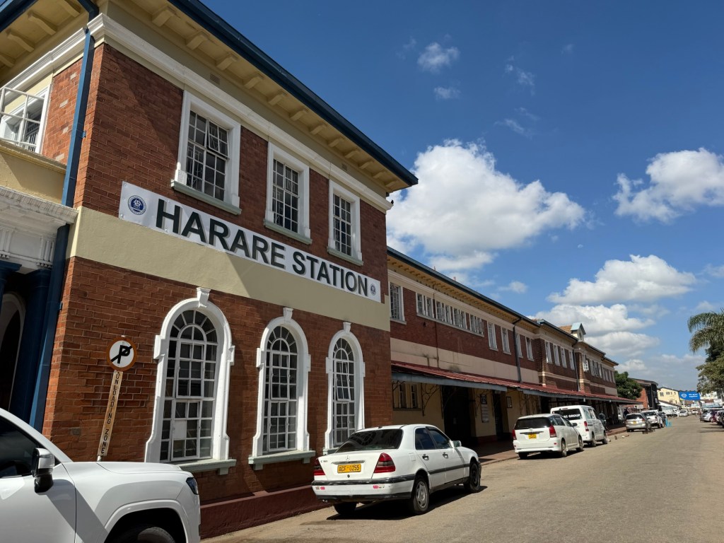
The old railroad station still stands proudly, but no passenger trains run and the terminal is locked:
Harare Railroad Station
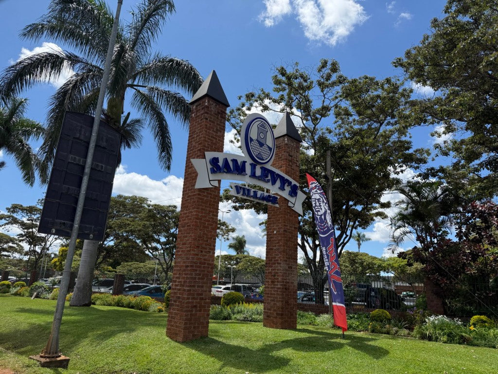
We drove around the different residential neighbourhoods in Harare. Though Zimbabwe never had formal apartheid or segregated living areas, certain areas were definitely favoured by one ethnicity or another. The Belvedere area is predominantly Indian, while the Greenwood and Hillside areas have large mansions inhabited mostly by whites or black politicians. In one of the upscale shopping plazas called Sam Levy, white patrons were sipping coffee and shopping for namebrand merchandise.
Sam Levy shopping Mall
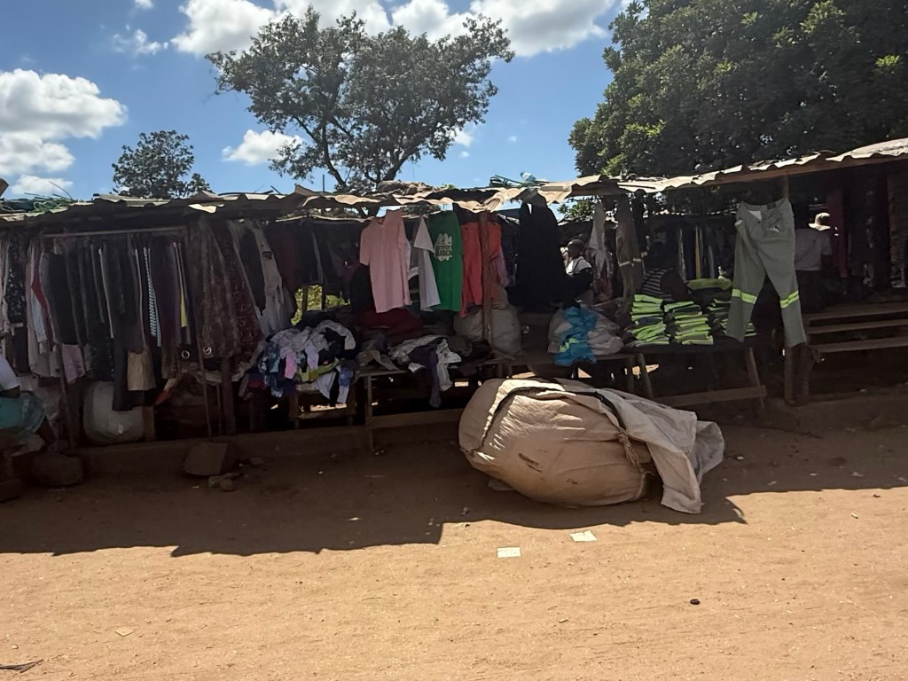
In the former black township of Mbare, houses were little more than shacks, the streets were dirt alleyways, outhouses prevailed, and the shops were mostly makeshift stalls:
MbareMbare shop
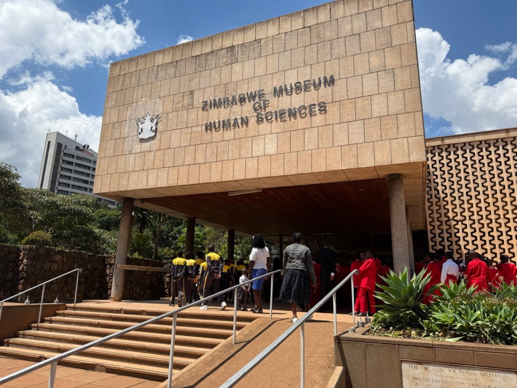
I visited the Museum of Human Sciences, but was a little disappointed. Its exhibits trace the natural evolution of Zimbabwe from dinosaurs to the Great Zimbabwe period, but there are large gaps, little information and it’s somewhat bare. I happened to visit on school photography day and ran into large classes of uniformed school children awaiting their class pictures. They were all friendly, anxious to practice their English with a native English speaker and give high-fives to the visitor.:
School kids at the Museum
The highlight for me was a day trip to Great Zimbabwe, ruins of a great civilization four hours drive from the capital. When Cecil Rhodes first learned of the structure, he concluded it could only have been constructed by non-blacks, perhaps the Phoenicians, Arabs or Jews, since he was certain the blacks could never make anything so wonderful.
Of course, archeology has proven him wrong. It is believed Great Zimbabwe was constructed in about the 11th century by the Karenga tribe, predecessor to the current Shona. The Karenga tribe were a Bantu tribe who had migratedg south from Nigeria and Chad about 2000 years ago. By 1100, it was immensely wealthy from its gold mining operations and traded its gold and ivory with merchants from India, Arabia, and perhaps as far as China.
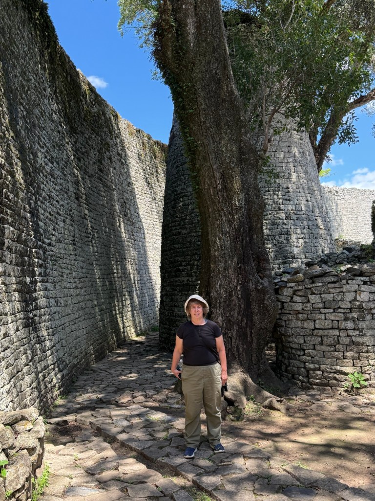
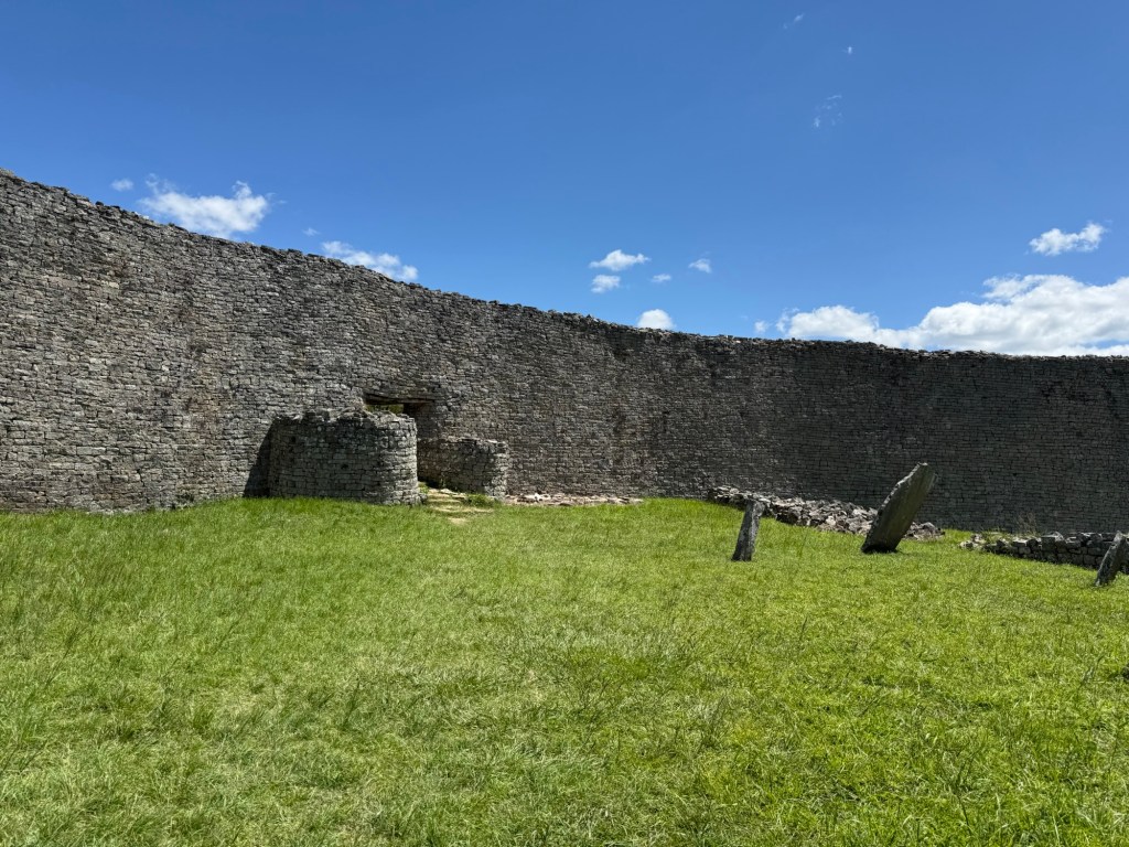
Great Zimbabwe today consists of two fabulous sets of ruins, the great enclosure and the hill complex. The photos below are of the great enclosure.
The walls are up to 13 m high and built without cement or motor. Amazingly, between the walls is a cooling breeze, a marvel of middle age air conditioning. It is believed that the enclosures were occupied by the King and his family, with mud huts housing up to 15,000 people in the surrounding area.
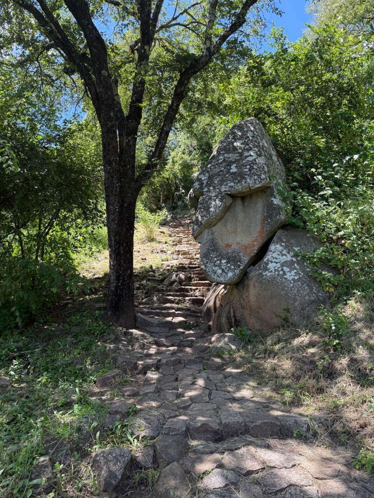
The hill complex is, as its name suggests, up a very steep hill. I climbed about 1/3 of the way before realizing that given my propensity for slipping and dislike of climbing, it was probably not a good idea for me to proceed any further up this somewhat precarious steps:
Steps to Hill Complex
I had been in Africa for about three weeks and not seen any wildlife, so I was delighted when I met up with some playful, but shy monkeys in and around the site:
Monkey at Great Zimbabwe
Zimbabwe offers many more activities beyond what I did. Victoria Falls are fabulous, but require a flight and I’d already seen them. Closer to Harare are game parks with the big five animals where safaris are offered. Again, I had done enough safaris that I didn’t feel the need to do anymore.
Harare is considered a reasonably safe city and I did walk a few times to grocery stores and restaurants without any problems. That’s not to say that Harare and Zimbabwe are without huge challenges. Every person I spoke to cited government corruption as a prevalent irritant and a barrier to economic prosperity. There’s high unemployment, huge numbers of HIV infection, and a general sense that unless there’s a drastic rethinking of the corruption in the government, nothing will improve.
So why did I enjoy Zimbabwe so much.? I’m sure a lot had to do with the loveliness of the gardens in my hotel. But there was also interesting things to see and do, especially learning about the society that constructed Great Zimbabwe. If there was one country on my current agenda, I would happily return to, it is Zimbabwe.
It’s hard to describe how I feel about Eswatini, where I spent four days in its capital, Mbabane, in March 2025.
It is, first of all, very easy travelling. I took a pleasant 4 1/2 hour shuttle bus from Johannesburg airport, cleared customs in a minute, and then arrived in Mbabane. The bus let me off literally a two minute walk from my hotel, the best in the country, a Hilton with somewhat unique architecture, but every convenience necessary.:
Mbabane Hilton
The street lights worked, Internet worked. Credit cards were accepted everywhere and the city felt safe. A Spar grocery store sold all the necessities, at a far cheaper price than back home. A dozen eggs were $2.00, grapes $1.99 a kilo and a bottle of South African wine was only $6.00. I was introduced to the delights of fat cake, a delicious concoction of flour, sugar and water and fried in oil, which. I later learned, had a huge number of calories and absolutely no nutritional value whatsoever:
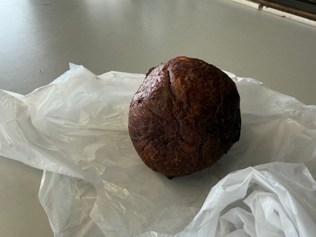
A Fat Cake
I did a walking tour of Mbabane and, quite frankly, there’s not a lot to see. There’s an old Dutch Cape building.:
Mbabane Architecture
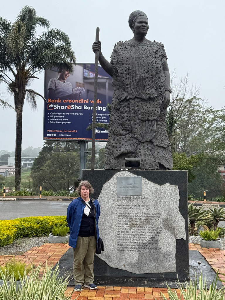
….and a statue its revered Queen Labotsibeni, the grandmother of the current King and, as Queen Regent, the person responsible for steering Eswatini through its turbulent colonial period:
Me and Queen Labotsibeni
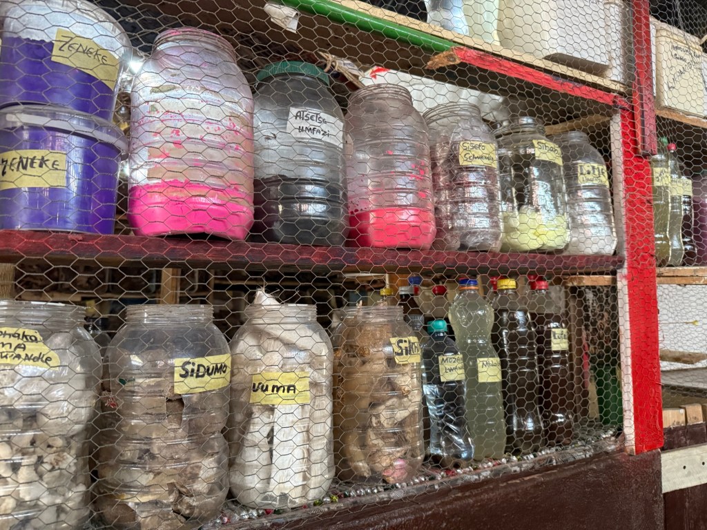
I ventured to the market, where various buildings housed crafts, fruits, and vegetables, and traditional medicine My guide said he used the Shaman medicine in the first instance, but if it didn’t work, he went to Western doctors:
Bottles filled with traditional medicines
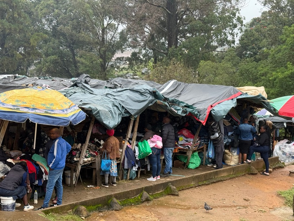
Sadly, there were makeshift stalls filled with “donated” western clothes which had made their way to the market for sale:
Used clothes for sale
Beside this rather brief walk through the town, I found little to do. Safaris in the National Park, abutting Kruger, were an option but I’ve done my share of safaris. Hiking in the gentle mountains was another option but I’m not much of a hiker and it was raining non-stop. A cultural center showcases Swazi customs, lifestyles and ceremonies, a nearby candle factory makes fanciful candles and a glass factory turns recycled glass into different objects.
None of this was of much interest to me; I prefer to learn about the history, the politics and the economics of a country, and, in these respects, Eswatini is fascinating.
The country is inhabited by mostly Swazi tribes people, who at one time lived in much of southern Africa. Wars amongst tribes and colonialism reduced their land to a small area beside South Africa. Swaziland ( the king changed the name to Eswatini in 2018 to avoid confusion with Switzerland) was forced to give up huge swathes of land to South Africa, including Kruger, at the behest of the British in order to maintain a semblance of independence. It became a British protectorate in 1906 and received independence in 1968. Although there was no formal apartheid, there was clear delineation between the races, with the non-whites being restricted to areas across the river in Mbabane after nightfall.
The longest serving monarch, King Sobhuza served from 1921 to 1982. His son, the current King Maswsti 111, was crowned in 1986. Unlikely other former British colonies which, at least paid lip service to transitioning to democracy, Eswatini did not. The king rules as an absolute monarch. Although there has been a Parliament since 1967, political parties are outlawed and only persons approved by the king are permitted to run. Rumours of disappeared opposition persons and censorship abound.
While notionally a Christian country, the Christian church stands side by side with traditional Swazi beliefs, including polygamy. The current 56 year old king has 15 living wives and last year announced his engagement to another, the 21 year old daughter of South Africa’s former president Jacob Zuma in exchange for 100 cows and 1,000,000 Rand (about $78,000 CDN). His marriages have never occurred in a Christian church, with its ban on polygamy.
The king lives a lavish lifestyle and each of his wives is said to have an opulent palace, but glimpsing any of the palaces isn’t possible as they are well hidden and guarded. So sorry, no pictures.
Unofficial reports say the king and his livelihood command 20% of the country’s annual budget. In a poor country like Eswatini, this is crushing. The majority of the population are subsistence farmers, many toiling on farms owned by the state. HIV is rife and unemployment high. For many, the only hope of a better life is to move to South Africa.
The king’s succession plan does not automatically fall to his oldest son and no one is certain who will be the next king. My guide said this was not a bad thing; anti-government riots in 2021 stemming from allegations of police brutality, have not resolved festering anger towards the absolute monarch. Maybe, my guide hoped, the death of the king would lead to political reform.
So what are my final thoughts about Eswatini? Mostly sad. It’s a beautiful country with kind, friendly people but they’re living under an oppressive regime which is hampering political and economic progress. I didn’t get the sense the country is a powder keg, like Mozambique felt, but more like a populace resigned to their fate. Hopefully it will change peacefully but I’m not optimistic.