I had been hesitant to come to Mozambique as armed conflicts in the north arose following disputed elections in October, 2024. The Canadian government’s foreign affair’s website warned against travel to the north, but as I was planning to go only to Maputo in the south, I decided to go.
A former South African diplomat whom I sat next to on one of my flights confirmed the south was safe and I should not be leary about going there, so I booked a flight. Unfortunately, the English language news sources where I obtain my information didn’t broadcast that the Mozambique police had opened fire at a demonstration by the opposition leader in Maputo, injuring 15, just two days before I was scheduled to arrive.
Thus, I was ignorant of the situation in Maputo. To compound matters, a high profile political trial was starting in the city the day after I arrived. I did ask the hotel and taxi driver whether I should have any safety concerns, and was emphatically told that everything was safe, but the hotel added many guests had cancelled their reservations and cruise ships were bypassing Maputo.
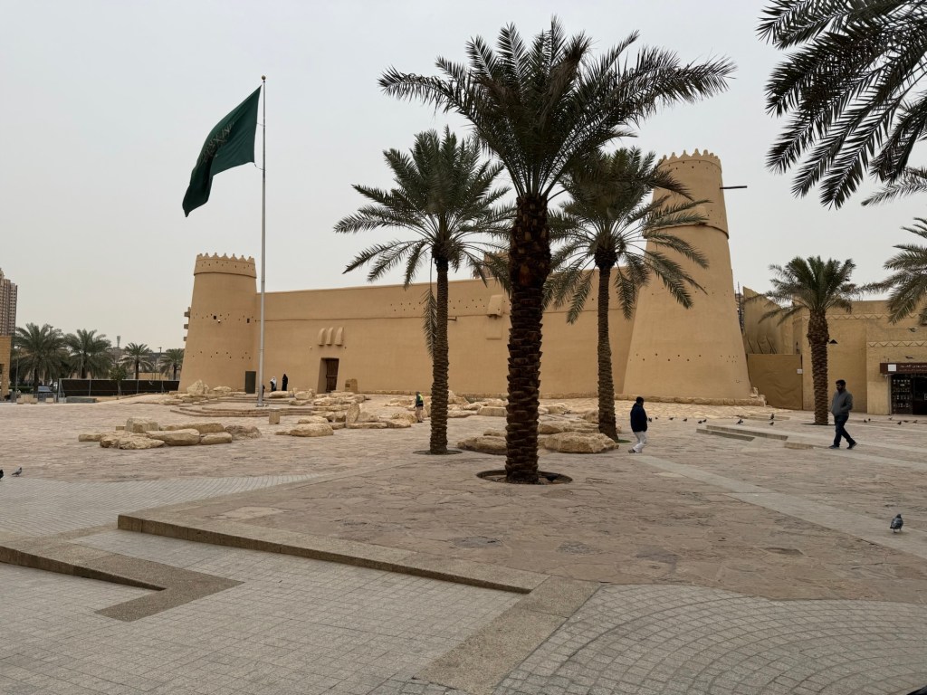
But my tour guide indicated everything was perfectly safe and I should join him for a walking tour of central historic Maputo, so I did.
To understand the current conflicts Mozambique is facing, it’s necessary to delve into its history.
Mozambique is a large country, with nearly 2500 km of coastline on the Indian Ocean, from the north which borders Tanzania to the south bordering South Africa. It was originally settled by the San tribes, who were displaced by the Bantu tribes in the south and the Zulu tribes in the north.
In the seventh century, Arab merchants established trading posts along the coast, mostly in the north, to facilitate their trade with India. They also brought back spices, ivory, and, with the help of local chieftains, slaves from Mozambique.
In 1498, Vasco de Gama sailed in and shortly thereafter established the first Portuguese trading post near the current city of Maputo. The Portuguese interests were the same as the Arabs, exploiting the land for its spices, ivory and slaves. For the next 300 years, Portugal, the Arabs and the local tribespeople all battled each other for supremacy. Eventually, the Portuguese were successful in colonizing all of current day Mozambique.
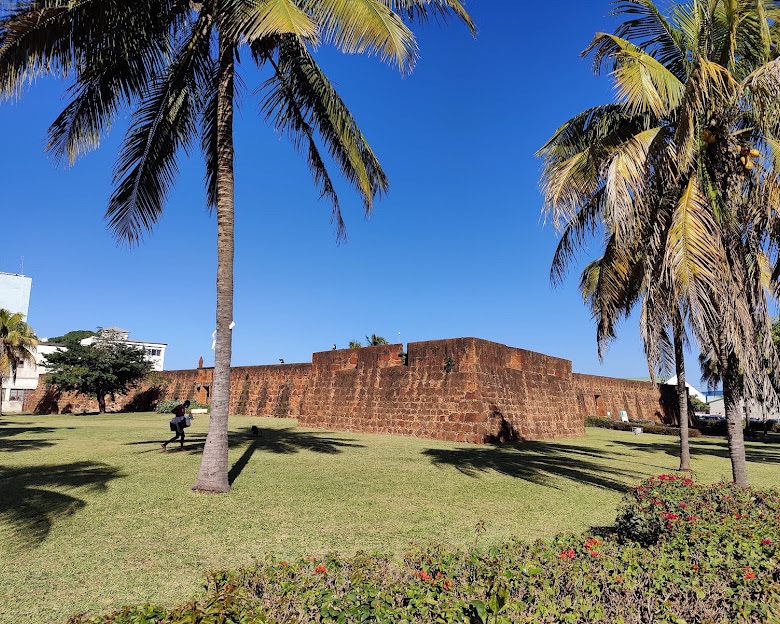
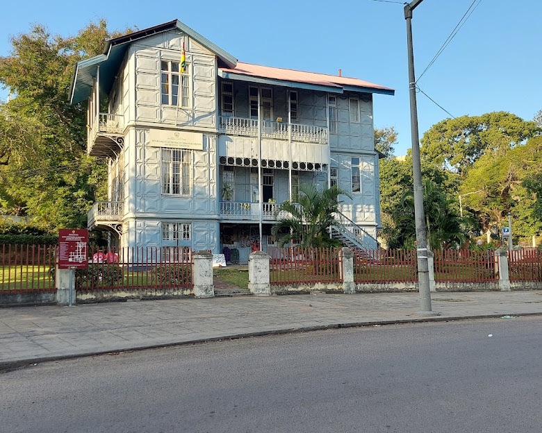
During its colonial period, the Portuguese, claimed all of the best land along the harbour for themselves and constructed a wall to keep out the non-Portuguese. The wall is long since gone, but many of the colonial hotels still remain, though somewhat decrepit and used mostly for bars or rooms by the hour:

One building unique to Maputo is the Casa de Ferro, a house commissioned by a wealthy Portuguese and designed by Gustavo Eiffel, of the Eiffel Tower fame. Constructed in Belgium and transported to Maputo, it is made completely of metal.:
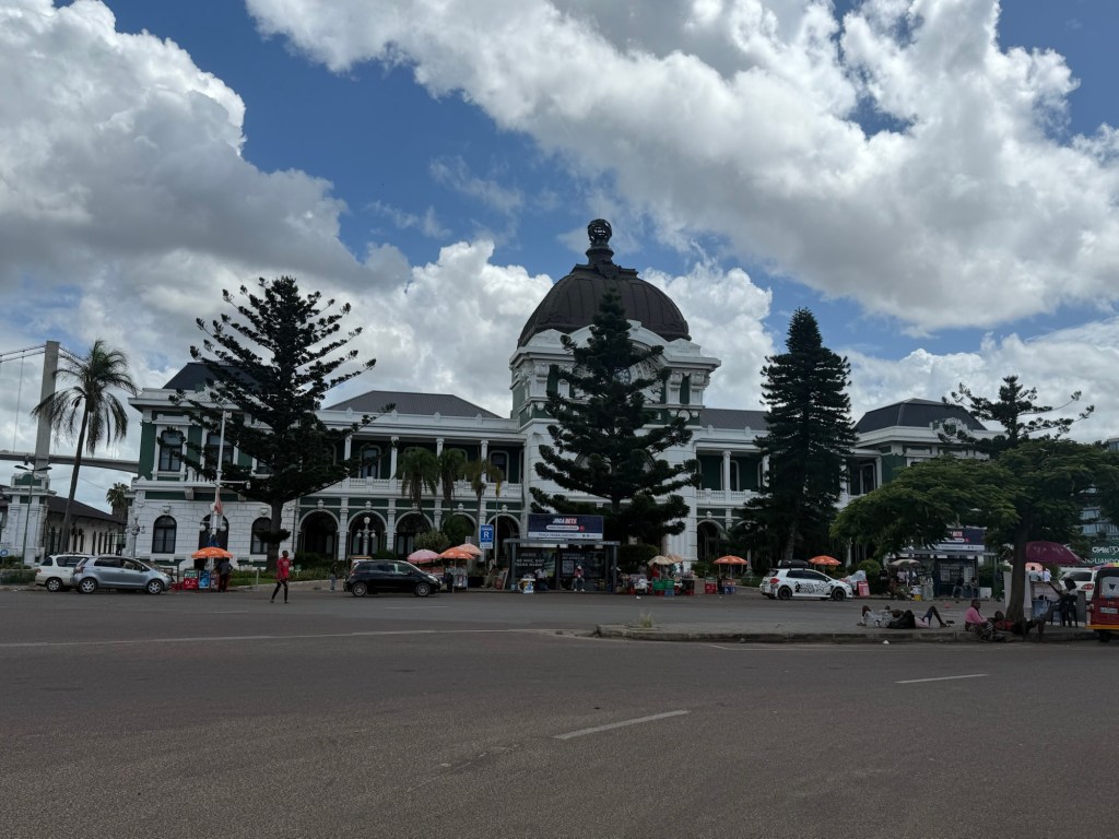
Another contribution of the Portuguese was the railroad, which they built in the late 1890s, primarily to transport gold from South Africa to the Maputo Harbor, and then back to Portugal. What is often considered one of the most beautiful railroad stations in the world still graces the harbour:
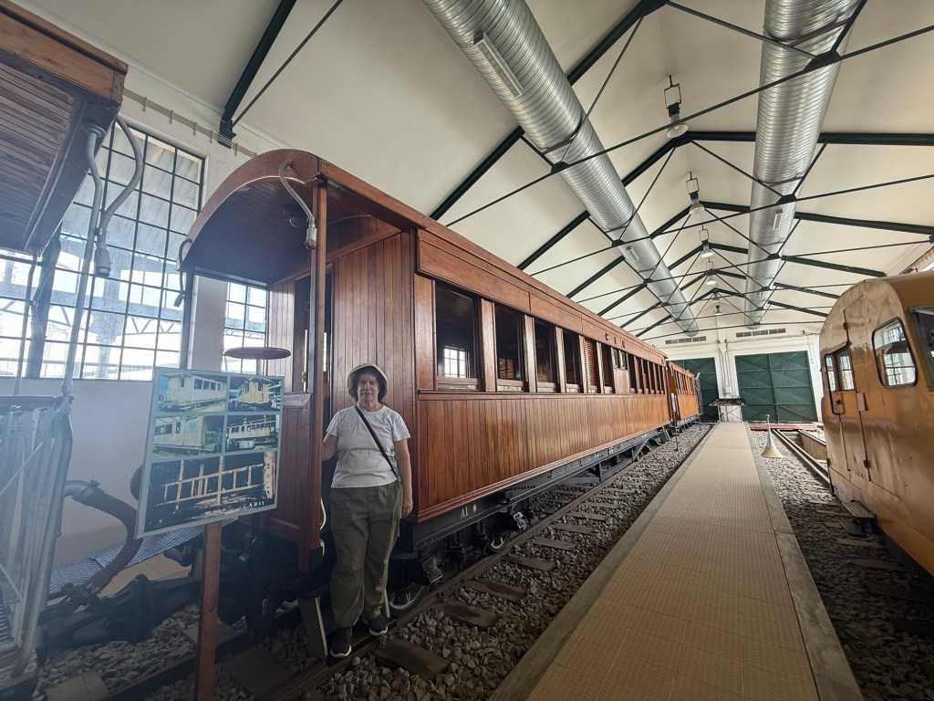
In the past, passengers could ride the train all the way to Johannesburg, South Africa, but those days are gone, and the train now stops at the border. Behind the railroad station is a lovely museum, devoted to the railroad, with old engines, railroad paraphernalia, and a first class carriage, where, naturally, I had my picture taken:
Unlike many of the other European imperialist countries, Portugal did not begin to divest itself of its colonies after World War II. In 1962, local Mozambicans began a decades long struggle for independence, a conflict which caused thousands of deaths. In 1974, when the regime founded by the Portuguese dictator Antonio Salazar finally fell, the Portuguese government was ready to give up its colonies. In 1975, Mozambique was declared an independent state and the charasmatic left leaning Samora Machel, head of the Frelimo party whose base was in the south and mostly Christian, was the first President. The Portuguese were expelled.
Civil War broke out shortly thereafter, generally between the Frelimo party, which was staunchly Marxist and supported by Russia and China and the Relamno party, which was based in the north and supported by both South Africa and Rhodesia. Horrible atrocities were committed by both sides, resulting in large fatality numbers and limited economic growth. In 1992, with both the collapse of the Soviet Union and the end of apartheid in South Africa, the traditional support of the warring parties disappeared. Peace was established in 1992 and has held, more or less, with mostly fair elections being won by the Frelimo party.
However, in 2023 and continuing through to 2024, Islamic fundamentalists in the north began insurgency activities, essentially seeking independence for the oil rich Muslim north which is being forcefully quelled by the government. This is what prompted the recent Do Not Travel warnings.
To further complicate matters, the latest election victory for the Frelimo party in October, 2024 is being challenged by the opposition leader, claiming fraud, precipitating the police shooting in Maputo I mentioned before. While I had no problems whatsoever, a large army and police presence in central Maputo was noticeable. The Botanical Gardens were closed and its gates manned by a masked police officer.
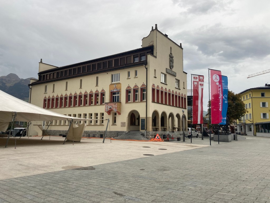
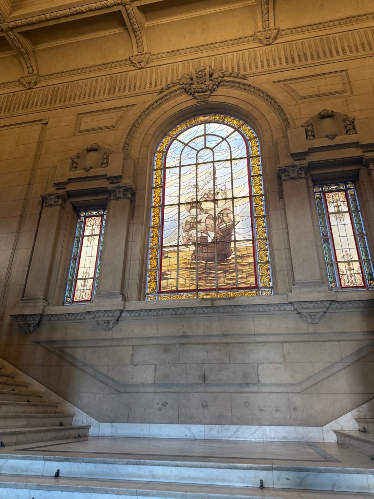
Despite their presence, our walking tour led to the current Town hall building on Independence Square, where, of course, the Portuguese had left their mark in the form of a stained glass window:
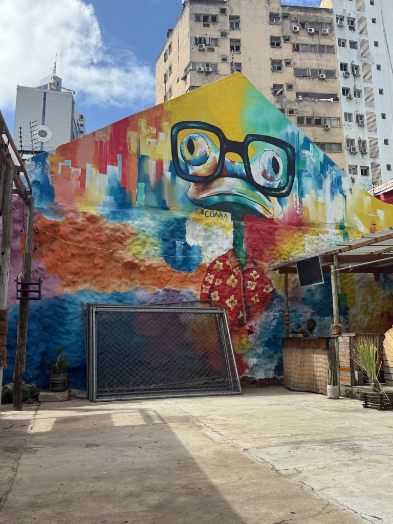
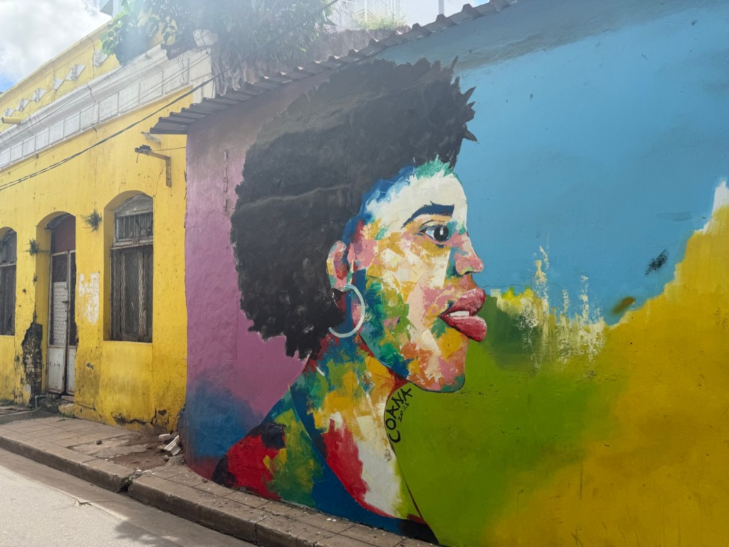
In the historical center, former colonial buildings have been repaired and renovated, many sporting brightly coloured murals:
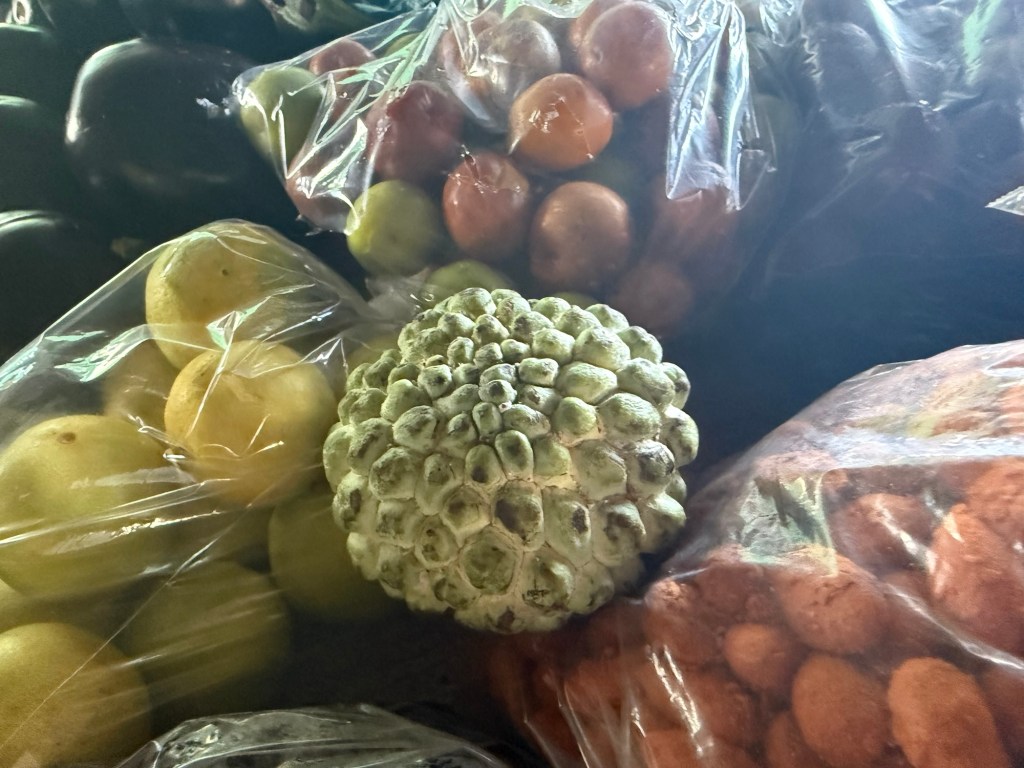
Our walk through Maputo included stops by cultural centers, art exhibits and a local produce market, where I tried the cherimoya fruit for the first time:
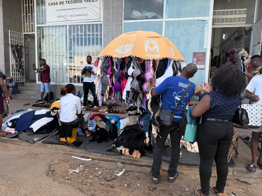
One disconcerting sight was what my guide referred to as “the baggy boys”. These were street vendors selling used clothes which had been donated by western countries and somehow found their way to these makeshift markets. The clothes were displayed on top of plastic bags, which were used to quickly wrap them up when the police came to stop this illegal activity.:
Maputo has its fair share of wealth. On its outskirts, five star resort hotels cater to South Africans seeking a beach holiday. In the neighbourhood where I stayed, large mansions stood behind barbed wire fences, some with private security guards at the gate. An upscale mall with high-end furniture stores, restaurants, and designer clothes was close by.
One thing that struck me about my short time in Mozambique was how willing many of the people with whom I spoke were quick to identify government corruption as a significant problem. Corruption was also rife amongst the police and army, but was slightly more tolerated due to their small salaries.
My impressions of Mozambique? It is a rich country with gold and ruby mines, oil and beautiful beaches. Unfortunately, it has its fair share of problems, including high unemployment, HIV infections, corruption and the referenced civil strife. Much as I would like to believe the country will resolve its issues peacefully, I’m not optimistic. Too many people in the country referred to it as a powder keg waiting to explode.
I have to admit I was happy to leave.
Next up: The peaceful kingdom of Eswatini