Broome: Swept away?

When I first visited Australia in 1994, mention of Broome conjured up visions of a secluded tropical paradise, hundreds of miles from the nearest town, nestled between the Indian Ocean and desert outback that dominates much of central and northern Australia. Flights were irregular and expensive and tourist infrastructure was just beginning. But progress it did, and its best known attraction, Cable Beach, began to regularly appear on top 10 beach lists. I didn’t make it there in 1994, but never gave up the idea of visiting it.

Thus, fast forward to my current Australian sojourn, where I am trying to see Australia’s west coast. Daily flights to Broome from Perth were reasonably priced, wide open and just two and a half hours away. I looked at hotel prices and they seemed inexpensive for beach resorts, then looked at potential tours on Trip Advisor and things began to make sense. None of the tours were available in January. As it was the wet season, it was also the low season. Fearful of battering storms, tropical cyclones and other weather undesirables, most tourists give Broome a wide berth in January.

But not me. If I can survive a Winnipeg winter, a bit of rain and some hot weather would be a walk in the park. As I later discovered, Broome has no actual parks (but there is a golf course). I booked a flight and 7 nights at the Mantra Frangipani hotel, located just a 15 minute walk to Cable Beach.

Arriving at 2:00PM, I stepped outside onto the airplane stairs and was smacked with “the wet”. Not rain, but extreme heat combined with high humidity making me feel like I had just walked into a furnace. By the time I had walked the 30 feet to the terminal building, I was drenched in sweat and welcomed the air conditioned area by the baggage carousel. It was the start of my new mission in Broome – finding air conditioned spaces.

First, some history. Broome’s roots are found in the pearling industry, when in 1879 the then governor proposed creating a port close to the pearl grounds. Pearls formed the economic basis for the town, but led to sordid historic episodes involving slavery, imported labour and indentured servants. The pearl divers were all of the above and exempt from Australia’s white only immigration policy that was finally abandoned in 1973. Malays, Chinese and Japanese were all imported, but prized above all for their diving prowess were pregnant Aboriginal women. The overseers and exploiters were white, leading to various degrees of apartheid well into the 1970’s.

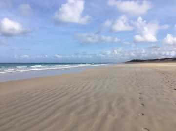
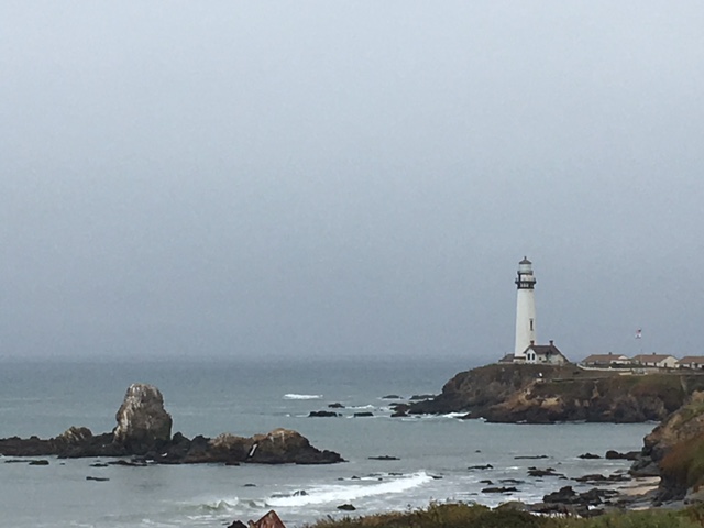
Today, pearls are still important, but farmed rather than wild oysters more prevalent. The main streets (there are 3) are lined with pearl stores and pearl museums. The oil and gas industry also contributes to the economy. Although the rigs are off-shore, Broome serves as the equipment and transport hub, with large helicopters ferrying workers back and forth to the rigs. Tourism is also big business. Cable Beach is renowned for its pristine sand and turquoise waters. It received its name when it became the Australian end point for a telegraph cable from Java in 1889. Aside from the beaches, Broome advertises itself as the gateway to the Kimberley, Australia’s outback.

The internet promotes numerous day tours around Broome in the Kimberley – to Horizon Falls, Cape Levesque, the Bungle Bungle Range, Windjana Gorge but only a few scenic and expensive (in excess of $1500) flights were operating. It was the wet, and the lack of tourists combined with the real possibility of flash floods wiping out the roads, meant most tour providers were enjoying the off season far away from Broome.

It wasn’t, however, particularly wet. The temperature regularly rose past 40 degrees by 9:00AM and cooled down only to the mid-30’s in the nights. But rain showed itself only twice during my week, once in a midnight storm and another time in an evening sprinkle, neither of which reduced the heat or cut through the humidity.

So I made the best of it. Cable Beach is beautiful, the Indian Ocean waters warm, the sand white but packed enough that walking along parts of its 22 kilometres in the mornings before the heat was pleasant. I avoided the nude part for plenty of good reasons, not the least of which involved the perceived extreme effort and contortionist maneuvers to get sunscreen all over my body. Staying clothed in calf length capri pants with a wide brim hat and giant sunglasses clearly reduced the area sunscreen was required.

img_4441
Cable Beach

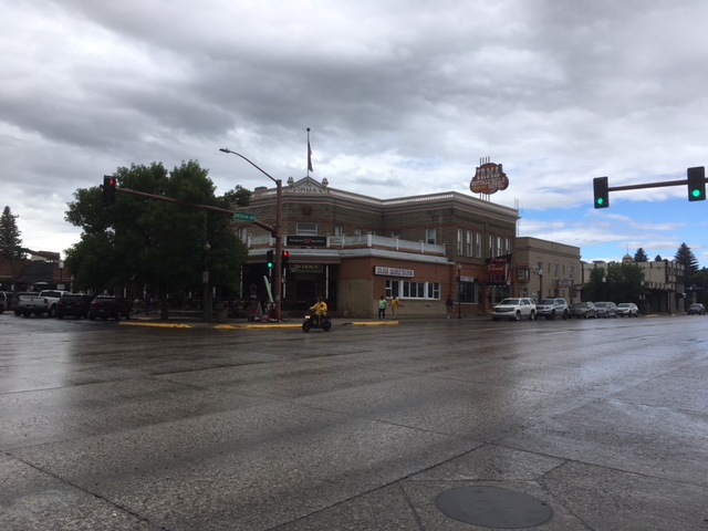
Broome, with a population of about 16,000, isn’t big enough to have a public bus but a private service stopped outside the hotel once an hour between 9 and 6 (11 and 5 on Saturdays and Sundays) to take me 5 kilometres into town. I went to the grocery store (Broome has 2) and to its central business district or misnamed Chinatown. There’s only 1 Chinese restaurant in Chinatown, but a host of other ethnic restaurants. Unfortunately, most were closed for the season. The Saturday Market, run in the courthouse square, had barely a dozen stalls and all were selling either local arts and crafts or food. Sun Pictures Theatre, the oldest and longest running outdoor cinema in the world, would show films in the evening, but as they started after the bus service ended, I passed.

img_4511
Sun Pictures cinema (with road construction)

Feeling obliged to do something touristy, I signed up for the only thing I could find that was running: Broome Trike Tours. Its owner, my driver and tour guide was Roger, a transplanted New Zealander who had first tried his hand at ostrich farming near the Perth area. When the ostrich market tanked, he drove up north to Broome, constructed a trike costing about $50,000, and started offering tours. I was lucky, I would get an exclusive since no one else had signed up.

img_4455

Roger greeted me, gave me a helmet and instructed me to straddle the back of the bike and off we went. It was my first time on a trike, but sitting on the raised seat at the back, I had a glorious view of the surrounds. I also got the wind full on in my face, making my lips quiver as Roger sped to 100 kilometres an hour. We started at the golf course, where a few wallabies were bouncing around chasing golf balls but were very unco-operative photo subjects. Next we drove to the sights of Broome, , through the downtown, stopping at Roeback Beach in the center of Broome, and finally to Gantheaume Pointe, to see dinosaur imprints and the sunset over Cable Beach.

img_4485

I made one more trip into Broome proper, trying to see more than just the grocery store and the outdoor market. However, with the temperature above 45 and high humidity, it was not easy to walk around. Most of the streets were deserted,  most restaurants and shops closed for the season. After an hour, I had gone through my liter of water, needed a clean t-shirt and gave up. The heat had beaten me. I took the bus back to the hotel, changed into a bathing suit and jumped into the pool.

It was a relaxing, lazy week. With so little to do, and the heat so oppressive, leaving the coolness of the hotel’s pool was a task not undertaken lightly. As for Cable Beach, was it a top 10 beach in the world? I don’t know as I haven’t visited most of the others. It is gorgeous and I loved my walks along the beach, but the high temperatures bordered on oppressive in January. I am embarrassed to admit I missed having umbrella vendors and tiki bars and people walking up and down the beach selling ice cream and massages and sand buckets. I understand that part of Cable Beach’s charm is its isolation, but for me, that is also one of its downfalls. I suspect at my next beach, I will be decrying the lack of privacy and the endless hawkers, but that is a few weeks away.

Notes: I travelled to Broome from Perth on Qantas, then onward to Darwin, also on Qantas. Both were daily, regularly scheduled flights. Daily rate for a 1 bedroom apartment hotel at the Mantra Frangipini in the low season is $100 per night. The Trike tour (broometriketours.com.au) cost $150 for a single rider, reduced to $135 for 2 or more.

Estonian Escapades

My 3 country Baltic tour began in Tallinn, the capital of Estonia. I was touring with a British based tour company called Explore, which focuses on small group travel for the over 30’s crowd. My tour mates included an American, 2 other Canadians and 12 Brits, along with our Estonian tour leader, Tounal. Aside from Tounal, our average age was about 65, contained 2 smokers, a rocket engineer, 2 Toronto lawyers, a bunch of teachers, a former banker and a lot of IT people, none of whom were able to explain how to use the Fongo phone app. which theoretically allows you to keep your local phone number.

We started our tour in the wonderfully preserved medieval city of Tallinn, with its imposing walls and watch towers which both provided protection from foreign invaders and divided the city into the High Town and the Low Town. Some history is needed to appreciate the significance of High vs. Low in Tallinn, so let me give an abbreviated version:

After the Ice Age (circa 10,000 BC), the ice receded, leaving the Baltics fertile and inhabitable by early hunters/farmers. These people enjoyed a happy, pagan life until 1227 when  German crusaders invaded, forced Christianity on the locals, grabbed the best land and made themselves nobles. These Germans occupied the high land in Tallinn; the locals had the low land. Hence the need for walls. The Germans and the Estonians, who were reduced to serfdom, lived more or less together until Estonia declared Independence in 1917 (from Russia) and took back the land held by the German nobles. In 1939, the last of the Germans were expelled.

IMG_1633
Tallinn City Wall and Tower

Of course, plenty of others invaded Estonia. It occupies a strategically important place in the Baltics, bridging east and west, its lands are fertile (rye, flax and wheat) and forested and its seas swarming with fish. It was, at various times, overrun by Swedes, Danes, Poles, more Germans and Russians. Russia seized control of Estonia from Sweden during the Great Northern War between 1700 and 1721 and retained it until the events of the Russian Revolution allowed Estonia to declare independence in August, 1917, whereupon it was promptly invaded by Germany. Following WWI, it was granted independence until the Nazis invaded. The Russians “liberated” it from the Nazis, annexed it into the Soviet Union and didn’t leave until 1991.

The attitude of Estonians to their former Russian occupiers (as they are always referred to) is extremely negative. Notwithstanding the dislike of the Russians, of the 1.3 million people in Estonia, nearly 1/3 are “the Russian minority.” When Russia departed, it left Estonia without social services, insurance, pensions or a currency. It banned all fish from Estonia, since the fish had, overnight, gone bad. Estonians need visas to go to Russia, even though a river dissects the city of eastern Estonian city of Narva from Russia.

Against this backdrop, in Tallinn, we saw the medieval walls of the city (built by Germans), Lutheran churches, Orthodox churches ( for the Russian minority) and a Guild Hall, the 14th century equivalent of an old boys club/community center where important matters were decided and significant events performed, all under the watchful eyes of the married, male nobility. It is perfectly preserved and currently a museum of Estonian history.

Adorning the old market square are buildings of various centuries, numerous restaurants and souvenir shops. When I asked what the famous Estonian dishes are, the response was “rustic.” Most restaurants featured schnitzel, burgers, salmon and dark rye bread. Creamy mushroom sauces and butter grilled fish were ubiquitous, but nothing particularly Estonian. My two significant finds were September raspberries in the fruit market and a decent selection of not too expensive wines in the supermarkets from Europe, Australia and Chile. None from the USA and the 3 vineyards in Estonia did not produce wine in commercial quantities.

Estonia is famous for other things, notably folk singing festivals in every town, every season and marking every event (declare independence? let’s sing about it…). There is also a plethora of kooky statues, honouring everything from poets, scientists, the pig and fisher people:

From the main city of Tallinn, our tour proceeded to the Baltic island of Saaremaa, where we explored the well preserved/reconstructed Bishop’s Palace. It was built as early as 1380 by the German crusaders seeking to consolidate power, but Danes, Swedes and Russians occupied it over the centuries. As medieval castles go, it is fine, but the more offbeat exhibit is one of Soviet life in Estonia during the most recent occupation. The kitchen is miniscule, food is rare, the single bedroom has multiple beds, the bathroom has a toilet and a bucket to heat the water. On the stairs, were different jokes about the Soviets (Lenin was good, Stalin was bad, Gorbachov? We will get to know when he dies….). The exhibit was not a tongue in cheek look back at the Soviet occupation; it was a stark reminder of how difficult those times were.

We visited a fishing village on the island, learned the timetable of the airport (two flights weekly from Tallinn and charter flights from Finland) and other fascinating facts about the area. It was basically a former fishing area which could no longer sustain itself from fishing, so it promoted itself as a tourist destination –the lake country of Estonia. It boasted that hallmark of capitalism, the first golf course in Estonia, naturally constructed after the Russians departed. As a bit of trivia, the first golf course in Russia was not constructed until 1993.

After two days in Saaramaa we returned to the mainland. We looked at the remains of another medieval castle at Viljander and some churches (Lutheran and Orthodox). Our last stop was in the second largest city in Estonia, Turtu, which has the remains of a medieval cathedral, some Lutheran churches and a pub in the old gun armory of the medieval castle, which hosts a weekly beerpong tournament. Naturally, there was a pretty market square, food markets and its symbol, the Fountain of the Kissing Students, reflecting its large student population.

IMG_1795

After a week in Estonia, I had my fill of medieval Castles, Orthodox churches, the former Russian occupation and schnitzel. It is a wonderful country- very clean (it is famous for its garbage clean-up campaigns) and lots of historical buildings, and a gentleness or naivete, depending on your point of view, from having true independence for less than 30 years. Time to move on.

Warring with GPS: The Pacific Coast Highway

This post was supposed to be about the drive from Crescent City to San Francisco along the Pacific Coast Highway, with gorgeous photos of white, ocean waves smashing into the vertigo inducing cliffs hugging the coast. But it is not. “Why?” you ask. Let me tell you.

First, while everyone warns one should get to the USA National Parks early to beat the crowds, I have never read anywhere that one should start the journey on the Pacific Coast late to beat the fog. So I left Crescent City about 8:00 AM and encountered 5 straight hours of fog.

The one redeeming feature was another opportunity to drive through a redwood forest at yet another State or National Park with redwood in its name. Fortunately, it lived up to the hype.

IMG_0686

Second, despite one of my talents being the ability to read maps and generally navigate by the sun, I had been convinced that maps and compasses are passé and I needed a GPS to get me through the USA. I had reluctantly bought a Garmin GPS and my son had installed it for our trip to Florida in February. He set it to the proper British accent (we christened it James) and it got us to Florida and back, although how difficult can it be to go due south and return straight north, especially since my car has a compass embedded in the rear view mirror. Nonetheless, I resolved to test James on my extended USA road trip.

James worked okay generally, but there were some flaws. While James directed me to Henderson, Nevada after a long drive from Sedona, he inexplicably quit about 10 miles from the destination on the middle of a newly named interstate. I was driving in the dark, doing about 80 miles an hour (the legal speed limit) when James advised he could not configure and turned himself off. Period. No reconfiguring, no telling me the Interstate had just recently changed from a different highway. Nothing. Just a black screen. So I took the nearest exit, turned on Google Maps on my phone and Siri (the voice on my I-phone) guided me to the hotel.

I ceased relying on James, but would check him out occasionally. He was useless in Edmonton;  its street and avenue numbers instead of names being impossible for James to locate, but he was okay in Banff and Vancouver.

However, the Pacific Coast Highway was a complete bust for James. He kept trying to send me along Highway 101 – the quickest route- but I wanted to drive Highway#1 along the ocean. I ignored him and did not get lost once. Admittedly, this was not a difficult achievement since all I had to do was keep the Pacific Ocean on my right.

Once the fog lifted, the scenery was spectacular.IMG_0745

But James continued to disappoint. I gave him one last try- get me to my hotel in San Francisco -which was actually near the Oakland airport. James led me off the Highway  to Richmond, then Berkley and next, in his perfect butler voice, directed me to veer right. This was the most useless command imaginable, since I was on a 6 lane highway, each of which veered right and led to 3 separate ramps-one to Alameda, one to the Oakland Airport and another to San Francisco. Since I was staying near the Oakland airport, I thought I would veer right, then take the middle exit, but James insisted that I veer right and stay in the right lane. I stupidly trusted technology, stayed in the right lane and found myself on the Oakland/San Francisco toll bridge to San Francisco. $6.00 (US) later and 4 miles down the highway, James directed me to “when possible, make a U-turn.” The nearest exit was at Treasure Island, which has only dead ends and construction zones and no possible way of getting back on the San Francisco toll bridge heading west. I gave up on James, shut the damn thing off and pulled out my I-phone and Google Maps.

Siri directed me back onto the bridge for two miles, then make a left turn at the Embarcadero in downtown San Francisco, guiding  me back on to the bridge the way I needed to go and, eventually, over an hour later than necessary, to my hotel in Oakland. ,

I spent 2 days touring  San Francisco. I had been there previously in 1978, seeing most of the main tourist sites then. This time, my first stop was at the Tourist Information Center, where I picked up a paper map. Using it, San Francisco was remarkably easy to navigate. I took a free walking tour (I tipped $20) of Chinatown and the financial district, where two other participants asked where I got the paper map. After the tour, I walked to the most crooked street in the world, Lombard Street, followed by North Beach, , Ghiradelli Square and Fisherman’s Wharf. Everything looked pretty much as I remembered it, but with many more tourists.


I left San Francisco with James relegated to the glove compartment. I would rely on Google Maps for the next part of my trip. I continued down the Pacific Coast Highway for about 300 kilometers. As I had arrived at the Pacific Coast Highway much later in the day, the fog was mostly gone and the scenery spectacular.

Six hours later, guided by Siri and Google Maps, I turned east towards Bakersfield . Eventually, the signs and Siri directed me off the Interstate 15. I took the exit and came to a T-road. The sign pointed Bakersfield right. Siri said “go left.” Left was west; east was right but I foolishly gave technology one more try and turned left. A mile later with no guidance from Siri, I made a u-turn. I turned off the phone, and followed the signs. Bakersfield arrived, on the right, shortly afterwards. Relying on more street signs, my car compass and the setting sun and totally ignoring Siri and James, I arrived in RidgeCrest without incident an hour later.

Into the (Red) Woods: Crescent City

I continued down the Pacific Coast Highway/US101 from Seaside, Oregon to California, basking in the fantastic scenery:

My destination was Crescent City, an oceanside town just south of Oregon in California. The beach is not the attraction here, rather it is the redwood trees unique to the northern coastal areas of California. The Del Norte Redwoods State Park, the Jedediah Smith Redwoods State Park, the Redwoods National Park, the Prairie Creek Redwoods State Park and a bunch of other parks with redwoods are located nearby.

I drove down Howland Hill Road, where a sign warns of a rough, winding road ahead for 6 miles-no RV’s allowed. It quickly turned to gravel, then packed dirt. The redwoods were soon visible, standing like gigantic soldiers guarding the forest. As the road snaked around the trees directing cars between massive trunks, my car sensors kept beeping I was too close to a tree. The redwoods dwarfed the cars and everything else around.

IMG_0678

Statistically, the Redwoods (genus sequoia) are the largest trees in the world, growing to heights of 380 feet or the equivalent of a 38 story building. Their trunks’ diameters have been measured in excess of 27 feet and they can live as long as 2000 years.


IMG_0651

I found a well marked hiking trails and walked a few miles amongst the trees, feeling like I had landed in the movie set of Honey, I Shrunk the Kids.

IMG_0670

Hundreds of activities in the vicinity relate to the trees: Jurassic Park where dinosaurs roam, Mystery Trees where a cable car takes you high into the canopy and the famous “Drive your Car through the Tree” attraction. There are actually 3 of the drive your car through sites, but each charge $10 to do so and I wasn’t inclined to set off the car sensors again.  I kept walking through the trees until my neck started hurting from the strain of constantly looking up. So it was back to the hotel for a good night’s sleep. I have a long drive to Oakland tomorrow.

The End of the Trail: Seaside, Oregon

I had thought to go to Portland, Oregon. It had been named one of the top destinations to visit in the US for a number of years, but when I looked at its must see attractions, I hesitated. There were the highly rated Japanese Gardens, but I had just seen Japanese gardens at the Devonian Gardens in Edmonton. Portland also boasted Chinese Gardens, but, well, I had been to China. It had great hiking trails, but I had hiked in Jasper and Lake Louise a few days prior. Good food proclaimed Trip Advisor, but I was coming from Vancouver. My son said it was all about Hipsters, which held little appeal and even less so when I suffered through the first episode of Portlandia. When Rose, a new found friend, said the shopping was great in Portland, that sealed it. I was not going near there.

But I still wanted to drive down the Pacific Coast, so I headed to Seaside, Oregon down the Pacific Coast Highway, US101. It was a fabulous drive, except for the occasional logging truck bullying its way onto the highway, confident that all the cars would slow down to avoid hitting them. US101 is a gentle winding road,  covered in canopies of massive trees,  hills rich in forests and, on the right side (going south), the Pacific Ocean. Mile long bridges cross the Columbia River and quaint towns with white clapboard shacks announcing sales of freshly caught Chinook salmon dot the highway.

After entering Oregon near Astoria and making the now welcome stop at a Walmart for a rotisserie chicken and wine, I meandered 15 miles south to the town of Seaside. Its primary claim to fame is that it was the last stop on the 4,000 mile trek across the US in 1805 by Lewis & Clark. A statue proudly standing at the edge of the town commemorates this achievement.

IMG_0618

Today, Seaside is a pretty beach town, acting as a magnet for families spending a few days on the coast. The expansive beach is sandy with tall grass marking its boundaries. Kids make sand castles and fly kites and seniors walk barefoot in the surf, dipping their toes in the waves. Swimmers were scarce today;  the water was cold and the weather cool.

IMG_0622

The town itself, all 8 blocks of it, is a throwback to those idealized 1950’s resorts with Art Deco buildings housing an arcade called Funland and a bumper car track. Stores sell salt water taffy (150 varieties) and homemade fudge and ice cream cones. Restaurants are named  the Crabby Oyster and Finn’s Fish House and Sam’s Seaside Café.

IMG_0615

Along the mile and ½ promenade, toddlers ride their training bikes, little boys skateboard, moms push strollers. No one wears suits or talks into their cell phones or totters in high heels. People said “hi” just because and smile a lot. Everyone is relaxing by the beach in a perfect little beach town. With apologies to Portland, I am glad I came here instead.

O Canada: Two Scenic Drives

Despite living in Edmonton for 7 years, I had never visited Jasper National Park or driven the Icefields Parkway between Jasper and Banff. It is rated as the most scenic drives in Canada (according to canadiansky.co.uk). My last memory of driving through the Rockies was an 8 year old, being bundled into a car with my brother and sister, a cousin, a babysitter and our two dogs while my mother drove us to Kelowna for a month long holiday. It was time to remedy these omissions in my travels.

Jasper National Park: First stop in Jasper was at the tourist information center , inquiring about the bear temperament that day (use normal precautions) and Lake Louise (parking lot was already full).  I drove to the first suggested hike at Athabasca Falls. If I was doing an assignment for a creative writing course, I would wax poetic about the blue grey river, the powerful swirls of water hitting rocks, etc., but I am not. It was pretty. The mist acted as a natural air conditioner, much appreciated on this 30+ degree day. I took a pleasant walk down the Athabasca river, observing the falls from different angles. A large placard reminded us not to go over the fence. If so, it warned, hypothermia (these were glacial waters) would happen in seconds and one would be pulled quickly to the falls where death would happen instantly. A few feet away was a memorial to “Justin”, where a wreath of flowers, a smurf doll and other items lay,  but his relationship to the falls was not apparent.

IMG_0519

The next hike was at the Sunwapta Falls. They, too, were pretty and provided a cooling mist.

IMG_0531

From there, I drove the Icefields Parkway. It was two hours of spectacular scenery-mountains, glaciers, trees, a herd of goats, but no bears or moose or elk. I stopped to climb the Athabasca Glacier, described as “a unique Canadian experience” on the welcoming sign. After a slightly strenuous 10 minute climb, I arrived at the toe of the glacier. There were lots of small rocks, dirt, some pieces of ice and snow. Call me cynical, but I had seen much the same in Antarctica and that isn’t in Canada. I left and continued on the Parkway to the entryway to Lake Louise.

IMG_0562

Lake Louise: A sign on the highway echoed the warning that the parking lot was full, but it was 6:00PM, so I decided to see for myself. At the entrance to the parking lot, a traffic attendant (something the US parks would be well to adopt) ushered me to the second parking lot where there was a spot. Congratulating myself on my luck, I parked and walked toward the lake..….

Where I was met with hordes of tourists, all crowding around the boardwalk posing for pictures, eating ice-cream and swimming in the lake.

IMG_0577

The throng of tourists was disappointing (although what was I expecting with everyone telling me the parking lot was full), but Lake Louise has 2 redeeming qualities. First, it is really, really, really pretty. The water sparkles a turquoise blue green, it is surrounded by verdant cedar trees and the Chateau Lake Louise set against the backdrop of the Rockies is majestic.

Second, there is a packed dirt path that winds along one side of the lake. It is only 2 kilometres long (both the path and the lake). I started along the path away from the immediate vicinity of the Chateau Lake Louise.  Soon the sound of the wind, the cool breeze from the lake, the rays of sunshine shimmering bright reflections removed all thoughts of the crowds. It was a worthy highlight of a lovely day.

IMG_0586

Scenic Drive Number 2:

I had been cautioned that the drive along the southern TransCanada Highway from Calgary to Vancouver would be frustrating, being single lane a lot of the way with plenty of truck traffic. It was, and there was endless construction, two separate traffic jams caused by herds of goats and obsolete odes to Stephen Harper’s “Economic Action Plan” teasingly promising to turn the 2 lane highway into 4. There was little evidence of that; only the rare passing lanes gave respite to the thousands of trucks laboring to ascend the mountains.

The state of the roadway aside, it lived up to its reputation as one of the most scenic drives in Canada (again by canadiansky.co.uk. and my waiter at the Canmore hotel where I stayed). My words cannot do it justice; I will try with the picture I took shortly after Salmon Arms where I stopped to picnic (more rotisserie chicken from Walmart).

IMG_0601(1)

The parks and drives were fantastic. Every Canadian should do them at least once in their lifetime.

How (not) to travel: The Reverse Bucket List

Lately, I have been visiting friends and family in Saskatoon and Edmonton and doing very little sightseeing or much else of interest. Since Saskatoon’s newest art gallery was recently the subject of a complimentary New York Times article and Edmonton’s West Edmonton Mall is just another oversized shopping center, I will resist discussing either. Rather,  I will share one of my most important guides on how and where I travel: my reverse bucket list.

Like most people I have a travel bucket list. It is simple, but extensive. I want to go everywhere I haven’t been and return to every place I have already visited. Which makes choosing where to go next a challenge. For many years now, my first step in picking a destination is not deciding what I want to see, but rather to consult my reverse bucket list to figure out what and where I don’t want to go.

I started it about 15 years ago and have added, but never subtracted, from it. The concept is straightforward. List all the things I will not regret never having done as I lie on my deathbed (hopefully decades away). It is short, but here it is:

  1. Eat no living food. Do not get me wrong. I am not a vegan and can be quite adventurous in trying different foods, especially animal products. Rattlesnake, kangaroo, ostrich, crocodile, fried caterpillars, grasshoppers, frogs and probably a lot of animals I cannot name have all graced my lips. But they all have one thing in common. They are dead before they hit my mouth. That’s where I draw the line. I am a happy meat eater so long as someone else does the killing.
  2. Do not fly on Russian built airplanes. They crash a lot. Enough said.
  3. Avoid going to the top of tall buildings or any other high structure. I have vertigo and looking down from the Eiffel Tower or the Empire State Building is a guaranteed way for me to get dizzy.
  4. No overnight accommodation without an attached bathroom. Simply stated, I do not like roughing it. However ignoble or princess-like this characteristic, I accept and travel accordingly. Thus, through hiking the Appalachian Trail (5-7 months of camping without facilities) or wilderness treks in the Borneo rainforest are not adventures I will try until there are nightly options with en suite bathrooms.
  5. No bungee jumping. Some people may relish the thrill of paying a lot of money to leap off a high perch and, if all goes well, swing upside down on a long rope. I am not one of them. I feel the same way about most roller coasters, zip lines and  other endeavors that go from high to low at breakneck speed without an airplane encapsulating me.
  6. Mountains are for viewing, not climbing.  I like mountains and am quite happy to look at them from the ground, or, like Mount Everest, from a plane. But climbing them gives me a combination of potential vertigo and too much vigorous physical exercise. I come by this dislike with practice, having climbed halfway up Mount Sinai in Egypt, halfway up Bird’s Nest Mountain in Bhutan and halfway up Uluru in Australia. Every time, midway up, something inside me says I am not having fun and I quit. Recognizing this tendency, hiking Mount Kilamanjaroo or even Mount Fuji, are not heights I aspire to.
  7. No changing tires. If I was driving along a deserted highway and blew a tire, I would try a lot of things: call the Automobile Association, hitchhike to the nearest service station, or pull out my fold-up chair and sit and wait for help. But the one thing I would absolutely never, in a million years, contemplate is to change the tire myself. I have many skills – I can make a tasty risotto, navigate through major cities with GPS or maps and calculate my taxes manually. But changing tires is something I have never tried to learn and have no desire to do so. Thus, off-road jaunts or extended drives through sparely populated areas will not figure into my travel plans unless I have a companion who can change tires.
  8. Avoid war zones. The potential to be shot at or kidnapped is not a lifelong goal, so, sadly, countries like Syria and the Congo are on my no go list.
  9. Stay away from Rat Temples. I love animals and have happily gone alligator hunting on the Amazon and tracked rhinos in Namibia. But I put my foot down at seeing rats. After a long drive to Bikaner, in Rajasthan, India, our driver and tour guide tried to usher us into the car for another  drive to the Karni Mata Temple. We were tired, road weary and all the temples were starting to look the same. “No”, insisted the driver, “this one is very different. It is the rat temple, home to 25,000 rats.” Rats are not particularly bothersome to me, unless they are in my hotel room. I frequently see them by the sewers and think they are kind of cute. But to go out of my way to spend three hours looking at rats is not something I am inclined to do. So I didn’t and have not spent a moment of regret about missing the rat temple.

If I stick to this list, I will be very gruntled. Does anyone else have a reverse travel bucket list?

Dallying in the Dakotas

Mount Rushmore, South Dakota

If I have learned anything from my Yellowstone National Park foray, it is get to the park as early as possible. So it was that I found myself at Mount Rushmore at 6:00AM. No need to play parking lot bingo and another bonus, parking is free before 7:00AM.

I parked and made my way to the monument, along with the other 12 people early enough to beat the crowds. Since Mount Rushmore is a giant mountain with the heads of four presidents (Washington, Jefferson, Lincoln, Teddy Roosevelt) carved on it, it is very hard to miss. It stares straight at you from the parking lot.

I walked past the columns identifying when each state entered the Union and passed the (closed) restaurant that featured ice cream made with the same recipe used by Thomas Jefferson. Mount Rushmore looked the same, just a little closer.

I looked at it some more. No stirring renditions of the Star-Spangled Banner blared from loudspeakers, no boy scouts recited the Pledge of Allegiance. Not even a costumed Uncle Sam offering photos for $5.00 a shot. I looked around for a booth where someone would take my picture as the 5th head on the mountain, but if there was one, it was closed.

After 5 minutes, I asked a lady to take my picture. She did. I took hers. Then I left.

IMG_0448

North Dakota

The drive from Mount Rushmore to Saskatoon, Canada takes 11 to 12 hours and goes the length of North Dakota. It is mostly a single lane highway, basically flat, straight and completely lacking in anything I find remotely interesting.

IMG_0460

For those of you (like me) that seek to make border entries as quick and painless as possible, the border crossing at Fortuna, North Dakota/Oungre, Saskatchewan doesn’t have a Nexus line. Good thing there was only one other vehicle there.

All things West: Cody, Wyoming

Since leaving Salt Lake City for Yellowstone National Park, everything became more “West”; there were ranches and signs warning “watch out for horseback riders,” stores ceased and instead trading posts and emporiums lined the small town main streets.

So, too, in Cody, Wyoming, chosen by me for an overnight stop because of its hour proximity to Yellowstone. As I entered the town (population 9,836), I passed its grandstand where the Cody rodeo was in full swing. Two fellows on horseback wearing cowboy hats sauntered towards the rodeo and a covered wagon being pulled by two horses appeared. A few blocks further, the Buffalo Bill Center of the West museum appeared, sporting a large statue of Buffalo Bill along with 3 tipis. Hmmm….. I thought, Buffalo Bill, Bill Cody, Cody, Wyoming….was there a connection?

IMG_0409(1)

Or course there was, as I learned surfing the internet. William Cody, aka the showman Buffalo Bill Cody and star of the Buffalo Bill Wild West show, was also the founder of the town. Hence, its name, Cody, Wyoming.

So, when in Rome…..I made my way to the Buffalo Bill Center of the West, advertised as 5 museums in 1, to learn all things Buffalo Bill and the West.

The Buffalo Bill Museum traces the life and accomplishments of Buffalo Bill (except his stint living in Mississauga as a youth). He was a scout, although whether this was for the Pony Express, is debated, fervently anti-slave and served for the Union army during the civil war. Post war, he hunted buffalo to provide meat for the railroad workers, fought in the Indian Wars and became friends with another Western icon, Wild Bill Hickok.

IMG_0423(1)

In the 1870’s, he was bit by the acting bug and over the years, developed and starred in the show that would become synonymous with him, Buffalo Bill’s Wild West. A combination of PT Barnum meets the Wild West, it was the predecessor to today’s rodeos and featured glorified visions of the Wild West to Easterners and Europeans anxious for a romanticized glimpse into the settling of the West. Extraordinary feats of horsemanship were performed alongside the marksmanship (markswomanship?) of ladies such as Calamity Jane and Annie Oakley.

Numerous Indians and their families traveled with the show, performing in mock battles of the Indian Wars, which they always seemed to lose. Mention was made in the museum of Custer and his defeat at Little Big Horn, but the focus was oddly on his widow’s attempts to keep his memory alive. The highlight of the Buffalo Bill Wild West show was the reenactment of the robbery of the Deadwood Stagecoach using the real Deadwood Stagecoach. The audiences always cheered loudly when the attackers were repelled and the stagecoach carried on its way.

Video footage of the show was available throughout the museum, alongside locations of its performances (Europe, Chicago) and some of its famous viewers (the Pope, Queen Victoria).

He also founded Cody, an old trail town, in 1895 where he dabbled in mining, architecture (the Irma hotel in downtown Cody is named after his daughter) and irrigation (the nearby dam is the Buffalo Bill dam). The Irma hotel still stands:

IMG_0429

I toured, quickly, the Natural History Museum, mostly a shrine to the art of taxidermy. The Plains Indian museum was next, where the traditional Plains Indians’ lifestyle was portrayed, followed by a muted description of the European settlers’ arrival and the upheaval caused by them and finally, a look at the current revival of Indian customs and teachings. I passed on the Cody Firearms Museum and the Western Art Museum and decided to go for breakfast at the grill at the Irma hotel.

IMG_0411(1)

The décor was stereotypical West with a giant wooden bar backed by a long mirror, thick red carpet and more taxidermy. IMG_0432(1)

The offerings were decidedly unWesternlike: a breakfast buffet and the diners were, like me, tourists. I ate and set off for my next destination.

Following the Faithful: Yellowstone National Park


Visiting Yellowstone National Park should never be done when it is cold, raining or crowded. It was all of the foregoing the afternoon I arrived. The ranger’s qarning it could take up to 25 minutes to get between sites was hopelessly optimistic. It took me nearly an hour and 45 minutes to arrive at my first destination, inching along the main highway in bumper to bumper traffic. Running parallel to the highway was the Madison River, offering iconic views of a Montana wilderness scene. The only thing missing was the fisherman standing waist high in the water (they came later):

IMG_0322

Fountain Paint Pot

Steam billowed in the foreground, announcing the beginning of the thermal or volcanic area of Yellowstone. I began the game of parking lot bingo, finally grabbing a spot in the lot near Fountain Paint Pot, an area with each of  four thermal features (hot springs, fumeroles (steam vents), mud pots and geysers). A boardwalk circling the features shouted out this warning:

IMG_0326

Notwithstanding, I saw 3 people dip their fingers into the water, then quickly pull them out, exclaiming “it’s hot!” Perhaps I am being presumptuous, but did they not think that boiling water would be hot?

People aside, the Fountain Pain Pot sent my senses into overload. The stench of sulfur, the hissing of the vents and the bubbling caldron of mud baths and the magnificent streams of water shooting forth from the geysers made the area a joy to behold. The colours of the mini–lakes, shades of turquoise and terracotta swirls from the algae greeted my eyes.

Grand Prismatic Spring

The Grand Prismatic Spring is the largest hot spring in the US. Viewed on a hot, sunny day, it offers a vivid rainbow of colours – blues, greens, yellows and oranges. Unfortunately, it was cold and rainy, making the spring less grand and not at all prismatic. The cold weather creates a roof of steam, covering the spring and obscuring the rainbow effect.

IMG_0361


Old Faithful

Another slow car ride and a frustrating 30 minute search in the parking lots ensued before I finally emerged victorious with a parking spot. I thought about giving up; after all, I had seen plenty of geysers before and what was so special about seeing another geyser spout water. But it was tantalizing close and I couldn’t bear the thought of hearing “you mean you didn’t see Old Faithful?”

I walked onto the Boardwalk. Helpful signs provided the time of the next eruption: 5:18 PM +/- 10 minutes. An hour and a half later. Displays in the Visitor’s Center explains that Old Faithful is one of 5 geysers in the park for which eruptions can be reliably predicted. It all depends on the prior eruption and how much water was expelled. The more water that is shot out, the longer it takes to replenish the spring and obtain the necessary pressure to gush forward again and vice versa. But in general, Old Faithful erupts about every hour and a half.

I took my seat at one of dozens of benches encircling Old Faithful. By 5PM, hundreds of other tourists had joined me, all of us waiting for the 5:18 spray. By 5:15, the anticipation was growing, the excitement palpable and Old Faithful teased us with mini-spouts, only a few feet high, before the wisps of steam trailed away. 5:18 came and nothing happened. Then 5:19, 5:20 and another tease, but no blast. 5:22…would this be the time when Old Faithful wasn’t so faithful? Tremors, earthquakes deep below could all destroy the delicate forces of nature that make Old Faithful so predictable. 5:23 and more water bubbled forth, then quickly receded. 5:24 and the kids in front of me asked their mother if they could go. 5:25….and finally, swoosh and thar she blows-a gusher 120 to 150 feet in the sky, majestically tossing water high into the sky before cascading back to earth:

IMG_0396:

The show lasted nearly 5 minutes. Then I (and the other hundreds) left, feeling quite satisfied that I had persevered to see the spectacle and it did not disappoint.